Banana, Queensland facts for kids
Quick facts for kids BananaQueensland |
|||||||||||||||
|---|---|---|---|---|---|---|---|---|---|---|---|---|---|---|---|

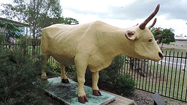
Statue of the bullock "Banana", 2014
|
|||||||||||||||
| Population | 348 (2021 census) | ||||||||||||||
| • Density | 0.3703/km2 (0.959/sq mi) | ||||||||||||||
| Postcode(s) | 4702 | ||||||||||||||
| Area | 939.9 km2 (362.9 sq mi) | ||||||||||||||
| Time zone | AEST (UTC+10:00) | ||||||||||||||
| Location |
|
||||||||||||||
| LGA(s) | Shire of Banana | ||||||||||||||
| State electorate(s) | Callide | ||||||||||||||
| Federal Division(s) | Flynn | ||||||||||||||
|
|||||||||||||||
Welcome to Banana, a small country town in Queensland, Australia! It's also a 'locality,' which means it's a specific area. In 2021, about 348 people lived here. Banana is located in the area known as the Shire of Banana, which is named after the town itself!
Contents
Where is Banana?
Banana is found where two main roads meet: the Dawson Highway and the Leichhardt Highway. It's about 46 kilometers (29 miles) west of Biloela, which is the main town for the local government area.
A Look Back in Time
Early Days and Name Origin
The land around Banana is the traditional home of the Gangalu Aboriginal people. Their language region covers a wide area, including towns like Clermont and Springsure.
In 1853, some early settlers started a large farm called Rannes. Banana began as a smaller part of this farm. By 1855, it became its own sheep farm.
The town of Banana got its unique name from a famous old bullock. This bullock was a light brown color and was named Banana. He was very good at helping local stockmen guide wild cattle into their pens.
Town Growth and Changes
The first post office in Banana opened on September 1, 1861. That same year, the first plots of land in the town were put up for sale.
In 1887, there was a small "gold rush" in Banana. This brought a few hundred more people to the town, hoping to find their fortune!
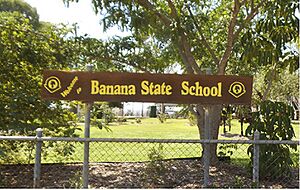
Banana Provisional School first opened its doors on September 18, 1871. It became a full State School in 1874. The school closed for a while in 1935 but reopened in 1960.
In 1880, the local government area called the Shire of Banana was created, and its main office was in Banana. However, in 1930, the office moved to Rannes. Since 1946, the shire's main office has been in Biloela.
A mobile library service, which brings books to people, started in Banana in 2004.
What Banana Does
The main industries in Banana are still beef farming and coal mining. Agriculture, like growing crops, is also important to the area's economy.
Learning in Banana
Banana State School is a primary school for students from Prep to Year 6. It's located on Bramston Street. In 2012, the school had 37 students and 3 teachers.
There isn't a high school in Banana itself. Older students usually go to secondary schools in nearby towns. The closest government high schools are Moura State High School in Moura (to the west) and Biloela State High School in Biloela (to the east).
Places to Visit
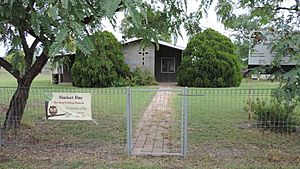
Banana has a Uniting Church located on Bowen Street, at the corner of North Street.
The Banana Shire Council runs a mobile library service that visits Banana and the school every two weeks. This means you can borrow books right in your town!
The local branch of the Queensland Country Women's Association meets on Bramston Street. This group helps women in country areas and supports the community.
 | May Edward Chinn |
 | Rebecca Cole |
 | Alexa Canady |
 | Dorothy Lavinia Brown |


