Bannaventa facts for kids
Quick facts for kids
Bannaventa
|
|
|---|---|
|
Settlement
|
|

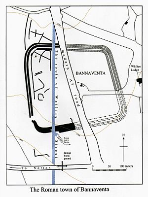
Plan of the site of Bannaventa
|
|
| Country | England |
| County | Northamptonshire |
| Region | East of England |
| District | Daventry |
| Parish | Norton |
 |
|
Bannaventa was an old Roman town in England. It was a fortified settlement, meaning it had strong walls for protection. Bannaventa was located on a very important Roman road called Watling Street. Today, this road is known as the A5 trunk road.
Bannaventa is about 1 mile (1.6 km) northeast of the village of Norton. This village is in the English county of Northamptonshire.
Contents
Watling Street: A Roman Superhighway
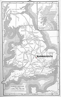
The road where Bannaventa was built, Watling Street, was probably the first road the Romans made in Britain. It started in a place called Portus Ritupis (now Richborough) in Kent. From there, it stretched northwest, connecting many important Roman towns and settlements.
Watling Street was like a superhighway for the Romans. It helped them move soldiers, goods, and people across Britain. Bannaventa was a small, fortified town along this vital route. It was about 10.9 miles (17.5 km) northwest of another Roman town called Lactodorum (now Towcester). Further northwest, about 17.3 miles (27.8 km) away, was the Roman settlement of Venonis (now Wigston Parva). At Venonis, Watling Street crossed another major Roman road, the Fosse Way.
What's in a Name?
The name Bannaventa comes from an old language called Brittonic. *Bannā meant "peak" or "hill." *Wentā might have meant "place of sacrifice" or simply "place." So, Bannaventa could mean something like "hill place" or "place on the hill."
We know about Bannaventa from an ancient Roman travel guide. It was written by Emperor Antoninus Pius and called Itinerarium Antonini Augusti (The Road Routes of Antoninus Augustus). This guide listed different routes and the distances between towns.
Here are some mentions of Bannaventa from the guide:
- Route 2: Venone 12 miles, Benaventa 17 miles, Lactodorum 12 miles.
- Route 6: Lactodorum 16 miles, Isannavantia 12 miles, Tripontium 12 miles.
- Route 8: Venone 12 miles, Benaventa 18 miles, Magiovinter 28 miles.
Isannavantia is thought to be the same place as Bannaventa. The other places mentioned are:
- Venone = High Cross, Wigston Parva, Leicestershire
- Tripontium = Cave's Inn, Warwickshire
- Magiovinter = Dropshort, Buckinghamshire
Bannaventa was an important "posting station" for Roman travelers. Think of it like a rest stop or a motel along a busy highway today. Travelers could stop here to rest, get warm, and buy supplies for their journey. They could also safely keep their horses and other animals overnight.
The town also offered protection to people living nearby when there was danger. Close to Bannaventa, archaeologists have found other Roman sites. These include the remains of a villa (a large Roman house) on Borough Hill. There was also a smaller settlement and several other small farmhouses found nearby.
Finding the Lost Town
It took a long time to figure out exactly where Bannaventa was. For many years, people thought it might be in other nearby places like Weedon Bec or Daventry. But in the early 1700s, the true site was finally identified.
Many exciting discoveries helped pinpoint the location. Archaeologists found a skeleton and many cremation burials in a Roman graveyard south of the town's boundaries. They also found Roman coins, building foundations, stonework, and pottery. These early finds confirmed the town's exact spot.
More discoveries were made in the 20th century:
- Rubbish pits from the 1st and 2nd centuries were found.
- In 1900, Roman coins, pottery, and parts of buildings like wall plaster and roof slates were uncovered.
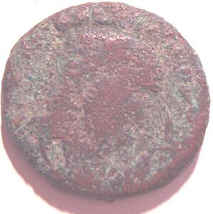
- In 1922, more Roman coins were found, including a Sestertius from the time of Emperor Hadrian.
- In 1957, a large pot, a painted pot, and pieces of a glass bowl were discovered. Many other artifacts were also found.
In 1970, the site was photographed from an airplane. This aerial view clearly showed the path of Roman Watling Street cutting through the town. It also revealed the outline of the town itself. Bannaventa was shaped like an uneven square with rounded corners. It was protected by three sets of banks and ditches. The enclosed area was quite large, covering about 13.5 acres (55,000 square meters). Inside, there was evidence of the wooden buildings that made up most of the town.
What's Left Today?
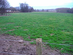
Today, you won't see any obvious Roman remains above ground at Bannaventa. The land is privately owned and used for farming. There is no public access to the site. However, it is protected as a Scheduled Ancient Monument. This means it's an important historical site that is legally protected.
Was Saint Patrick Born Here?
Saint Patrick, who is the patron saint of Ireland, wrote about his life in a book called his Confession. He said he was born in a place called Bannavem Taburniae. No one knows for sure where this place was. But the first part of the name, Bannavem, sounds a lot like Bannaventa.
This led some historians to wonder if Saint Patrick was born at the Roman town of Bannaventa in Northamptonshire. However, an early story about Saint Patrick says he was born "near the western sea." This makes sense, as he was taken as a slave to Ireland by Irish raiders. It's likely that the name of Patrick's birthplace included another word, like "Taburniae," to tell it apart from the Bannaventa we know in Northamptonshire.


