
Barburgh Mill facts for kids
Quick facts for kids Barburgh Mill |
|
|---|---|

Barburgh Mill
|
|
| OS grid reference | NX 90116 88316 |
| Council area | |
| Country | Scotland |
| Sovereign state | United Kingdom |
| Police | Dumfries and Galloway |
| Fire | Dumfries and Galloway |
| Ambulance | Scottish |
| EU Parliament | Scotland |
| UK Parliament |
|
Barburgh Mill is a small group of buildings, or a hamlet, in south-west Scotland. It's located north of Auldgirth in Dumfries and Galloway. The main part of the hamlet was an old mill, first used for processing flax (to make linen) and later for wool.
The area is close to the A76 road, the River Nith, and the Lake Burn. This burn once provided power for the mill. Barburgh Mill is also known for its links to the Covenanters, a group of Scottish Presbyterians who faced tough times for their religious beliefs. People also believe a Roman fortlet (a small fort) and a Roman road were once here.
Contents
History of Barburgh Mill

Barburgh Mill is about 4 kilometers south of Closeburn. The stream that runs through it is called the Lake Burn. This burn starts near the old Closeburn Loch, which is now drained. Over time, the hamlet has been known by many different names, like Barbauch, Burborough, and Burburgh.
The first time the name appeared on a map was in 1747-1755. It was hard to read, but it might have said 'Bolybruchhead'. However, no mill or settlement was shown then.
The Lake Burn flows from the site of the old Closeburn Loch. It joins the River Nith at a spot called Lintmill Pool. This area is famous for its connection to the Covenanters. These were Scottish people who believed in the Presbyterian Church. They faced difficult times, sometimes called the 'Killing Times', during the reigns of King Charles II and King James VI and II. These events eventually helped establish the Presbyterian Church of Scotland.
Around 1848-1858, maps showed the area as 'Burbrough'. There were several small houses and a bobbin mill. This mill made wooden bobbins, which are important for spinning and weaving thread. Before that, it was a lint mill, used for processing linen.
Some old records mention a 'Bar Brugh' or 'Defence Fort'. This was described as a large pile of stones near Cairn Farm. It was thought to be a circular fort that protected the entrance to the parish. However, the railway now runs through this area, and any such fort might have been destroyed.
The Mill, Smithy, and Burn

The mill at Barburgh got its water from the Lake Burn, not the River Nith. Water flowed through a special channel called a lade. This lade had sluices (gates to control water flow) and mill ponds. This water system was part of a bigger plan to power other local businesses.
The first mention of Barburgh Mill is from 1684. A Covenanter named John Padzean worked there, possibly as the miller.
Near Barburgh Mill, the River Nith has a spot called 'Lintmill Pool'. This name likely comes from the mill's early use for preparing lint or linen from flax plants. The mill first appeared on maps in 1804 as a lint mill. By 1855, it was a 'Bobbin' mill, making wooden bobbins. Later, by 1899, it became a woollen mill. It continued to operate as a woollen mill until it finally closed in the 1960s.
The current mill building was likely built by Charles Stuart Menteth around 1790-1810. Later, in 1862, the Baird family bought the estate and owned the mill.
The mill building itself is two stories high and made of stone. It's shaped like an 'L'. In the early 19th century, it was a woollen mill, making blankets in 1939. It closed in the 1960s and was later used for storage. The mill had a large water wheel inside a special building. The lade (water channel) was also changed over time.
Barburgh Smithy was a workshop where a blacksmith worked. It stood west of the mill and was a single-story stone building. It likely served the local community and the mill. There was also a saw pit nearby, used for cutting wood. Stables and homes for workers might have been here too.
Barburgh Mill House is west of the burn. This house was where the miller lived. It even had a sundial in 1854, which was a fancy feature back then.
Barburgh Mill Roman Fortlet
In 1945, a small Roman fort, called a fortlet, was found near Barburgh Mill. It was fully dug up by archaeologists in 1971. Sadly, much of the fortlet was destroyed by gravel quarrying (digging for gravel) later on.
The old Roman road is believed to have run underneath the hill where the fortlet was located. The fortlet was quite small, about 700 square meters. It had two timber barracks, each with six rooms. During the first Antonine period (a time in Roman history), a fortlet like this would have housed about 100 Roman soldiers. The ditch around the fortlet would have been visible for a long time, possibly until the 14th century.
Transport Links
Barburgh Mill is in Nithsdale, which is a natural path for travel. This is why the main A76 road and a railway line pass through the area. The A76 road connects Dumfries to Ayr, passing through Thornhill from Auldgirth.
The hamlet never had its own passenger train station. Today, the closest station is Sanquhar. In the past, there was a station at Auldgirth.
The A76 used to be a turnpike road, which meant people had to pay a toll to use it. There was a toll house here, first recorded in 1821 as Burbrught Toll. Later, on maps from 1843-1882, it was called 'Stepends Toll'. It had a weighing machine and a water trough nearby. By 1899, the toll system was gone, and the site was just called 'Whitespots Cottages'.
What's in a Name?
The name 'Barbrough' is thought to mean 'the whizzing town'. This might come from the humming sound made during the lint manufacturing process at the mill.
The name 'Lintmill Pool' is also linked to the mill's past. It was used for preparing lint or linen from flax plants. Sometimes, flax was left in deep 'lint pools' along the river. This was part of a process called retting, where the flax would rot a little before being processed at the mill.
An old record from 1247 called Barburgh 'Bridburgh'. This might mean 'Bridda's Fort' or even the 'Fort of the Birds'.
Images for kids
-
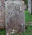
The gravestone of the Covenanter James Mathieson at Closeburn cemetery.

