Barra Strait facts for kids
Quick facts for kids Barra Strait |
|
|---|---|
| Grand Narrows | |

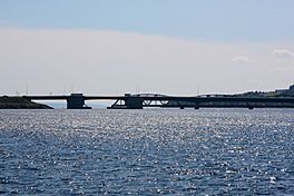
Barra Strait and Bridges from the North
|
|
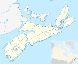
| Location | Cape Breton Island, Nova Scotia |
| Coordinates | 45°57′09″N 60°48′15″W / 45.95250°N 60.80417°W |
| Type | Channel |
| Native name | Taawitk Error {{native name checker}}: parameter value is malformed (help) |
| Part of | Bras d'Or Lake |
| Ocean/sea sources | Gulf of Saint Lawrence, Atlantic ocean |
| Basin countries | Canada |
| Max. length | 1.2 nautical miles (2.2 km; 1.4 mi) |
| Max. width | 0.66 nautical miles (1.22 km; 0.76 mi) |
| Max. depth | 50 metres (160 ft) |
| Settlements | Grand Narrows & Iona |
The Barra Strait is a narrow waterway, like a natural channel, in Nova Scotia, Canada. It's about 1.22 kilometers (0.76 miles) wide. This strait connects the two main parts of Bras d'Or Lake, which is a large saltwater lake in the middle of Cape Breton Island.
The strait also marks the border between two counties on Cape Breton Island. On the eastern side, you'll find the community of Grand Narrows in Cape Breton County. On the western side is Iona, located in Victoria County.
History of the Name
The Mi'kmaq people, who are the original inhabitants of this land, called the strait Taawitk. This name means "where the water flows out."
An older name for the strait was "Grand Narrows." This name is still used for the community on the east bank. It also names the railway bridge that crosses the strait. The word "Grand" helped tell it apart from the "Little Narrows" in the same Bras d'Or Lake.
The name "Barra Strait" comes from the Sound of Barra. This is a place on the Isle of Barra in the Scottish Hebrides. Many settlers in this area came from there around the year 1802. The name "Barra Strait" was officially approved on November 2, 1950.
Boats and Shipping
In 1869, the St. Peters Canal opened. This made the Barra Strait part of a safe shipping route. Boats could travel between Sydney and the Strait of Canso. This route was used by both sailing ships and steam-powered vessels.
The size of boats that can use this route is limited by the lock in the St. Peters Canal. This lock is about 91.44 meters (300 feet) long. It is 14.45 meters (47.4 feet) wide, and boats can have a draught (how deep they sit in the water) of up to 4.88 meters (16 feet).
Since 1991, people have kept track of boat traffic through the Barra Strait. Each year, between 1,700 and 2,100 boats pass through the bridges. The busiest year was 2002, with 2,100 passages. Most of these boats (about 90%) are for fun, like recreational boats. About 8% are government boats, and only 2% are commercial ships.
The Bridges of Barra Strait
In the late 1880s, the Intercolonial Railway of Canada built a bridge across the strait. This was the Grand Narrows Bridge, also known as the Barra Strait Railway Bridge. It is the longest railway bridge in Nova Scotia. It connects Uniacke Point on the west side to Kelly Point on the east.
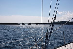
This railway bridge has a special part called a swing span. This part can swing open to let boats pass through the strait.
For many years in the 20th century, the Government of Nova Scotia ran a small ferry service for cars to cross the strait. This ferry was replaced in October 1993. A new bridge, the Barra Strait Bridge, was built. It carries Route 223 and has two parts that can lift up, called a bascule bridge.
How Deep is the Strait?
The Barra Strait is quite deep at its southern entrance. It's more than 50 meters (164 feet) deep between Hectors Point and Derby Point. The strait then goes northeast for about 2.2 kilometers (1.4 miles). It gets narrower, becoming just over 500 meters (1,640 feet) wide between Uniacke and Kelly Points.
In this narrower part, the bottom of the strait rises. The deepest point here is about 22.8 meters (75 feet). The navigation channel, where boats pass through the bridge openings, has a depth of 8 meters (26 feet).
The water currents in the Barra Strait are strongest when the tide is halfway in or halfway out. They can flow as fast as 3 knots (about 5.5 kilometers or 3.4 miles per hour). The currents usually flow north-northeast or south-southwest through the strait. However, near the swing bridge, they can be pushed to the northwest and southwest by Kelly Point.
 | Calvin Brent |
 | Walter T. Bailey |
 | Martha Cassell Thompson |
 | Alberta Jeannette Cassell |


