
Barton Creek facts for kids
Quick facts for kids Barton Creek |
|
|---|---|

Barton Creek in 1900
|
|

Barton creek watershed in Travis County
|
|
| Country | United States |
| State | Texas |
| Region | Texas Hill Country |
| Municipality | Austin |
| Physical characteristics | |
| Main source | Hays County, Texas 380 m (1,250 ft) 30°14′22.87″N 98°9′10.4″W / 30.2396861°N 98.152889°W |
| River mouth | Colorado River (Texas) Lady Bird Lake 130 m (430 ft) 30°16′1.46″N 97°45′40.63″W / 30.2670722°N 97.7612861°W |
| Length | 64 km (40 mi) |
Barton Creek is a stream that flows into the Colorado River in the Texas Hill Country. It runs through some of the most beautiful areas near Austin. Much of the creek is surrounded by a special protected area called a greenbelt. This greenbelt is home to many native plants and animals. The creek flows through the Barton Creek Greenbelt and is fed by Barton Springs.
Contents
Where Does Barton Creek Flow?
Barton Creek starts in northern Hays County. It flows about 40 miles (64 km) east through Austin. The water then goes into the Edwards Aquifer recharge zone in southwest Austin. An aquifer is like a huge underground sponge that holds water. The creek then comes back to the surface at Barton Springs. From there, it flows towards Lady Bird Lake (which used to be called Town Lake). Finally, it joins the Colorado River.
History of Barton Creek
For hundreds of years, Barton Creek has been an important place. In the 1600s and 1700s, Native American groups like the Tonkawa and Comanche are thought to have camped along the creek.
The creek gets its name from William Barton. He built a house near Barton Springs in 1837. As the city of Austin grew, the springs became a popular spot for people to visit. The natural swimming hole was later turned into a swimming pool in the 1930s.
Keeping Barton Creek Clean
As Austin grew in the 1970s and 1980s, the creek's water quality and wildlife faced threats. Heavy rains sometimes caused pollution to enter the creek. This happened because of runoff (water flowing over land) and leaks from sewer lines. These pollutants would enter the Edwards Aquifer, which is a major source of drinking water.
People in Austin were very concerned about this. In response, the Austin City Council passed rules to protect the creek's watershed in 1980 and 1986. A watershed is an area of land where all the water drains into a common stream or river.
In 1990, there were plans to build more on the land around the creek. This caused even more public concern. This led to the "Save Our Springs Citizens' Initiative" in 1992. This new rule limited construction and set strict standards to control pollution. It also put in place ways to reduce accidental contamination.
Protecting Nature Along the Creek
A large part of the creek flows through the Barton Creek Greenbelt. This is a public park and protected area. It helps keep the land around the creek safe for nature.
In 1994, an organization called The Nature Conservancy bought land around the upper part of the creek. They created the Barton Creek Habitat Preserve. This preserve is about 4,084 acres (1,653 hectares) and is managed with help from local residents. It protects old forests with juniper, oak, cedar, and elm trees. You can also find rare woodland flowers and plants there. These include Heller's marbleseed and gravelbar brickelbush. The preserve is also home to endangered birds like the golden-cheeked warbler and black-capped vireo. The threatened Guadalupe bass fish also lives here.
Fun Things to Do at Barton Creek
When it rains a lot, the upper part of Barton Creek fills with water. This makes it a great place for water activities. You can go kayaking, tubing, and swimming.
The Lower Barton Creek Greenbelt offers these water sports all year round. You can swim in the Barton Springs Pool. You can also go kayaking and canoeing in the creek. The creek here is fed by the water that flows out of Barton Springs.
Gallery
-
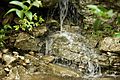
Waterfall on Barton Creek
-
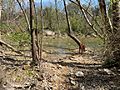
A Vizsla dog standing near the Little Barton Creek confluence
-
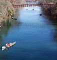
Barton Creek near the Colorado River confluence


.JPG)

