Batesville, Indiana facts for kids
Quick facts for kids
Batesville, Indiana
|
|||
|---|---|---|---|
 |
|||
|
|||

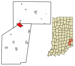
Location of Batesville in Ripley County and Franklin County, Indiana.
|
|||
| Country | United States | ||
| State | Indiana | ||
| Counties | Ripley, Franklin | ||
| Area | |||
| • Total | 6.17 sq mi (15.98 km2) | ||
| • Land | 6.10 sq mi (15.81 km2) | ||
| • Water | 0.07 sq mi (0.17 km2) | ||
| Elevation | 942 ft (287 m) | ||
| Population
(2020)
|
|||
| • Total | 7,202 | ||
| • Density | 1,179.88/sq mi (455.52/km2) | ||
| Time zone | UTC-5 (EST) | ||
| • Summer (DST) | UTC-4 (EDT) | ||
| ZIP code |
47006
|
||
| Area code(s) | 812 | ||
| FIPS code | 18-03664 | ||
| GNIS feature ID | 2394080 | ||
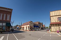
Batesville is a city in Indiana, located in both Ripley and Franklin counties. In 2020, about 7,202 people lived here. This makes Batesville the largest community in both counties. However, it is not the main county town for either.
The Batesville Casket Company has its main office in Batesville. The city is also known for its good location. It sits between three major cities: Indianapolis, Cincinnati, and Louisville.
Contents
History of Batesville
Batesville has a rich history, with many important buildings. The Central Batesville Historic District was added to the National Register of Historic Places in 2011. This means it's a special place with historical value.
How Batesville Began
Batesville was started by George H. Dunn. He owned a company that bought land. This company then created new towns along the railway lines. Dunn was also the president of the Cincinnati and Indianapolis Railroad.
Joshua Bates helped plan the town of Batesville. Many believe the town was named after him. The very first train from Cincinnati to Indianapolis passed through Batesville on November 1, 1853.
Growing the Town
After the railway opened, Dunn and Bates built more structures. George Sims planned the first expansion of Batesville in 1858. The next year, Henry Boehringer, an immigrant from Germany, became a major builder. He built a three-story building with a basement on East Pearl Street. This building became known as Boehringer Hall. It had a dance floor on the third story.
In 1858, Louis Walter opened Batesville's first gristmill. A gristmill grinds grain into flour. Between 1860 and 1870, Boehringer built many apartments and homes. These were on the north side of Batesville, on Boehringer Street.
In 1863, Conrad Rapp bought Walter's gristmill. In 1865, John Brinkman built a hotel and restaurant. It was called the Sherman House. It was named after William Tecumseh Sherman, a general who helped win the Civil War.
Sebastian Messersmith built Union Hall in 1865. This two-story building was important to the town. It was used for fire department meetings. It also served as a temporary school while the main school was being rebuilt. Batesville has been known for its many factories since the 1870s.
Early Businesses and Government
In 1873, the Greeman Bracket Company started making products. It was a leading business for 30 years. The Schrader Furniture Factory was built in 1873. It had to be rebuilt in 1875 after a fire. Later, John and William Hillenbrand bought the business.
In 1874, the Union Furniture Factory also burned down. The Blank Bros. Furniture Manufacturing Company was built the next year. In 1879, Batesville started its first newspaper, The Prairie Farmer.
In the 1880s, Batesville formed its first local government. The first mayor was George M. Hillenbrand. The first town board members worked without pay. They often used their own money to help the town. For example, in 1883, they paid for town bills. Also in 1883, Batesville began building new roads.
Important Developments
The Batesville Casket Company was started in 1884. George M. Hillenbrand later bought it in 1906. Also in 1884, the town jail was finished. It cost $211.55 to build. People in jail had to break stones to pay for their stay.
In 1887, Batesville expanded and got telephone connections. These improvements were funded by a grant. Also in 1887, John Hillenbrand and Victor Oberting opened a stone quarry. In December 1887, the town hall was completed. It had space for the town board and the fire company. It was also rented for public events.
In 1888, the school board decided to add to the schoolhouse. This project was estimated to cost $1,500. The first city attorney was also appointed that year. Many new businesses opened, including a tin shop and a grocery store. A covered bridge was built over Laughery Creek, making travel easier.
In 1889, Batesville paved its roads with stone from the local quarry. The Batesville State Bank also opened that year. In 1890, the first sidewalks were built. Street lamps were introduced in the 1890s. At first, they used oil. Later, in 1894, the first electric lamp was placed in front of Town Hall.
In 1895, a new school was planned. It was estimated to cost $5,700. In 1897, Batesville stopped using electric lamps because they were too expensive. But in 1898, they decided to use them again at lower rates, only when needed.
Geography and Climate
Batesville covers an area of about 6.16 square miles (15.98 square kilometers). Most of this area is land.
Local Climate
The weather in Batesville has hot, humid summers. Winters are usually mild to cool. According to the Köppen Climate Classification system, Batesville has a humid subtropical climate. This means it gets plenty of rain and has warm temperatures for most of the year.
Economy and Businesses
Batesville is home to two large companies that are traded publicly. There are also smaller manufacturing companies. A telecommunications company, formerly called Enhanced Telecommunications Corporation, serves Batesville and nearby towns. Batesville Tool & Die, a metal parts maker, is also based here.
Batesville Casket Company
The Batesville Casket Company started in 1884. It is still a very successful business today. It is one of the top casket companies in the United States.
Hospital Equipment Manufacturing
The biggest industry in Batesville is making hospital and health care equipment. This includes hospital beds. William Hillenbrand and his aunt Mary Mitchell started HillRom in 1927. The company grew quickly after the Great Depression. William convinced hospitals to try his wooden hospital beds for six months for free.
Transportation in Batesville
Most people in Batesville travel by road. Several major roads cross through the city.
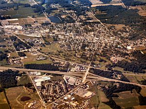
Batesville is located on I-74. This interstate connects Indianapolis to the west and Cincinnati to the east. It runs through the northern part of the city. Most of Batesville is south of I-74, but some businesses and homes are north of it.
Indiana 229 goes from north to south through the city center. It links Batesville to Oldenburg in the north and Indiana 48 in the south. Parts of Main Street and Walnut Street are also Indiana 229.
Indiana 46 runs east to west through Batesville. It connects the city to Greensburg in the west and other small towns in the east. Indiana 46 runs alongside Interstate 74.
A railroad also runs through Batesville. It is owned by the Central Railroad Company of Indiana. This line connects Indianapolis to Cincinnati and is used only for freight.
There are no taxi or limousine services in Batesville. Greyhound Lines buses stopped service in Batesville on June 20, 2005.
Education in Batesville
Batesville has one public school corporation, Batesville Community Schools. It includes:
- Batesville Primary School
- Batesville Intermediate School
- Batesville Middle School
- Batesville High School
In the 2011–2012 school year, about 2,083 students were enrolled in the district.
The only private school is St. Louis Catholic School. It has about 420 students in its K-8 program. It also has 50 students at St. Louis Catholic Preschool.
Ivy Tech Community College has a campus in Batesville. It is a branch of Ivy Tech Southeast.
The town also has a public library, the Batesville Memorial Public Library.
Fun and Recreation
Batesville offers several places for outdoor fun. Batesville Liberty Park is the main public park. It has many activities like horseshoes, volleyball, baseball, and basketball. It also has playgrounds and a large pavilion.
Batesville also has walking and biking trails, a skatepark, and a pump track. The main bike and running trails are in Brum Woods. This is an 80-acre (32-hectare) area of woods donated by Lena Brum. Batesville also has a golf course called Hillcrest Country Club and Golf Course. The Southeast Indiana YMCA is also located here.
Batesville also has a movie theater, The Gibson Theatre. Dr. C. W. Gibson built it in 1921. The theater has a special neon-lit look.
Local Media
Batesville has one radio station, WRBI. It plays country music on 103.9 FM. WRBI is owned by White River Broadcasting Co., Inc. This station also shares local news and sports with the community.
Population Facts
| Historical population | |||
|---|---|---|---|
| Census | Pop. | %± | |
| 1890 | 1,169 | — | |
| 1900 | 1,384 | 18.4% | |
| 1910 | 2,151 | 55.4% | |
| 1920 | 2,361 | 9.8% | |
| 1930 | 2,838 | 20.2% | |
| 1940 | 3,065 | 8.0% | |
| 1950 | 3,194 | 4.2% | |
| 1960 | 3,349 | 4.9% | |
| 1970 | 3,799 | 13.4% | |
| 1980 | 4,152 | 9.3% | |
| 1990 | 4,720 | 13.7% | |
| 2000 | 6,033 | 27.8% | |
| 2010 | 6,520 | 8.1% | |
| 2020 | 7,202 | 10.5% | |
| U.S. Decennial Census | |||
2010 Population Details
In 2010, Batesville had 6,520 people living in 2,492 households. There were 1,678 families. The city had about 1071 people per square mile (414 per square kilometer). Most of the people living in Batesville were White (95.1%).
About 38.4% of households had children under 18. About 53.6% were married couples. The average household had 2.55 people. The average family had 3.16 people.
The average age in the city was 38.2 years. About 28.6% of residents were under 18. About 15.9% were 65 years or older. The population was 47.7% male and 52.3% female.
See also
 In Spanish: Batesville (Indiana) para niños
 | Jackie Robinson |
 | Jack Johnson |
 | Althea Gibson |
 | Arthur Ashe |
 | Muhammad Ali |


