Bayside, Wisconsin facts for kids
Quick facts for kids
Bayside, Wisconsin
|
|
|---|---|

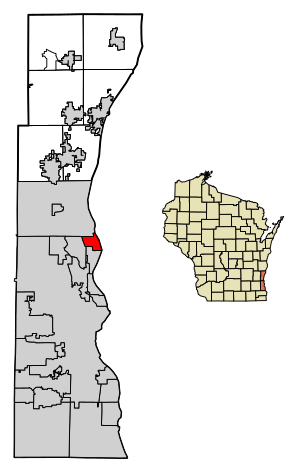
Location of Bayside in Milwaukee and Ozaukee Counties, Wisconsin.
|
|
| Country | |
| State | |
| Counties | Milwaukee, Ozaukee |
| Incorporated | February 13, 1953 |
| Area | |
| • Total | 2.39 sq mi (6.19 km2) |
| • Land | 2.39 sq mi (6.19 km2) |
| • Water | 0.00 sq mi (0.00 km2) |
| Elevation | 673 ft (205 m) |
| Population
(2020)
|
|
| • Total | 4,482 |
| • Estimate
(2021)
|
4,421 |
| • Density | 1,814.91/sq mi (700.66/km2) |
| Time zone | UTC-6 (Central (CST)) |
| • Summer (DST) | UTC-5 (CDT) |
| ZIP code |
53217
|
| Area code(s) | 414 |
| FIPS code | 55-05450 |
| GNIS feature ID | 1561327 |
Bayside is a small village located in the state of Wisconsin, USA. It's special because it's split between two counties: Milwaukee and Ozaukee. In 2020, about 4,482 people lived there. Most of them, 4,378, were in Milwaukee County. Only 104 people lived in the Ozaukee County part.
Contents
Where is Bayside?
Bayside is located at coordinates 43°10′49″N 87°54′17″W. This means it's in the northern part of the United States.
The village covers an area of about 2.39 square miles (6.19 square kilometers). All of this area is land. The beautiful Lake Michigan forms the eastern border of Bayside. While most of Bayside is in Milwaukee County, a small part near Fish Creek is in Ozaukee County.
A Look Back: Bayside's History
The land where Bayside now stands was first home to Native Americans. They gave up their land to the United States government in the 1830s. Some stories say that a Potawatomi Chief named Waubeka might have had a summer camp in Bayside as late as 1845.
In the 1800s, this area was part of the Town of Milwaukee. Early Dutch-American settlers used most of the land for cutting down trees (logging) and then for farming.
Nine Mile Farm and Nature Center
In 1885, the Uihlein family started buying land in Bayside. This family owned the famous Joseph Schlitz Brewing Company. They created a large farm called Nine Mile Farm. Here, they raised strong horses for their brewery. They also had chickens and cows. Around 1910, they began planting many trees to reforest the area.
Years later, in 1971, the Schlitz Foundation gave this land to the National Audubon Society. This gift helped create the Schlitz Audubon Nature Center. Today, it's a huge 185-acre nature center where people can learn about nature and see wildlife.
Becoming a Village
In the late 1800s and early 1900s, some important people from Milwaukee built summer homes in a community called "Fairy Chasm." This area was close to Lake Michigan.
Bayside grew quickly after World War II. Many homes in the village were built between 1950 and 1980. The village officially became a village on February 13, 1953. This was done to stop the larger City of Milwaukee from taking over Bayside, which had happened to other nearby communities.
In 1955, some people living in the Fairy Chasm area of Ozaukee County asked to join Bayside. The southern part of Fairy Chasm became part of Bayside, while the northern part joined the City of Mequon.
Schools in Bayside
Bayside has two public school districts for younger students:
- The Fox Point-Bayside School District serves the eastern part of the village. Students here go to Stormonth Elementary and Bayside Middle Schools.
- The Maple Dale-Indian Hill School District serves the western part. Students attend Indian Hill Elementary and Maple Dale Middle Schools.
All students in Bayside attend Nicolet High School in Glendale for their high school years.
People of Bayside
| Historical population | |||
|---|---|---|---|
| Census | Pop. | %± | |
| 1960 | 3,181 | — | |
| 1970 | 4,461 | 40.2% | |
| 1980 | 4,724 | 5.9% | |
| 1990 | 4,789 | 1.4% | |
| 2000 | 4,518 | −5.7% | |
| 2010 | 4,389 | −2.9% | |
| 2020 | 4,482 | 2.1% | |
| 2021 (est.) | 4,421 | 0.7% | |
| U.S. Decennial Census | |||
In 2010, there were 4,389 people living in Bayside. The average age of people in the village was 48 years old.
Famous People from Bayside
- Gaston Vandermeerssche: He was a leader in the Dutch resistance during World War II.
- Mark Metcalf: An actor known for playing Doug Neidermeyer in the movie Animal House.
See also
 In Spanish: Bayside (Wisconsin) para niños
 | William L. Dawson |
 | W. E. B. Du Bois |
 | Harry Belafonte |


