
Ozaukee County, Wisconsin facts for kids
Quick facts for kids
Ozaukee County
|
|
|---|---|

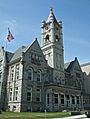
Ozaukee County Courthouse in July 2009
|
|

Location within the U.S. state of Wisconsin
|
|
 Wisconsin's location within the U.S. |
|
| Country | |
| State | |
| Founded | 1853 |
| Seat | Port Washington |
| Largest city | Mequon |
| Area | |
| • Total | 1,116.2 sq mi (2,891 km2) |
| • Land | 233.08 sq mi (603.7 km2) |
| • Water | 883.12 sq mi (2,287.3 km2) |
| Population
(2020)
|
|
| • Total | 91,503 |
| • Estimate
(2023)
|
93,460 |
| • Density | 392.7/sq mi (151.6/km2) |
| Time zone | UTC−6 (Central) |
| • Summer (DST) | UTC−5 (CDT) |
| Congressional district | 6th |
Ozaukee County is a county in the state of Wisconsin, USA. In 2020, about 91,503 people lived here. The main city and government center is Port Washington. Ozaukee County is part of the larger Milwaukee area, which includes Waukesha and West Allis.
Ozaukee County is known for being a wealthy area. In 2000, it had one of the lowest poverty rates in the entire United States, at just 2.6%. It also ranked as the 25th wealthiest county based on how much money people earned.
Contents
What Does "Ozaukee" Mean?
The name "Ozaukee" comes from the Ojibwe name for the Sauk people. It likely means "people living at the mouth of a river." This name connects the county to its early Native American history.
A Look at Ozaukee County's Past
Early Human Life in Ozaukee County
One of the oldest places where people lived in Ozaukee County is the Hilgen Spring Mound Site. This site is near Cedar Creek in Cedarburg. It has three round burial mounds built by early Woodland period Mound Builders.
In 1968, experts from the Milwaukee Public Museum found human remains and tools in one mound. They found stone altars, arrowheads, and pottery pieces. Tests showed these mounds were built around 480 BCE, making them some of the oldest in Wisconsin.
Another old artifact found in the area is the Ozaukee County Birdstone. A six-year-old boy found it in 1891 near Saukville. Many birdstones are very old, dating from 3000 BCE to 500 BCE.
Native American Tribes and Early Settlers
In the early 1800s, the Menominee, Potawatomi, and Sauk people lived in Ozaukee County. Many Native American villages were located along the Milwaukee River.
The Menominee gave up their land east of the Milwaukee River to the U.S. government in 1832. The Potawatomi gave up their land west of the river in 1833. They were asked to leave the area by 1838. Some Potawatomi moved west, but others stayed in Wisconsin. These groups eventually formed the Forest County Potawatomi Community.
The first white settlers arrived in 1835. They bought land for $1.25 an acre. Wooster Harrison settled the area that became Port Washington in 1835. He first called it "Wisconsin City."
How Ozaukee County Was Formed
At first, Ozaukee County was part of Washington County. People wanted Port Washington to be the county seat. But it was far from other towns like Mequon and Grafton.
In 1853, the Wisconsin government split Washington County into two parts. This created Ozaukee County. Port Washington became the main city for the new Ozaukee County. The Washington County seat moved to West Bend.
Growth and Challenges in the 1800s
In the 1840s, many immigrants from Germany, Ireland, and Luxembourg moved to Ozaukee County. Germans were the largest group. By 1870, seven out of eight people in the county were of German descent.
Early towns grew around mills on the rivers. Places like Cedarburg, Grafton, and Saukville had mills by the late 1840s. The county's economy mostly relied on farming.
During the American Civil War, there was some trouble. In 1862, some people panicked due to false rumors of a Native American uprising. Many men were away fighting in the war, making people feel unsafe. Some residents fled to Milwaukee.
Later, the government started a draft for the war. Many German immigrants did not like this. On November 10, 1862, people in Port Washington protested. They attacked officials, burned draft papers, and damaged homes. The riot ended when soldiers from Milwaukee arrived.
In the 1870s, new railroads helped the county grow. The Milwaukee & Northern Railway connected Milwaukee to northern Wisconsin. It passed through Thiensville, Cedarburg, Grafton, and Saukville. Another railway, the Milwaukee, Lake Shore and Western Railway, ran along Lake Michigan. These railroads made it easier to transport goods and people.
Ozaukee County in the 1900s
From 1908 to 1940, electric trains called "interurbans" served the county. They carried people and farm products like milk and meat to Milwaukee. These trains stopped in many towns, including Belgium, Port Washington, and Cedarburg. The interurban service stopped in Ozaukee County in 1948.
The rural area of Mequon grew into a city in 1957. Today, Mequon is the largest city in Ozaukee County.
Ozaukee County Today
In 2021, the Wisconsin Shipwreck Coast National Marine Sanctuary was created in Lake Michigan. Part of this sanctuary is off the coast of Ozaukee County. This area protects many important shipwrecks.
Geography of Ozaukee County

Ozaukee County has 233 square miles of land. This makes it the second smallest county in Wisconsin by land area. The county also includes 883 square miles of water, mostly in Lake Michigan.
The Lion's Den Gorge Nature Preserve is a large protected area on the Lake Michigan shore. It has bluffs and wetlands.
Main Roads in Ozaukee County
 Interstate 43
 Highway 32 (Wisconsin)
 Highway 33 (Wisconsin)
 Highway 57 (Wisconsin)
 Highway 60 (Wisconsin)
 Highway 167 (Wisconsin)
 Highway 181 (Wisconsin)
Train Lines
- Union Pacific
- Wisconsin and Southern Railroad
Neighboring Counties
- Sheboygan County - north
- Oceana County, Michigan - northeast (across Lake Michigan)
- Muskegon County, Michigan - east (across Lake Michigan)
- Milwaukee County - south
- Waukesha County - southwest
- Washington County - west
Who Lives in Ozaukee County?
| Historical population | |||
|---|---|---|---|
| Census | Pop. | %± | |
| 1860 | 15,682 | — | |
| 1870 | 15,564 | −0.8% | |
| 1880 | 15,461 | −0.7% | |
| 1890 | 14,943 | −3.4% | |
| 1900 | 16,363 | 9.5% | |
| 1910 | 17,123 | 4.6% | |
| 1920 | 16,335 | −4.6% | |
| 1930 | 17,394 | 6.5% | |
| 1940 | 18,985 | 9.1% | |
| 1950 | 23,361 | 23.0% | |
| 1960 | 38,441 | 64.6% | |
| 1970 | 54,421 | 41.6% | |
| 1980 | 66,981 | 23.1% | |
| 1990 | 72,831 | 8.7% | |
| 2000 | 82,317 | 13.0% | |
| 2010 | 86,395 | 5.0% | |
| 2020 | 91,503 | 5.9% | |
| U.S. Decennial Census 1790–1960 1900–1990 1990–2000 2010 2020 |
|||
Population in 2020
In 2020, the population was 91,503 people. There were about 393 people per square mile. Most residents (89.9%) were White. Other groups included Asian (2.5%), Black or African American (1.7%), and Native American (0.3%). About 3.4% of the population was Hispanic or Latino.

Religious Groups
Many different religious groups live in Ozaukee County. The largest group is the Roman Catholic Archdiocese of Milwaukee, with over 28,000 members. There are also many Lutheran churches, including the Missouri Synod Lutherans and ELCA Lutherans. Other groups include Presbyterians, United Church of Christ, Methodists, and Jewish synagogues.
Getting Around Ozaukee County
Port Washington has a harbor on Lake Michigan. This is important for boats and shipping.
The Ozaukee County Interurban Trail is a path for walking, biking, and other non-motorized travel. It runs through Grafton and connects to trails in other counties. It follows an old train line.
Public bus service to Milwaukee used to be available. However, in 2024, the county decided to stop this service. This means there is no longer a public bus connection to Milwaukee from Ozaukee County.
Cities, Towns, and Villages
Cities
- Cedarburg
- Mequon
- Port Washington (the county seat)
Villages
- Bayside (mostly in Milwaukee County)
- Belgium
- Fredonia
- Grafton
- Newburg (mostly in Washington County)
- Saukville
- Thiensville
Towns
Other Communities
- Waubeka (a census-designated place)
Small Communities and Ghost Towns
- Dacada (partial)
- Decker
- Decker Corner
- Druecker
- Hamilton
- Holy Cross
- Horns Corners
- Knellsville
- Lake Church
- Lakefield
- Little Kohler
- Sauk Trail Beach
- Ulao
- Stonehaven (a former town)
High Schools in Ozaukee County
- Cedarburg High School
- Grafton High School
- Homestead High School (in Mequon-Thiensville)
- Ozaukee High School (in Fredonia)
- Port Washington High School
Images for kids
-
Ozaukee County Courthouse in July 2009
See also
 In Spanish: Condado de Ozaukee para niños
