Fredonia (town), Wisconsin facts for kids
Quick facts for kids
Town of Fredonia, Wisconsin
|
|
|---|---|

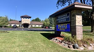
Fredonia Town & Village Hall
|
|

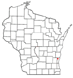
Location of Town of Fredonia in Ozaukee County, Wisconsin.
|
|
| Country | United States |
| State | Wisconsin |
| County | Ozaukee |
| Incorporated | 1847 |
| Area | |
| • Total | 35.0 sq mi (90.5 km2) |
| • Land | 34.7 sq mi (89.8 km2) |
| • Water | 0.3 sq mi (0.8 km2) |
| Elevation | 899 ft (274 m) |
| Population
(2000)
|
|
| • Total | 2,903 |
| • Density | 83.8/sq mi (32.3/km2) |
| Time zone | UTC-6 (Central (CST)) |
| • Summer (DST) | UTC-5 (CDT) |
| Area code(s) | 262 |
Fredonia is a town in Ozaukee County, Wisconsin, in the United States. In 2000, about 2,903 people lived there. The Village of Fredonia is a separate community completely surrounded by the town. Other small communities like Little Kohler and Waubeka are also part of the Town of Fredonia.
Contents
History of Fredonia
The land where Fredonia is now was first home to Native Americans, including the Potawatomi tribe. They gave up their land to the U.S. government in 1833 through a special agreement called the 1833 Treaty of Chicago.
Many Native people moved west. However, some Potawatomi stayed behind. They were sometimes called "strolling Potawatomi" because they moved around their old lands. One group was led by Chief Waubeka, who had a winter camp in the area until 1845. Later, the Potawatomi who stayed formed the Forest County Potawatomi Community in northern Wisconsin.
Fredonia was once part of the Town of Port Washington. In 1847, the Town of Fredonia was created. It was named after Fredonia, New York. A post office opened in Fredonia in 1850.
The community of Waubeka was the main center of population in the town until the 1870s. In 1873, a railway company built the Fredonia Station. This helped the Village of Fredonia grow. The village officially became its own community in 1922.
During World War II, there was a special camp in Little Kohler. It was called Camp Fredonia. This camp held 330 German prisoners of war. Forty-six U.S. soldiers guarded the camp. It opened in June 1945 and closed in January 1946. The prisoners often worked on local farms, helping to harvest crops like peas and sugar beets.
Geography and Nature
Fredonia covers about 35 square miles (90.5 square kilometers). Most of this area is land, with a small part being water. The Village of Fredonia is located in what used to be the southwest part of the town.
The town shares borders with other towns. These include the Town of Sherman to the north and the Town of Belgium to the east. To the south is the Town of Saukville, and to the west is the Town of Farmington. The small communities of Little Kohler and Waubeka are in the western part of the town.
Land and Water Features
Fredonia is in an area shaped by glaciers from the last ice age. This area has flat plains and some underground Silurian limestone formations. These rocks can be seen near the Milwaukee River. Fossils of ancient sea creatures have even been found there!
Before settlers arrived, much of Fredonia was covered in forests. These forests had many American beech and sugar maple trees. Most of these forests were cleared for farming. However, some nature areas still have these old-growth forests.
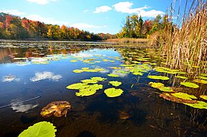
The area also has many bogs and swamps. These wet areas formed in hollows left by the glaciers. They include wetlands around Spring Lake and the bog in the Huiras Lake Woods and Bog State Natural Area. These wetlands are home to trees like white cedar and tamarack.
Animals and Plants
As towns grow, wild animals sometimes live closer to people. In Fredonia, you might see large animals like white-tailed deer, coyotes, North American river otters, and red foxes. Many birds, such as great blue herons and wild turkeys, also live here. The Huiras Lake Woods and Bog State Natural Area is a great place for many bird species.
Some plants and animals that are not native to the area have also moved in. These are called invasive species. They can sometimes harm the local environment. Examples include the emerald ash borer (an insect) and plants like reed canary grass and purple loosestrife.
People and Population
In 2000, there were 2,903 people living in Fredonia. Most of the people were White (97.14%). There were also smaller groups of Black, Native American, and Asian people. About 1% of the population was Hispanic or Latino.
There were 727 households in the town. About 36% of these households had children under 18 living with them. Most households (73.9%) were married couples. The average household had 2.83 people.
The median age in Fredonia was 24 years old. This means half the people were younger than 24, and half were older.
Culture and Traditions
Flag Day in Waubeka

The first official celebration of United States Flag Day happened in the Waubeka community. On June 14, 1885, a teacher named Bernard J. Cigrand asked his students to write about what the flag of the United States meant to them. This was to remember when the flag was chosen as a national symbol in 1777. This event was the first formal Flag Day observance.
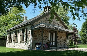
In 1995, the National Flag Day Foundation built the Americanism Center in Waubeka. This center is a museum and the foundation's main office. It has many patriotic items, old military uniforms, and things from Bernard J. Cigrand's life. The foundation also organizes a parade in Waubeka every Flag Day.
Churches in Fredonia
The Village of Fredonia has the Divine Savior Catholic Congregation. This church has a school for kids from kindergarten to sixth grade. They also have other chapels in nearby communities. There is also a Lutheran church called St. John Lutheran Church in the Village of Fredonia.
Education in Fredonia
Students in Fredonia attend schools in two different school districts.
- Northern Ozaukee School District: Students in the southern parts of the town go to schools in this district. They attend Ozaukee Elementary School (kindergarten to 5th grade), Ozaukee Middle School (6th to 8th grade), and Ozaukee High School (9th to 12th grade). There is also a special public school called the Riveredge School, which focuses on nature.
- Random Lake School District: Students in the northern parts of the town go to schools in this district. They attend Random Lake Elementary School (kindergarten to 4th grade), Random Lake Middle School (5th to 8th grade), and Random Lake High School (9th to 12th grade).
In addition to public schools, the Divine Savior Catholic Congregation also runs a private Catholic school in the Village of Fredonia for kindergarten through sixth grade.
Transportation
Wisconsin Highway 57 is a main road that goes through the town.
For public transportation, Fredonia residents can use the Ozaukee County Transit Services' Shared Ride Taxi. This taxi service runs seven days a week. You need to call ahead to schedule your ride.
The Wisconsin and Southern Railroad has a freight train line that passes through Fredonia. However, there is no passenger train station in Fredonia right now.
Nature Preserves and Recreation
The Ozaukee Washington Land Trust helps protect three nature areas in the Town of Fredonia:
- Hames Nature Preserve: This is a seven-acre forest along the Milwaukee River. It has hiking trails and is a good spot for watching birds.
- Huiras Lake State Natural Area: The Land Trust takes care of 113 acres of this large natural area. It's a beautiful forest and wetland with bogs and swamps.
- MacLaurin Woods: This five-acre preserve in western Fredonia has hiking trails. Deer hunting is allowed there during hunting season.
There are also two private camps in the town:
- Camp Awana is a Christian camp on Lake Twelve.
- The Milwaukee Jewish Community Center runs the JCC Rainbow Day Camp on part of the Huiras Lake State Natural Area.
Notable people
- Bernard J. Cigrand, who helped start United States Flag Day, was born in Waubeka.
Images for kids
See also
 In Spanish: Fredonia (condado de Ozaukee, Wisconsin) para niños
 | Emma Amos |
 | Edward Mitchell Bannister |
 | Larry D. Alexander |
 | Ernie Barnes |


