Beacon Hill, Norfolk facts for kids
Quick facts for kids Beacon Hill |
|
|---|---|
The summit of Beacon Hill
|
|
| Highest point | |
| Elevation | 105 m (344 ft) |
| Prominence | 79 m (259 ft) |
| Listing | County top |
| Geography | |
| Location | Norfolk, England |
| Parent range | Cromer Ridge |
| OS grid | TG186413 |
| Topo map | OS Explorer 25 |
| Geology | |
| Mountain type | Prominent hill |
| Climbing | |
| Easiest route | Sandy Lane |
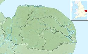
Beacon Hill is the highest point in the English county of Norfolk. It's a cool place to visit! This hill is about 0.75 miles (1.2 km) south of West Runton village. West Runton is right on the North Norfolk coast.
The very top of Beacon Hill is 103 metres (338 ft) above sea level. That's pretty high! People also call this hill Roman Camp. The top of the hill and the woods around it are looked after by the National Trust. You can find a car park if you follow a track called Calves Well Lane. This track runs west from Sandy Lane. The car park is kept tidy with donations to the National Trust. There are also bins and benches, making it a great spot for a picnic. You can explore the area on many footpaths.
How Beacon Hill Was Formed
Beacon Hill is part of the Cromer Ridge. This ridge is made of old piles of rock and dirt left behind by glaciers. These piles are called moraines. The Cromer Ridge sits right next to the coast near Cromer.
Scientists think the ice sheet stayed in this area for a long time during the last ice age. This is why the ridge is so big! All the material that the glaciers scraped up from the North Sea was dropped here. This created Beacon Hill and the rest of the ridge. The Cromer Ridge is the highest land in East Anglia. It stretches for about 9 miles (14 km) along the North Norfolk coast.
The ridge has a bumpy, wavy shape and lots of trees. In the west, you can see large areas of heather. You'll also find small fields, grassy banks, and sunken lanes. Sandy Lane, which leads up Beacon Hill, is one example of a sunken lane.
Interesting Features of Beacon Hill
At the very top of Beacon Hill, there's an old earthwork. This area is known as Roman Camp. People believe this name was made up around the 1800s. Local horse-drawn cab drivers probably used the name to attract tourists. They used the existing earthworks to make it sound more exciting.
However, there is no real proof that the Romans ever lived here. The earthworks were likely a coastal signal station. It might have also been used for earlier beacons. A beacon is a fire or light used as a signal. We don't know the exact spot of these old beacons.
History of the Beacon and Signal Station
Historians think a watch was kept at this site as early as 1324. So, it's very likely some kind of beacon was here around that time. There was probably a beacon here during the time of the Spanish Armada in 1588. Records show repairs were made to a beacon in 1608.
During the 1650s and 1660s, money was collected in Norfolk to keep a beacon here. This was to make sure a watch was still being kept. This was important during the time of the Dutch invasions.
A map from 1797 by Faden describes this hill as "The Old Beacon or Watch Tower." This suggests it was no longer in use then. Even though we don't know the exact spot of these beacons on the ridge, this hill seems like the most likely place.
Maps from the 18th century show the site as a round enclosure called "The Old Beacon and Watch Tower." The Ordnance Survey map from 1838 calls the site a Signal Station. It also calls it Black Beacon Hill.
The banks you see today are believed to be the remains of a signal station. This station was built during the Napoleonic Wars. It was part of a long chain of signals. These signals stretched from Devon all the way north to Edinburgh. The signal sites in Norfolk and further south were stopped in November 1841.
 | Emma Amos |
 | Edward Mitchell Bannister |
 | Larry D. Alexander |
 | Ernie Barnes |


