Bear Mountain (New Hampshire) facts for kids
Quick facts for kids Bear Mountain |
|
|---|---|

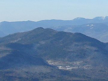
Bear Mountain seen from Mt. Chocorua
|
|
| Highest point | |
| Elevation | 3,219 feet (981 m) |
| Prominence | 1,422 ft (433 m) |
| Geography | |
| Location | Carroll County, New Hampshire U.S. |
| Topo map | USGS Bartlett (1:24,000) |
Bear Mountain is a mountain located in Bartlett, New Hampshire, USA. It stands about 981 meters (or 3,219 feet) tall. This makes it a notable peak in the area. Bear Mountain is found in Carroll County, New Hampshire.
Where is Bear Mountain?
Bear Mountain is surrounded by other interesting natural features. To its northwest, across a spot called Bear Notch, is Bartlett Haystack. This mountain is about 1,027 meters (3,369 feet) high. To the east, you'll find Table Mountain, which is about 815 meters (2,675 feet) tall. After that, there's Big Attitash Mountain, standing at 890 meters (2,920 feet).
Water Around the Mountain
The water from the north side of Bear Mountain flows into the Saco River. This happens through smaller streams like Louisville Brook and Albany Brook. On the southern side, water drains into the Swift River. Douglas Brook carries water from the southwest, and Cilley Brook flows from the southeast. Cilley Brook joins the Swift River at a cool spot called Rocky Gorge.
Fun Facts About Bear Mountain
Did you know that Bear Mountain once had a special trail for skiing? It was an alpine ski trail, meaning it was designed for downhill skiing. Sometimes, people get Bear Mountain mixed up with another nearby peak. There's a place called Attitash Mountain Resort, which is a popular ski area. It has a peak named Bear Peak, which is different from Bear Mountain. So, it's easy to get them confused!

