Beaver Run (Bowman Creek tributary) facts for kids
Quick facts for kids Beaver Run |
|
|---|---|

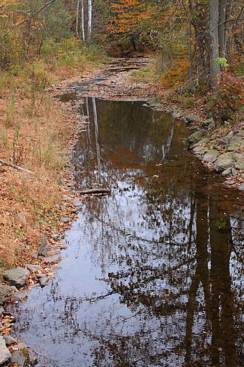
Beaver Run looking downstream near its mouth in Noxen
|
|
| Physical characteristics | |
| Main source | wetland on Kocher Mountain in Lake Township, Luzerne County, Pennsylvania between 2,100 and 2,120 feet (640 and 646 m) |
| River mouth | Bowman Creek in Noxen Township, Wyoming County, Pennsylvania 948 ft (289 m) 41°24′57″N 76°02′42″W / 41.41573°N 76.04509°W |
| Length | 7.7 mi (12.4 km) |
| Basin features | |
| Progression | Bowman Creek → Susquehanna River → Chesapeake Bay |
| Basin size | 10.6 sq mi (27 km2) |
| Tributaries |
|
Beaver Run is a stream, also called a tributary, that flows into Bowman Creek. It's located in Luzerne County and Wyoming County, in Pennsylvania, USA.
This stream is about 7.7 miles (12.4 km) long. It flows through Lake Township in Luzerne County and Noxen Township in Wyoming County. The area of land that drains into Beaver Run, called its watershed, is about 10.6 square miles (27 km2).
Beaver Run is known as a healthy stream. It is not considered "impaired," which means it's not polluted. The water is cold and clean, making it a great home for fish.
Contents
Where Does Beaver Run Flow?
Beaver Run starts in a wet, marshy area on Kocher Mountain in Lake Township, Luzerne County. It flows generally east and south at first. Then, it turns north-northeast, moving through a valley.
For a few miles, the stream flows next to Pennsylvania Route 29. Along the way, it gets water from two smaller, unnamed streams. It also passes through a wetland area where its valley gets wider. After this, Beaver Run leaves Luzerne County.
Next, Beaver Run enters Noxen Township in Wyoming County. It flows northeast near Sorber Mountain. It then turns north, crossing Pennsylvania Route 29 again. The stream flows between Sorber Mountain and Grassy Ridge. After a while, it reaches the village of Noxen. Finally, Beaver Run joins Bowman Creek.
Water Quality and Flow
Beaver Run is a very healthy stream. It is not listed as an "impaired waterbody," which means it meets high standards for water quality. This is good news for the plants and animals that live there!
Sometimes, heavy rains can cause the water level in Beaver Run to rise. This can lead to minor flooding in Lake Township. However, because the area around the stream isn't heavily developed, this flooding usually doesn't cause much damage.
Land and Rocks Around the Stream
The land around Beaver Run is quite interesting. Near where the stream joins Bowman Creek, the ground is about 948 feet (289 m) above sea level. Up at its source, on Kocher Mountain, the elevation is much higher, between 2,100 and 2,120 feet (640 and 650 m).
The ground near Beaver Run is made up of different types of soil and rock. You can find alluvium (soil deposited by water) and a type of till left behind by glaciers. There are also areas with wetlands, where the ground is very wet. You might also see sandstone and shale bedrock.
Long ago, before the Ice Age, a large lake called Harveys Lake used to drain into Beaver Run. But now, Harveys Lake flows into a different stream called Harveys Creek. During the Ice Age, glaciers helped shape the valley where Beaver Run flows today.
Wildlife and Fish
The area that drains into Beaver Run is special. It's known as a "High-Quality Coldwater Fishery." This means the water is very cold and clean, which is perfect for certain types of fish. It's also a "Migratory Fishery," meaning fish travel through it.
Wild trout naturally live and reproduce in Beaver Run. You can find them from the very start of the stream all the way to its mouth. In the past, people have also added brook trout to the stream to help the fish population grow.
History of Beaver Run
Beaver Run has been recognized officially for a long time. Its name was added to the Geographic Names Information System on August 2, 1979.
Historically, the Lewis log train, which carried logs, connected with the Lehigh Valley Railroad near Beaver Run. In the late 1800s, an iron bridge was built over the stream, replacing an older wooden structure.
More recently, new bridges have been built or repaired over Beaver Run:
- A steel bridge carrying Maple Street (T-327) was built in 1943 and fixed in 2010. It's about 26.9 feet (8.2 m) long.
- A modern bridge carrying Beaver Street (T-337) was built in Noxen in 2009. This bridge is about 29.9 feet (9.1 m) long.
In 2006, there was a plan to clean up debris (like fallen trees and trash) from Beaver Run to help keep it healthy and flowing smoothly.
 | Sharif Bey |
 | Hale Woodruff |
 | Richmond Barthé |
 | Purvis Young |


