Beaver Run (Chillisquaque Creek tributary) facts for kids
Quick facts for kids Beaver Run |
|
|---|---|

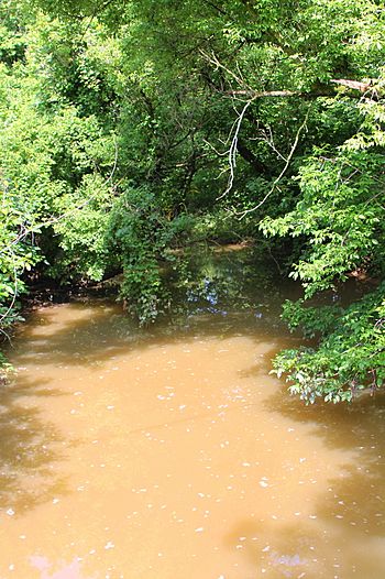
Beaver Run looking downstream
|
|
| Physical characteristics | |
| Main source | pond in a valley on Montour Ridge in Liberty Township, Montour County, Pennsylvania between 900 and 920 feet (270 and 280 m) |
| River mouth | Chillisquaque Creek in East Chillisqaque Township, Northumberland County, Pennsylvania 466 ft (142 m) 40°59′14″N 76°46′43″W / 40.98725°N 76.77873°W |
| Length | 6.2 mi (10.0 km) |
| Basin features | |
| Progression | Chillisquaque Creek → West Branch Susquehanna River |
| Basin size | 12.0 sq mi (31 km2) |
Beaver Run is a small stream, also called a tributary, located in Pennsylvania. It flows into a larger stream called Chillisquaque Creek. Beaver Run travels through two counties: Montour County and Northumberland County.
The stream is about 6.2 miles (10.0 km) long. It flows through Liberty Township and East Chillisquaque Township. The area of land that drains water into Beaver Run, called its watershed, is about 12.0 square miles (31 km2). Some parts of the stream are not as healthy as they should be. This is mainly because of too much siltation (fine dirt and sand) from nearby farms. Many bridges have been built over Beaver Run. Also, some areas along the stream do not have enough trees and plants, which are important for keeping the water clean.
Contents
Where Does Beaver Run Flow?
Beaver Run starts in a pond. This pond is found in a valley on Montour Ridge in Liberty Township, Montour County. The stream first flows southwest for about a mile. Then it turns northwest, leaving Montour Ridge behind.
It enters a much wider valley. The stream then turns north and northeast for a short distance. After that, it turns northwest again. It crosses Pennsylvania Route 45 and then starts to wind southwest.
After a while, it turns northwest again. Further downstream, it leaves Montour County. It then enters East Chillisquaque Township in Northumberland County. Soon after, it joins Chillisquaque Creek. Beaver Run meets Chillisquaque Creek about 7.8 miles (12.6 km) upstream from where Chillisquaque Creek ends.
How High is Beaver Run?
The land around the end of Beaver Run is about 466 feet (142 m) above sea level. The place where the stream starts, its source, is higher up. It is between 900 and 920 feet (270 and 280 m) above sea level.
The path of Beaver Run, along with other streams like Chillisquaque Creek, is shaped by natural landforms. These include Limestone Ridge and a line of hills in Montour County. To the south, Montour Ridge helps define the area that drains into Beaver Run.
What About Water and Wildlife?
The watershed of Beaver Run covers an area of 12.0 square miles (31 km2). The end of the stream is in a map area called Northumberland. However, its beginning is in a map area called Riverside.
There are about 24.6 miles (39.6 km) of streams in the Beaver Run watershed. Almost half of these, about 12.16 miles (19.57 km), are considered "impaired." This means they are not as healthy as they should be. The main reason for this is siltation, which is when fine dirt and sand wash into the water. This often happens because of agriculture (farming activities).
Some areas along Beaver Run do not have a good riparian buffer. A riparian buffer is a strip of trees and plants along the stream banks. These plants help filter pollution and keep the soil from washing away. Planting native trees in these areas would help reduce nonpoint source pollution. This would also make the water quality better.
One small stream that flows into Beaver Run is known as a Warmwater Fishery. This means it's a good place for fish that prefer warmer water.
History of Beaver Run
Beaver Run was officially added to the Geographic Names Information System on August 2, 1979. This system helps keep track of names and locations of places.
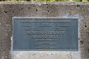
Many bridges have been built over Beaver Run over the years.
- A steel bridge for State Route 3003 was built in 1909. It was repaired in 1973 and is 29.9 feet (9.1 m) long.
- Another steel bridge for T-308 was built in 1912 and repaired in 1997. It is 41.0 feet (12.5 m) long.
- A concrete bridge was built in 1924 for T-318. It is 26.9 feet (8.2 m) long.
- A concrete slab bridge for State Route 3003 was built in 1941 and repaired in 2007. It is 24.9 feet (7.6 m) long.
- A steel bridge for T-306 was built in 1991. It is 44.9 feet (13.7 m) long.
- A concrete culvert bridge for T-843 was also built in 1991. It is 24.0 feet (7.3 m) long.
- In 1999, another concrete culvert bridge was built for State Route 3004. It is 25.9 feet (7.9 m) long.
These bridges help people travel easily over the stream.
 | Sharif Bey |
 | Hale Woodruff |
 | Richmond Barthé |
 | Purvis Young |


