Beinn Ghlas facts for kids
Quick facts for kids Beinn Ghlas |
|
|---|---|

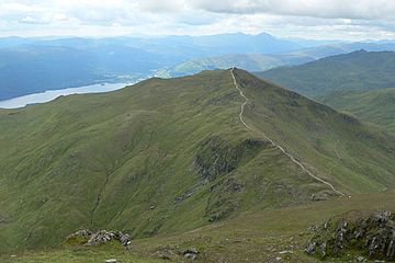
Beinn Ghlas from the western slopes of Ben Lawers
|
|
| Highest point | |
| Elevation | 1,103 m (3,619 ft) |
| Prominence | c. 105 m |
| Listing | Munro |
| Naming | |
| English translation | Grey-green mountain |
| Language of name | Gaelic |
| Geography | |
| Location | Perth and Kinross, Scotland |
| OS grid | NN625404 |
| Topo map | OS Landranger 51 |
Beinn Ghlas is a mountain in the Southern Highlands of Scotland. It stands tall on the north shore of Loch Tay. This mountain is part of the famous Ben Lawers Range.
Many people walk up Beinn Ghlas without even knowing it! This is because it's on the popular path to Ben Lawers. The path starts from a car park run by the National Trust for Scotland. Because so many people use this path, it used to get very worn down. But don't worry, it has been fixed up recently.
What's in a Name?
The name Beinn Ghlas comes from the Gaelic language. It means 'grey-green mountain'. This name fits perfectly because of the rocks that make up the mountain.
The mountain is mostly made of a rock called mica-schist. This rock often looks grey-green. You can see pieces of this rock, called scree, on the mountain's south-western side. As you walk up, you might even spot large, shiny garnet crystals in the rock!
Exploring the Mountain
The most common way to reach the top of Beinn Ghlas starts from the car park. You follow a stream called Edramucky Burn. Then, you climb up the mountain's south-western side.
To the north of Beinn Ghlas, there's a deep, bowl-shaped valley. This type of valley is called a corrie. This one is named Coire Odhar, which means 'the dun-coloured corrie'.
If you're hiking further to Ben Lawers, there's a clever way back. You can avoid climbing back up Beinn Ghlas on your return. Just take a path that goes west of the summit, down into Coire Odhar. This saves you an extra 100-meter climb!
 | Jessica Watkins |
 | Robert Henry Lawrence Jr. |
 | Mae Jemison |
 | Sian Proctor |
 | Guion Bluford |

