Loch Tay facts for kids
Quick facts for kids Loch Tay |
|
|---|---|

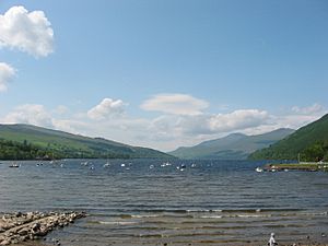
Loch Tay at Kenmore in spring
|
|
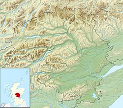
| Location | Perthshire, Scotland |
| Coordinates | 56°30′56″N 4°08′46″W / 56.51556°N 4.14611°W |
| Lake type | Loch |
| Primary inflows | Dochart, Lochay |
| Catchment area | 232 sq mi (600 km2) |
| Basin countries | United Kingdom |
| Max. length | 14.55 mi (23.42 km) |
| Max. width | 0.7 mi (1.1 km) |
| Surface area | 10.19 sq mi (26.4 km2) |
| Average depth | 60.66 m (199.0 ft) |
| Max. depth | 154.8 m (508 ft) |
| Water volume | 1.6 km3 (0.38 cu mi) |
| Shore length1 | 3 km (1.9 mi) |
| Surface elevation | 102 m (335 ft) |
| Islands | 7 |
| Settlements | Killin, Kenmore, Lawers |
| 1 Shore length is not a well-defined measure. | |
Loch Tay (Scottish Gaelic: Loch Tatha) is a large freshwater lake in the middle of the Highlands in Scotland. It is located in the Perth and Kinross and Stirling areas. This beautiful loch is a major part of the historic area known as Breadalbane.
Contents
About Loch Tay
Loch Tay is a very long and narrow lake. It stretches for about 14.55 miles (23.4 km). Its width is usually between 1 to 1.5 miles (1.6 to 2.4 km). This makes it the sixth-largest loch in Scotland by its surface area.
The loch is also very deep. At its deepest point, it goes down more than 150 meters (492 feet). This makes it one of Scotland's deepest lakes.
Mountains and Towns
On the north side of Loch Tay, you'll find Ben Lawers. This mountain is 1,214 meters (3,983 feet) tall. It is the tenth-highest mountain in the British Isles. Ben Lawers is part of a group of seven mountains called munros. A munro is a Scottish mountain that is over 3,000 feet (914.4 meters) high.
The main towns along the loch are Killin and Kenmore. Killin is at the start of the loch, where rivers flow into it. Kenmore is where the River Tay flows out of the loch. Smaller villages like Acharn, Ardeonaig, and Ardtalnaig are on the south side. Fearnan and Lawers are on the north side. The loch gets its water from the Dochart and Lochay rivers, plus many smaller streams.
Fun Facts About Loch Tay
Loch Tay is a popular place for fishing, especially for salmon. The loch is also famous because it's mentioned in a traditional Scottish song. This song is called the 'Loch Tay Boat Song' (or Iorram Loch Tatha in Scottish Gaelic).
The song is quite sad. It tells the story of someone rowing on the loch at the end of the day. They are thinking about a red-haired woman they love, but their love is not returned. Famous singers like Liam Clancy and The Corries have recorded this song.
There used to be a train station called Loch Tay railway station. It was part of the Killin Railway. However, this station is now closed.
Ancient Homes: Crannogs
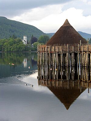
Long ago, during the Iron Age, some Celtic people lived on special islands in Loch Tay. These islands were not natural. They were built by people and are called crannogs. Crannogs were like small, strong forts in the water.
People think crannogs started being built even before 2000 BCE (Before Common Era). They were used for a very long time, even into the Middle Ages. People lived in them and used them as safe places.
Crannogs were found in other parts of Scotland, Ireland, and Wales too. They offered great protection. They kept people safe from unfriendly neighbors. They also protected them from dangerous wild animals. Wolves, bears, boars, and lynxes used to live in the British Isles.
More than 20 crannogs have been found in Loch Tay. Most of them are now under the water. You can see an example of a reconstructed crannog on the south side of the loch. It is at the Scottish Crannog Centre. This center shows what life was like on these ancient island homes.
See also
 In Spanish: Lago Tay (Escocia) para niños
 | Sharif Bey |
 | Hale Woodruff |
 | Richmond Barthé |
 | Purvis Young |


