
Belfast, New York facts for kids
Quick facts for kids
Belfast, New York
|
|
|---|---|
 |
|

Belfast, New York
Location in New York
|
|
| Country | United States |
| State | New York |
| County | Allegany |
| Established | 1824 |
| Renamed | 1825 |
| Government | |
| • Type | Town Council |
| Area | |
| • Total | 36.54 sq mi (94.65 km2) |
| • Land | 36.30 sq mi (94.00 km2) |
| • Water | 0.25 sq mi (0.64 km2) |
| Elevation | 1,808 ft (551 m) |
| Population
(2020)
|
|
| • Total | 1,656 |
| • Estimate
(2021)
|
1,640 |
| • Density | 44.52/sq mi (17.19/km2) |
| Time zone | UTC-5 (Eastern (EST)) |
| • Summer (DST) | UTC-4 (EDT) |
| ZIP code |
14711
|
| Area code(s) | 585 |
| FIPS code | 36-003-05573 |
| GNIS feature ID | 0978720 |
| Website | https://www.belfastny.org/ |
Belfast is a town in Allegany County, New York, United States. It's located in the "Southern Tier" part of the state. In 2020, about 1,656 people lived there. The town was named in 1825 after the city of Belfast, Ireland. This was because many early settlers had Scots-Irish family roots from that area.
Contents
Exploring Belfast's Past
For many centuries, the Seneca people lived in this area. They were part of the Haudenosaunee, also known as the Iroquois Confederacy. This powerful group of Native American tribes controlled a large region south of the Great Lakes.
Early European Settlers
European-American settlers started arriving here after the American Revolutionary War. The Seneca people had been allies with the British. After the war, their lands were given to the United States. Many Haudenosaunee people moved to Ontario, Canada. The British Crown gave them new land there.
The first European-American settlers were recorded in Belfast by 1804. In 1809, David Sanford built a sawmill and a grist mill on the Genesee River. The community officially became a town in 1824. It was first called Orrinsburgh.
How Belfast Got Its Name
In 1825, the residents decided to change the town's name to Belfast. Many new settlers were from northern Ireland, and Belfast was a major port there. Irish immigrants often worked on canals and in mills in upstate New York. The small community of Belfast grew into a "mill town." It used the power of the Genesee River, which flows through the town. In 1831, the state added more land to Belfast from the nearby town of Caneadea.
Canals and Railroads
Around 1853, the Genesee Valley Canal was finished. This canal connected markets in the southern part of the state to the Great Lakes. It helped Belfast grow even more. Later, three railroads also served the town. Trains were faster and could carry more goods than canals. This caused canal traffic to decrease. The Rail and Titsworth Canal Warehouse in Belfast is an important building from this time. It was added to the National Register of Historic Places in 2000.
Community Life and Growth
In the mid-1800s, new English settlers arrived. There were some disagreements between them and the Irish residents. These groups had a long history of tensions back in Ireland. After some smaller clashes, many Irish families moved to the other side of the river.
A bigger conflict happened from 1846 to 1847. A food shortage made tensions worse. Many new Irish immigrants were also arriving in New York. They were escaping the Great Famine in Ireland. The New York State militia had to step in to calm things down.
Industrial growth continued in the 1800s. Sandstone was dug up in the late 1870s. This stone was used to make grindstones.
A Boxing Legend's Training Ground
In 1889, John L. Sullivan, a famous Irish-American boxer, came to Belfast. He trained with William Muldoon for his last bare knuckle boxing championship. This was a very important fight for Sullivan. Muldoon was known for his advanced training methods. He helped Sullivan get into the best shape of his life. Sullivan fought Jake Kilrain in Mississippi and won after 72 rounds!
In 2009, Muldoon's training barns in Belfast became the world's only Bare Knuckle Boxing Hall of Fame. They had remained almost untouched for over 120 years.
Modern Times in Belfast
Since the 1970s, some pirate radio stations have used the Belfast post office. They use it as a place to receive letters from their listeners.
In the 1980s, an Amish community settled in Belfast. They earn a living through farming, sawmilling, and making furniture. These families moved to western New York from places like Lancaster, Pennsylvania.
Belfast's Location
Belfast covers about 36.5 square miles (94.6 square kilometers). Most of this area is land, with a small part being water.
The Genesee River flows north through the northeastern part of the town. New York State Route 19 runs alongside part of the river. This route meets County Road 26 in the Belfast community.
People of Belfast
| Historical population | |||
|---|---|---|---|
| Census | Pop. | %± | |
| 1830 | 743 | — | |
| 1840 | 1,646 | 121.5% | |
| 1850 | 1,679 | 2.0% | |
| 1860 | 1,827 | 8.8% | |
| 1870 | 1,488 | −18.6% | |
| 1880 | 1,470 | −1.2% | |
| 1890 | 1,500 | 2.0% | |
| 1900 | 1,574 | 4.9% | |
| 1910 | 1,773 | 12.6% | |
| 1920 | 1,279 | −27.9% | |
| 1930 | 1,113 | −13.0% | |
| 1940 | 1,213 | 9.0% | |
| 1950 | 1,277 | 5.3% | |
| 1960 | 1,265 | −0.9% | |
| 1970 | 1,339 | 5.8% | |
| 1980 | 1,495 | 11.7% | |
| 1990 | 1,539 | 2.9% | |
| 2000 | 1,714 | 11.4% | |
| 2010 | 1,663 | −3.0% | |
| 2020 | 1,656 | −0.4% | |
| 2021 (est.) | 1,640 | −1.4% | |
| U.S. Decennial Census | |||
In 2000, there were 1,714 people living in Belfast. About 33.9% of households had children under 18. The average household had 2.63 people. The average family had 3.34 people.
The population was spread out by age:
- 31.7% were under 18
- 7.1% were 18 to 24
- 25.7% were 25 to 44
- 22.8% were 45 to 64
- 12.8% were 65 or older
The median age was 35 years.
Famous People from Belfast
- Charles M. Crandall: A doctor and a member of the New York State Assembly.
- William Muldoon: A champion wrestler, fitness expert, and the first chairman of the New York State Athletic Commission.
- Jesse Peterson: A well-known industrialist.
Places in the Town of Belfast
- Belfast: The main community, located on State Route 19 (Main Street) by the Genesee River.
- Black Creek: A stream that flows into the Genesee River north of Belfast.
- Genesee River: An important river in Western New York that flows into Lake Ontario.
- Marshall: A small area in the northwest part of the town.
- Rockville: A community near Black Creek in the western part of the town.
- Transit Bridge: A former location in the town, named after early survey lines.
Images for kids
-
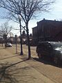
A view of Belfast, New York
See also
 In Spanish: Belfast (Nueva York) para niños
