Bell, New South Wales facts for kids
Quick facts for kids BellNew South Wales |
|||||||||||||||
|---|---|---|---|---|---|---|---|---|---|---|---|---|---|---|---|

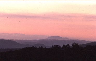
Dawn, Wollangambe River area
|
|||||||||||||||
| Population | 51 (2016 census) | ||||||||||||||
| Established | 1875 | ||||||||||||||
| Postcode(s) | 2786 | ||||||||||||||
| Elevation | 1,100 m (3,609 ft) | ||||||||||||||
| Location |
|
||||||||||||||
| LGA(s) |
|
||||||||||||||
| State electorate(s) | Blue Mountains | ||||||||||||||
| Federal Division(s) | Macquarie (formerly Calare) | ||||||||||||||
|
|||||||||||||||
Bell is a small village in the Blue Mountains area of New South Wales, Australia. Its postcode is 2786. It is the most north-western village in the City of Blue Mountains.
Bell is about 125 kilometres (78 miles) west of Sydney. It is also about 20 kilometres (12 miles) east of Lithgow. You can find Bell about 10 kilometres (6 miles) north of Mount Victoria. The village sits where the Bells Line of Road, Chifley Road, and Darling Causeway meet. It is about 1100 metres (3600 feet) above sea level.
Contents
Discovering Bell's History
Bell is named after Archibald Bell, Jr.. He was the first European to map a route over the Blue Mountains. This route started near Richmond.
Early Explorers and Routes
Another explorer, George Caley, had explored part of this area in 1804. He reached as far as Mount Banks. But Archibald Bell, Jr. was the first to travel the entire way. He went from the Richmond area to the Bell area. He had help from Indigenous guides, Emery and Cogy. These Darug men already knew the route very well. The important road called Bells Line of Road was later built along this path.
Bell's Railway Connection
Bell is located on the Main Western railway line. The railway station was built in 1875. It was meant to serve the village of Mount Wilson. Mount Wilson is about 14 kilometres (9 miles) from Bell. The Bell railway station was first called Mount Wilson railway station. It is 1060 metres (3478 feet) above sea level.
Nature and Environment Around Bell
The Bell area has a few properties. Each property is usually about 4 hectares (10 acres) in size. Around these properties, you can find many walking tracks. Some tracks are in the national park. Others are on private land. These tracks offer great views of the Hartley Valley and Wollangambe Wilderness.
Exploring the Blue Mountains National Park
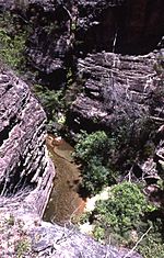
Bell is completely surrounded by native bushland. Most of this bushland is part of the Blue Mountains National Park. A major feature of this part of the park is the Wollangambe River. This river starts north of Bell. It then flows into the Colo River. The area is very rugged and rocky. There are not many easy paths. A special walking trail from Bell leads to the Wollangambe River. Experienced bushwalkers use this as a starting point. They explore the wild Wollangambe Wilderness from here.
Bell's Mountain Climate
Bell has a cool mountain climate. It often snows here almost every year. In winter (July), the lowest temperature is usually about 2.3°C (36.1°F). The highest temperature is about 9.3°C (48.7°F).
Summer Weather in Bell
In summer, Bell is much cooler than nearby Sydney. In January, the highest temperature is usually about 23.7°C (74.7°F). Sometimes, hot winds from the west can make the temperature rise. It might reach between 34°C (93°F) and 37°C (99°F).
Transport and Road Safety
Bells Line of Road is an important route. It is the only other main road over the Blue Mountains besides the Great Western Highway. Because of this, Bell has a special checking station. This station is for heavy vehicles. It helps make sure trucks are safe on the road.
 | Anna J. Cooper |
 | Mary McLeod Bethune |
 | Lillie Mae Bradford |


