Benarty Hill facts for kids
Quick facts for kids Benarty Hill |
|
|---|---|

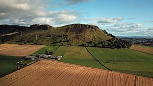
Benarty Hill from the north
|
|
| Highest point | |
| Elevation | 356 m (1,168 ft) |
| Prominence | 228 m (748 ft) |
| Parent peak | Dumglow |
| Listing | Marilyn |
| Geography | |
| OS grid | NT153978 |
| Topo map | OS Landranger 59 |
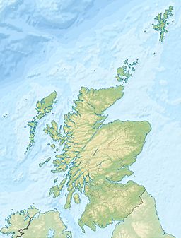
Benarty Hill, often called Benarty by locals, is a hill in Scotland. It stands tall near Ballingry in Fife. The top of the hill marks the border between Fife and Perth and Kinross.
Benarty Hill is easy to spot from the M90 motorway. You can also see it clearly from Kinross and Loch Leven. The lower parts of the hill are quite steep. However, the wide, open area at the top is mostly flat. This flat area is covered in heathland.
Exploring Benarty Hill
Benarty Hill is a great place for a walk. There are paths that lead you to the top.
Walking Paths
You can reach the summit from different directions. From the north, you can follow the "Sleeping Giant path." This path starts near the RSPB Loch Leven visitors centre.
The south side of the hill also has easy paths. These tracks go through the forest and then up to the flat, open top. It's a fun way to explore the hill.
Amazing Views from the Top
When you reach the top of Benarty Hill, you'll see incredible views. You can look across Loch Leven to the Lomond Hills. You can also see the Firth of Forth and the Lammermuir Hills and Pentland Hills in the distance.
On a clear day, you might even see the Isle of Arran. This island is about 80 miles away to the west! The views to the north and west show the Southern Highlands. It's a perfect spot for taking photos and enjoying nature.
 | William L. Dawson |
 | W. E. B. Du Bois |
 | Harry Belafonte |


