Bering Glacier facts for kids
Quick facts for kids Bering Glacier |
|
|---|---|

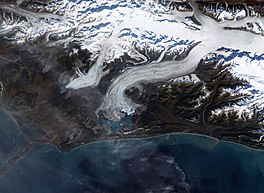
Terminus of Bering Glacier, September 29, 2002
|
|
| Type | glacier |
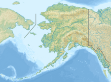
| Coordinates | 60°18′08″N 143°25′11″W / 60.30222°N 143.41972°W |
| Terminus | Vitus Lake south of Alaska’s Wrangell-St. Elias National Park |
| Status | Retreating |
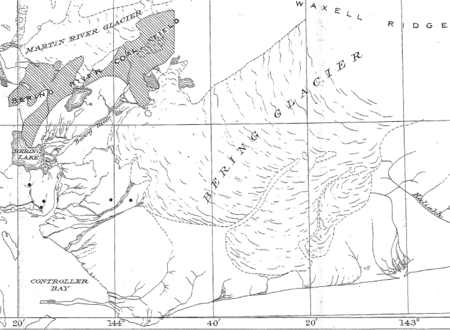
The Bering Glacier is a huge glacier found in the state of Alaska, United States. It ends in a lake called Vitus Lake. This lake is about 10 kilometers (6 miles) from the Gulf of Alaska.
When you combine the Bering Glacier with the Bagley Icefield, it becomes the largest glacier in all of North America. The snow that feeds the glacier and makes it grow comes from the Bagley Icefield. The glacier is named after a famous explorer, Vitus Bering.
Why is Bering Glacier Shrinking?
Over the last 100 years, the Bering Glacier has become much thinner. This is because of warmer temperatures and changes in how much snow and rain falls. It has shrunk by thousands of meters. Since the year 1900, the end of the glacier has moved back as much as 12 kilometers (7.5 miles).
Sometimes, the Bering Glacier has "surges." This means it speeds up and flows much faster for a short time. During these surges, the end of the glacier actually moves forward. But after a surge, it usually retreats even more. So, even with these surges, the glacier is still getting smaller overall. Many other glaciers along the coast of Alaska are also shrinking, just like the Bering Glacier.
How Glaciers Affect Earthquakes
The shrinking of the Bering Glacier has an interesting effect: it causes more earthquakes in the area. The Wrangell Mountains and Saint Elias Mountains are where the Bering Glacier starts. These mountains were formed when two huge pieces of the Earth's crust, called tectonic plates, crashed into each other. The Pacific Plate is slowly sliding under the North American Plate.
The enormous weight of the ice in the Bering Glacier pushes down on the Earth's crust. This weight helps to keep the boundary between the two tectonic plates stable. As the glacier melts and loses its mass, this heavy pressure is reduced. When there is less pressure from the ice, the rocks along the fault lines can move more easily. This movement causes more earthquakes to happen.
Scientists have found that the Bering Glacier releases a lot of water every year. It melts about 30 cubic kilometers (7.2 cubic miles) of water annually. This is more than twice the amount of water in the entire Colorado River!
The melted water from the glacier flows into Vitus Lake. From there, it travels through the Seal River and eventually reaches the Gulf of Alaska.

 | Misty Copeland |
 | Raven Wilkinson |
 | Debra Austin |
 | Aesha Ash |


