Berkeley, Illinois facts for kids
Quick facts for kids
Berkeley, Illinois
|
|||
|---|---|---|---|
|
|||

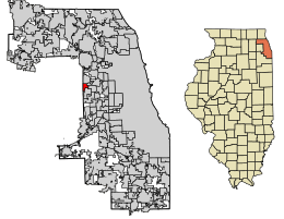
Location of Berkeley in Cook County, Illinois.
|
|||
| Country | |||
| State | Illinois | ||
| County | Cook | ||
| Township | Proviso | ||
| Incorporated | 1924 | ||
| Government | |||
| • Type | President-Trustee | ||
| Area | |||
| • Total | 1.40 sq mi (3.63 km2) | ||
| • Land | 1.40 sq mi (3.63 km2) | ||
| • Water | 0.00 sq mi (0.00 km2) 0% | ||
| Population
(2020)
|
|||
| • Total | 5,338 | ||
| • Density | 3,807.42/sq mi (1,470.57/km2) | ||
| Standard of living (2007-11) | |||
| • Per capita income | $25,952 | ||
| • Median home value | $202,200 | ||
| ZIP code(s) |
60163
|
||
| Area code(s) | 708/464 | ||
| Geocode | 17-05404 | ||
| FIPS code | 17-05404 | ||
Berkeley (say it like BURK-lee) is a small town, called a village, in Cook County, Illinois, USA. It became an official village in 1924. In 2020, about 5,338 people lived there.
You can catch a train from Berkeley's station to downtown Chicago. This train service is called Metra and runs on the Union Pacific West Line.
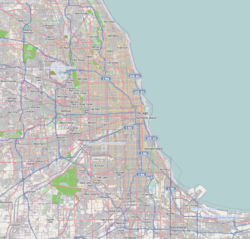
Berkeley is about 14 miles west of downtown Chicago. It's on the western edge of Cook County. The village is easy to reach because major highways, Interstates 290 and 294, are nearby. Also, the Union Pacific Railroad and a large train yard are to the north. These transportation routes connect Berkeley to other places. They also help give the village a cozy, small-town feel.
Contents
About Berkeley's Location
Berkeley is located at coordinates 41°53′12″N 87°54′38″W / 41.88667°N 87.91056°W. This means it's at 41.886794 degrees North and -87.910528 degrees West.
The village covers a total area of about 1.40 square miles (3.63 square kilometers). All of this area is land, with no water.
Berkeley's Story
Early Settlers and Farming
Around 1835, farmers started settling in the area that would become Berkeley. Many of these early settlers were from Germany and the Netherlands. The Dutch farmers often grew vegetables to sell, working on farms between 40 and 160 acres. German farmers usually did general farming.
In 1848, a small group of farming families started Sunnyside. This was a one-room schoolhouse. Today, Sunnyside Elementary School is still open, but it's in a much bigger, newer building. A short distance west on St. Charles Road, land was set aside for what is now Old Settler's Cemetery. This road was finished in 1836.
Growth and Changes
In 1902, the Chicago, Aurora & Elgin Railroad opened. This was the first passenger train service in the area. New neighborhoods were built in 1908 and again between 1914 and 1915. This brought new homes and people, mostly from England, to the area. Thanks to these new residents, Berkeley officially became a village in 1924.
The population grew even more after World War II. Between 1950 and 1960, Berkeley's population tripled! It went from 1,882 people to 5,792. In the late 1950s, the Interstate 290 highway was expanded. This highway cut through the western part of the village, and some homes were lost. The Chicago, Aurora & Elgin Railway stopped its passenger service in 1957. People started using the new highways instead. However, the old train path is now a biking trail called the Prairie Path.
In the 1960s, Berkeley bought land from the railroad to expand its northern borders. This allowed for a small industrial park to be built. By 2000, this park had 12 light industries. These included electrical companies, printing businesses, warehouses, and World Dryer Corporation, which makes hand dryers. Even with these businesses, Berkeley has mostly remained a place where people live. Many residents who bought homes in the 1950s stayed for a long time. The village expected many of these homes to be sold around the year 2000.
Who Lives in Berkeley
| Historical population | |||
|---|---|---|---|
| Census | Pop. | %± | |
| 1930 | 779 | — | |
| 1940 | 724 | −7.1% | |
| 1950 | 1,882 | 159.9% | |
| 1960 | 5,792 | 207.8% | |
| 1970 | 6,152 | 6.2% | |
| 1980 | 5,467 | −11.1% | |
| 1990 | 5,137 | −6.0% | |
| 2000 | 5,245 | 2.1% | |
| 2010 | 5,209 | −0.7% | |
| 2020 | 5,338 | 2.5% | |
| U.S. Decennial Census 2010-2020 | |||
As of the 2020 census, there were 5,338 people living in Berkeley. There were 1,793 households, which are groups of people living together in one home. About 1,339 of these were families.
The population density was about 3,807 people per square mile. The village had 1,933 housing units, like houses or apartments.
People from many different backgrounds live in Berkeley. In 2020:
- About 32.60% of residents were African American.
- About 27.58% were White.
- About 4.23% were Asian.
- About 1.85% were Native American.
- About 22.26% were from other racial groups.
- About 11.43% were from two or more racial groups.
- People who identified as Hispanic or Latino made up 37.62% of the population.
In the households, 32.3% had children under 18 living with them. The average household had 3.30 people. The average family had 2.82 people.
The median age in the village was 42.3 years. This means half the people were older than 42.3 and half were younger.
The median income for a household was $71,025. This is the middle income for all households. For families, the median income was $72,051.
| Race / Ethnicity (NH = Non-Hispanic) | Pop 2000 | Pop 2010 | Pop 2020 | % 2000 | % 2010 | % 2020 |
|---|---|---|---|---|---|---|
| White alone (NH) | 2,712 | 1,684 | 1,242 | 51.71% | 32.33% | 23.27% |
| Black or African American alone (NH) | 1,447 | 1,610 | 1,718 | 27.59% | 30.91% | 32.18% |
| Native American or Alaska Native alone (NH) | 4 | 17 | 13 | 0.08% | 0.33% | 0.24% |
| Asian alone (NH) | 198 | 199 | 219 | 3.78% | 3.82% | 4.10% |
| Pacific Islander alone (NH) | 0 | 1 | 3 | 0.00% | 0.02% | 0.06% |
| Other race alone (NH) | 10 | 4 | 13 | 0.19% | 0.08% | 0.24% |
| Mixed race or Multiracial (NH) | 60 | 96 | 122 | 1.14% | 1.84% | 2.29% |
| Hispanic or Latino (any race) | 814 | 1,598 | 2,008 | 15.52% | 30.68% | 37.62% |
| Total | 5,245 | 5,209 | 5,338 | 100.00% | 100.00% | 100.00% |
Learning in Berkeley
Most kids in Berkeley go to schools in Berkeley School District 87. These schools include Sunnyside Elementary School and MacArthur Middle School. Some students attend Hillside School in Hillside School District 93.
For high school, students can attend public schools run by Proviso Township High Schools District 209. The main high school for the community is Proviso West High School in Hillside. Berkeley residents can also apply to Proviso Math & Science Academy in Forest Park.
There are also private school options nearby. These include Immanuel Lutheran grade schools in Hillside, and Immaculate Conception, Visitation, and Immanuel Lutheran grade schools in Elmhurst. For high school, private options include Immaculate Conception High School in Elmhurst and Nazareth Academy in LaGrange Park. Timothy Christian school in Elmhurst serves students from kindergarten through 12th grade. Another popular choice is Walther Christian Academy in Melrose Park.
Getting Around Berkeley
The Berkeley station offers train service for people who travel to work or school. These Metra trains run on the Union Pacific West Line. You can travel east to Ogilvie Transportation Center in Chicago or west to Elburn station. Pace also provides bus services on routes 301 and 313. These buses connect Berkeley to other places in the region.
Businesses in Berkeley
Several companies have their main offices or operations in Berkeley:
- Vanee Foods
- Preferred Meals
- World Dryer
- Honey-Can-Do International
- Conflowence
Sister City
Berkeley has a special connection with another town across the ocean. It has a sister city in England, called Berkeley, Gloucestershire.
See also
 In Spanish: Berkeley (Illinois) para niños


