Hillside, Illinois facts for kids
Quick facts for kids
Hillside, Illinois
|
||
|---|---|---|

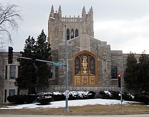
Queen of Heaven Mausoleum at corners of Wolf and Roosevelt roads
|
||
|
||

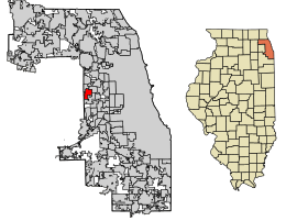
Location of Hillside in Cook County, Illinois.
|
||
| Country | United States | |
| State | Illinois | |
| County | Cook | |
| Area | ||
| • Total | 3.17 sq mi (8.20 km2) | |
| • Land | 3.17 sq mi (8.20 km2) | |
| • Water | 0.00 sq mi (0.00 km2) | |
| Population
(2020)
|
||
| • Total | 8,320 | |
| • Density | 2,626.26/sq mi (1,014.11/km2) | |
| Time zone | UTC-6 (CST) | |
| • Summer (DST) | UTC-5 (CDT) | |
| ZIP Code(s) |
60162
|
|
| Area code(s) | 708/464 | |
| FIPS code | 17-35086 | |
Hillside is a village located in Cook County, Illinois, United States. It is a suburb of the big city of Chicago. In 2020, about 8,320 people lived there.
Contents
Geography of Hillside
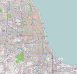
Hillside is located at 41°52′29″N 87°54′1″W / 41.87472°N 87.90028°W. The village covers a total area of about 3.17 square miles (8.20 square kilometers). All of this area is land, with no large bodies of water.
History of Hillside
Early Settlement and Farming
The story of Hillside began in the 1840s when German Lutheran immigrants settled here. They started farms and built the first school and church, called Immanuel. These early buildings were near Wolf and 22nd Street. This area became part of Hillside when the village was officially formed.
Limestone Quarry and Cemeteries
In the 1850s, Marion Covell discovered a lot of limestone underground. He opened a quarry in 1854, which dug up crushed stone for roads around Chicago. This quarry operated until the 1970s. Later, in 1979, the John Sexton Company bought it and used it as a landfill.
Over time, large cemeteries were built near Hillside. These included Mt. Carmel in 1894, followed by Oak Ridge, Glen Oak, and Queen of Heaven in 1947. These cemeteries were easy to reach because of the Illinois Central Railroad station and the Chicago, Aurora & Elgin Railroad. This led to new businesses like restaurants, flower shops, and monument stores. The village was named Hillside in 1905 because westbound trains had to go up a slope here.
Growth and Development
Hillside grew a lot in the 1920s as more farmland was sold for homes. Important institutions like St. Domitilla Roman Catholic Church and Mater Dolorosa Seminary also bought land. After World War II, Hillside's population grew very quickly. It more than doubled from 1,080 people in 1940 to 2,131 in 1950. By 1960, it had jumped to 7,794 residents!
In 1956, the Hillside Retail Mall opened. It was one of the first big shopping centers in the area. Soon, a Holiday Inn, movie theaters, an office building, and an industrial park were built nearby.
Changes to the Shopping Mall
The Hillside Retail Center was popular for a while. However, newer and bigger malls were built in the 1960s. This caused the Hillside mall to become less popular. Even with changes to its look and stores, it continued to decline. Most of the mall was torn down in 1997 to make way for a large car dealership.
Population of Hillside
| Historical population | |||
|---|---|---|---|
| Census | Pop. | %± | |
| 1910 | 328 | — | |
| 1920 | 555 | 69.2% | |
| 1930 | 1,004 | 80.9% | |
| 1940 | 1,080 | 7.6% | |
| 1950 | 2,131 | 97.3% | |
| 1960 | 7,794 | 265.7% | |
| 1970 | 8,888 | 14.0% | |
| 1980 | 8,279 | −6.9% | |
| 1990 | 7,672 | −7.3% | |
| 2000 | 8,155 | 6.3% | |
| 2010 | 8,157 | 0.0% | |
| 2020 | 8,320 | 2.0% | |
| U.S. Decennial Census 2010-2020 |
|||
As of the 2020 census, Hillside had 8,320 people living in 2,744 households. About 23.8% of households had children under 18. The average household had about 3.79 people.
The population includes a mix of different backgrounds. About 42.92% of residents were African American, and 21.19% were White. About 35.55% of the population identified as Hispanic or Latino.
The median age in the village was 40.2 years. This means half the people were older than 40.2 and half were younger.
| Race / Ethnicity (NH = Non-Hispanic) | Pop 2000 | Pop 2010 | Pop 2020 | % 2000 | % 2010 | % 2020 |
|---|---|---|---|---|---|---|
| White alone (NH) | 3,533 | 2,022 | 1,414 | 43.32% | 24.79% | 17.00% |
| Black or African American alone (NH) | 2,975 | 3,485 | 3,519 | 36.48% | 42.72% | 42.30% |
| Native American or Alaska Native alone (NH) | 9 | 6 | 10 | 0.11% | 0.07% | 0.12% |
| Asian alone (NH) | 418 | 269 | 253 | 5.13% | 3.30% | 3.04% |
| Pacific Islander alone (NH) | 1 | 3 | 2 | 0.01% | 0.04% | 0.02% |
| Other race alone (NH) | 9 | 12 | 35 | 0.11% | 0.15% | 0.42% |
| Mixed race or Multiracial (NH) | 142 | 108 | 129 | 1.74% | 1.32% | 1.55% |
| Hispanic or Latino (any race) | 1,068 | 2,252 | 2,958 | 13.10% | 27.61% | 35.55% |
| Total | 8,155 | 8,157 | 8,320 | 100.00% | 100.00% | 100.00% |
Education in Hillside
Public Schools
Students in Hillside attend public schools managed by three different school districts for elementary and middle school.
- Hillside School District 93 has Hillside Public School.
- Berkeley School District 87 includes Sunnyside School and MacArthur Middle School.
- Bellwood School District 88 serves students at Lincoln Primary School, Lincoln Elementary School, and Roosevelt Middle School.
For high school, most students go to Proviso West High School in Hillside. Some students can also attend the Proviso Mathematics and Science Academy in nearby Forest Park.
Colleges and Universities
There are several colleges and universities close to Hillside:
- Triton College in River Grove
- College of DuPage in Glen Ellyn
- Elmhurst University in Elmhurst
- Dominican University in River Forest
Transportation
Pace provides bus services in Hillside. These buses connect the village to other places in the region.
Business
One of the largest employers in Hillside is the Commercial Light Company. It is located on Fencl Lane.
Notable Cemeteries
Hillside is home to two important cemeteries. One is the Mount Carmel Cemetery. Many well-known historical figures are buried here, including Al Capone. His grave is a popular spot for visitors. Several important leaders of the Archdiocese of Chicago are also buried in the Bishop's Mausoleum at Mount Carmel.
The other Catholic cemetery is Queen of Heaven Cemetery. It is located just south of Mount Carmel, across Roosevelt Road.
Notable People
- Skip Pitlock: A baseball pitcher who played for the Chicago White Sox and San Francisco Giants. He was born in Hillside.
- Al Capone: A famous historical figure from Chicago, buried at Mount Carmel Cemetery in Hillside.
- Dennis Farina: An actor and former police officer, also buried at Mount Carmel.
- Emanuel "Chris" Welch: He is the Speaker of the Illinois House of Representatives.
- Do or Die: A well-known rap group that started in Hillside.
See also
 In Spanish: Hillside (Illinois) para niños
 | Percy Lavon Julian |
 | Katherine Johnson |
 | George Washington Carver |
 | Annie Easley |


