
Big Hole Pass facts for kids
Quick facts for kids Big Hole Pass |
|
|---|---|

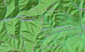
Local map of Big Hole Pass
|
|
| Elevation | 7,055 ft (2,150 m) |
| Traversed by | Continental Divide Trail |
| Location | Beaverhead-Deerlodge National Forest, Beaverhead County, Montana and Salmon National Forest, Lemhi County, Idaho |
| Coordinates | 45°32′59″N 113°49′13″W / 45.5496426°N 113.8203501°W |
| Topo map | USGS Big Hole Pass |

Big Hole Pass is a high mountain pass located on the border between Montana and Idaho. It sits at an elevation of about 7,055 feet (2,150 meters) above sea level.
You can find Big Hole Pass in the Beaverhead-Deerlodge National Forest in Montana and the Salmon National Forest in Idaho. It's about 8 miles south of Montana State Highway 43. Don't mix it up with a sign on Montana Highway 278 that points to the Big Hole valley.
The famous Continental Divide Trail (CDT) crosses right over this pass. Big Hole Pass is about 11 miles southeast of another well-known spot, Chief Joseph Pass. You can reach Big Hole Pass using Forest Service roads, like Dahlonega Creek Road (079) from the west or Forest Service Road #943 from Highway 43 in the east.
Long ago, in 1806, the Lewis and Clark Expedition traveled through this area. On their way back, William Clark and his group, including Sacagawea and her baby, crossed Big Hole Pass. They were heading to pick up supplies they had hidden earlier at a place called Camp Fortunate.
Exploring Big Hole Pass

Big Hole Pass is not on a main paved road, so you can't see it easily from your car. However, it's a very important spot for people hiking the entire Continental Divide Trail (CDT). Many outdoor lovers, like hunters and fishermen, also enjoy this area.
Close to Big Hole Pass, there's a dirt road that sits right on the Continental Divide. This is a cool spot because water on one side of the road flows towards the Pacific Ocean. Water on the other side flows towards the Atlantic Ocean! It's a great example of how the Continental Divide works.
Images for kids
-
Local map of Big Hole Pass
