Chief Joseph Pass facts for kids
Quick facts for kids Chief Joseph Pass |
|
|---|---|

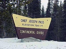
US Forestry sign at Chief Joseph Pass
|
|
| Elevation | 7,251 ft (2,210 m) |
| Traversed by | |
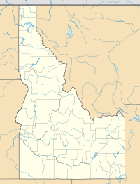
| Location | Lemhi County, Idaho / Beaverhead County, Montana, United States |
| Range | Bitterroot Mountains, Bitterroot Range, Rocky Mountains |
| Coordinates | 45°41′05″N 113°55′59″W / 45.68472°N 113.93306°W |
Chief Joseph Pass is a mountain pass located high in the Rocky Mountains in the northwestern United States. It sits on the Continental Divide, which is like a natural line that separates where water flows. On one side, water flows towards the Pacific Ocean, and on the other, it flows towards the Atlantic. This pass connects Lemhi County, Idaho and Beaverhead County, Montana.
The pass is part of the Bitterroot Mountains. Montana State Highway 43 crosses over it, making it an important route for travel. The pass is named after Chief Joseph, a famous leader of the Wallowa band of the Nez Perce tribe. He traveled through this pass in 1877 during a difficult time known as the Nez Perce War.
Where is Chief Joseph Pass?
Chief Joseph Pass is about 7,251 feet (2,210 meters) above sea level. It's a key spot for travelers between Idaho and Montana.
Just west of Chief Joseph Pass, Highway 43 connects with US-93 at a place called Lost Trail Pass. The two passes are very close, only about half a mile (0.8 kilometers) apart. Interestingly, for about one mile (1.6 kilometers) between these two passes, the Montana highway actually dips into Idaho!
This pass is the northernmost point where the Continental Divide forms the border between Idaho and Montana. Less than a mile north of Chief Joseph Pass, the Continental Divide turns eastward. It then follows the county line between Ravalli and Beaverhead counties, heading towards Butte.
A Historic Journey
East of Chief Joseph Pass, Highway 43 goes down into a valley towards Wisdom, which is about 26 miles (42 kilometers) away. Along this route, you can find the historic Big Hole National Battlefield. This site remembers an important event from 1877, connected to Chief Joseph and the Nez Perce people.
In early September 1805, the famous Lewis and Clark Expedition also passed through this area. They were exploring the western United States. Historians believe they crossed either Chief Joseph Pass or the nearby Lost Trail Pass as they traveled west into the Bitterroot Valley. This valley is now in Ravalli County.
Nearby Attractions
If you enjoy winter sports, the Lost Trail Powder Mountain ski area is located about one mile (1.6 kilometers) west of Chief Joseph Pass. It's found at Lost Trail Pass, right on US-93.
 | William Lucy |
 | Charles Hayes |
 | Cleveland Robinson |


