
Big Sandy Lake facts for kids
Quick facts for kids Big Sandy Lake |
|
|---|---|

(June 2006)
|
|

Big Sandy Lake
Location in Minnesota

Big Sandy Lake
Location in the United States
|
|
| Location | Aitkin County, Minnesota, U.S. |
| Coordinates | 46°46′05″N 93°16′26″W / 46.768°N 93.274°W |
| Primary inflows | Sandy River, Prairie River, Aitkin Lake Creek |
| Primary outflows | Sandy River |
| Basin countries | United States |
| Surface area | 6,526 acres (2,641 ha) |
| Max. depth | 84 ft (26 m) |
| Water volume | 134,018 acre⋅ft (0.165309 km3) |
| Shore length1 | 46.6 mi (75 km) |
| Surface elevation | 1,216 ft (371 m) |
| Islands | 25 |
| 1 Shore length is not a well-defined measure. | |
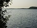
Big Sandy Lake is a large lake in Aitkin County, Minnesota. It's about nine miles north of the town of McGregor. This lake is known as a great place to catch walleye fish. It has different kinds of areas for fish to live. These include a wide-open main part, a deep, cool eastern part, and a shallower, more private southern part.
You can find thick beds of wild rice in the shallow bays on the south, west, and northwest sides of the lake. The Minnesota Department of Natural Resources provides two public spots to get onto the lake. One is on the Sandy River, and the other is on the northeast side of the lake. Other access points are also kept up by the United States Army Corps of Engineers and Shamrock Township.
Contents
How Big Sandy Lake Was Formed
Big Sandy Lake became a reservoir in 1895. This happened when the United States Army Corps of Engineers built a dam on the Sandy River. When the dam was first built, it had a lock. This lock allowed boats to travel from the lake all the way to the Mississippi River.
The Dam's History and Features
Today, the lock is no longer used for boats. The building where the lock was controlled has been turned into a small museum. This museum shows off interesting items from the local area's past.
Big Sandy Lake gets its water from three main rivers. These are the Sandy River, the Prairie River, and Aitkin Lake Creek. The Sandy River flows into the lake from the south. It then flows back out of the lake after the Big Sandy Dam, which is on the northwest side. The Prairie River enters the lake from the east into a spot called Bill Horn Bay. Aitkin Creek flows into the lake from the northwest, close to the Big Sandy Dam.
The Rich History of Big Sandy Lake
Big Sandy Lake has a long and important history. It was once home to the Dakota Sioux. Later, the Ojibwa people came to live there. In the Ojibwa language, the lake is called Mitaawangaagamaa. This means "Lake with flat, sandy beaches."
Native American Heritage
The lake is home to the Sandy Lake Band of Mississippi Chippewa. They are now part of the Mille Lacs Band of Ojibwe. However, they are working to be recognized as an independent group by the Bureau of Indian Affairs. The Minnesota DNR also owns one island in Bill Horn Bay. This island is preserved because it was a hiding place for Sioux women and children during conflicts with the Ojibwa in the 1800s.
Early Trading Posts and Trails
In 1798, a fur trading company called the North West Company had a post on the western side of the lake. Later, in 1830, the American Fur Company set up a post. This post was where the Sandy River met the Mississippi River, a short distance west of the lake.
The village of Gaa-mitaawangaagamaag was originally on the north shore of Big Sandy Lake. This village was the end point of an important path called the Northwest Trail. This trail connected the Mississippi River with the Saint Louis River. Today, Savanna Portage State Park remembers this historic trail. The park is located on the northeastern shore of the lake.
The Sandy Lake Tragedy Memorial
In 1850, the United States government tried to move the Ojibwa people. They wanted them to move from Michigan and Wisconsin to areas west of the Mississippi River. This difficult event led to what is known as the Sandy Lake Tragedy. Many Ojibwa people suffered greatly during this forced journey.
A memorial has been built to remember the Sandy Lake tragedy. It is located at the United States Army Corps of Engineers Sandy Lake Dam Campgrounds. Also, along Minnesota State Highway 65, there is a rest area with a view of Sandy Lake. This rest area has a special Historical Marker plaque that tells the story of the Sandy Lake tragedy.
Images for kids
-
(June 2006)
