
Birkhouse Moor facts for kids
Quick facts for kids Birkhouse Moor |
|
|---|---|

Striding Edge and Birkhouse Moor (right)
from St Sunday Crag |
|
| Highest point | |
| Elevation | 718 m (2,356 ft) |
| Prominence | c. 20 m |
| Parent peak | Helvellyn |
| Listing | Wainwright, Nuttall |
| Geography | |

Birkhouse Moor
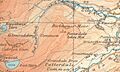
Location in Lake District
|
|
| Location | Cumbria, England |
| Parent range | Lake District, Eastern Fells |
| OS grid | NY364160 |
| Topo map | OS Explorer OL5 |
Birkhouse Moor is a beautiful fell (that's a fancy word for a mountain or hill) located in the amazing Lake District in England. It's part of the Helvellyn range and is considered one of the Eastern Fells. Even though it's really an eastern ridge of the much bigger Helvellyn mountain, a famous writer named Alfred Wainwright wrote about it as its own separate fell in his book Pictorial Guide to the Lakeland Fells. We'll follow his lead here!
Contents
What is Birkhouse Moor Like?
Birkhouse Moor is a wide, flat area that looks a bit like a three-fingered hand from above. It sits at the end of a famous rocky ridge called Striding Edge.
Striding Edge and the Valleys
Striding Edge is a very narrow, sharp ridge that comes off the top of Helvellyn. It's one of the most exciting paths for hikers in the Lake District! After Striding Edge, the path drops down to a grassy dip called Hole-in-the-Wall. From there, the land spreads out into the wide area that is Birkhouse Moor.
To the south of Birkhouse Moor is a long valley called Grisedale. This valley eventually leads to the beautiful Ullswater lake. The lower parts of the valley have some trees, and higher up, the valley walls are steep with rocks sticking out.
Glenridding Valley and Its Streams
On the northern side, Birkhouse Moor is bordered by the Glenridding valley system. Several streams flow into Glenridding Beck from this side. These include Mires Beck, Bleacove Beck, and Red Tarn Beck. Red Tarn Beck drains a large mountain lake (called a tarn) named Red Tarn. This tarn sits right below the summit of Helvellyn.
You can see more rocks on this side of Birkhouse Moor, especially at Nab Crag. There are also signs of an old mining operation called Greenside Mine. You can still spot old water channels and pipes that were used to carry water for the mine.
Lanty's Tarn and Keldas
One interesting spot is Keldas, a smaller hill separated from Birkhouse Moor by a small dip. In this dip is a little lake called Lanty's Tarn. It was named after an old landowner, Lancelot Dobson. Later, another family bought it and made it bigger by building a small dam. People used to fish here, and in winter, they would collect ice from the tarn. There's even an old ice house nearby!
The very top of Keldas is private land, but you are allowed to visit it. From Keldas, you get amazing views looking down Ullswater lake. The "Keldas Pines" (some trees) make for a great picture in the foreground!
What is Birkhouse Moor Made Of?
The rocks at the top of Birkhouse Moor are mostly made of a type of volcanic rock called dacitic lapilli-tuff. This means it's made from small pieces of volcanic ash and rock that exploded from a volcano a long, long time ago! At Keldas, you can see another type of rock called volcaniclastic sandstone, which is also formed from volcanic materials.
The Summits of Birkhouse Moor
Birkhouse Moor actually has two high points, or summits!
- The true summit is on the main ridge that leads towards Striding Edge. A stone wall runs along this ridge, and the highest point seems to be right where the wall crosses. There's also a small pile of stones (a cairn) nearby.
- The north summit is about a quarter of a mile away. It's where two smaller ridges meet. There's another cairn here, and you get good views looking north.
Between these two summits, the ground can be a bit wet and marshy, with a few small tarns (little lakes).
How Do People Climb Birkhouse Moor?
Birkhouse Moor is often part of a bigger adventure for people climbing Helvellyn from the village of Patterdale. Many paths cross it.
You can reach the ridge from the Glenridding side by following paths near Mires Beck or Lanty's Tarn. From the start of the Grisedale valley, a path goes up to Hole-in-the-Wall. You can choose to go to the summit of Birkhouse Moor or just walk past it. Some people also like to make their own way up The Nab or the north ridge from Glenridding.
When you stand on the true summit of Birkhouse Moor, the view is mostly taken up by the huge Helvellyn mountain and the curving arms of Striding Edge and Swirral Edge around it.
Images for kids
-
Map showing Birkhouse Moor and surrounding area from 1925.

