
Black River National Forest Scenic Byway facts for kids
Quick facts for kids
File:National Forest Scenic Byway.svg |
|
|---|---|
| County Road 513 | |
|
Black River NFSB highlighted in red
|
|
| Route information | |
| Maintained by GCRC and USFS | |
| Length | 11.328 mi (18.231 km) |
| Existed | June 20, 1992–present |
| Major junctions | |
| South end | |
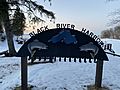
| North end | Black River Harbor |
| Location | |
| Counties: | Gogebic |
| Highway system | |
The Black River National Forest Scenic Byway is a special road in Michigan. It follows the beautiful Black River through the Ottawa National Forest. This scenic road is also known as County Road 513 (CR 513). It goes through Gogebic County in Michigan's Upper Peninsula.
Local road crews and the U.S. Forest Service work together to keep the byway in good shape. This road lets people visit many amazing waterfalls and other cool spots. The path for this byway has been around since the 1840s, first as a wagon road. It became a county road in the 1920s. On June 20, 1992, it was officially named a "Scenic Byway."
Contents
Exploring the Black River Byway
The Black River National Forest Scenic Byway starts near Bessemer. It begins where County Road 513 meets County Road 204. This is west of the Gogebic-Iron County Airport. From there, the road heads north, following the Black River.
The byway runs through the thick Ottawa National Forest. You'll see tall pine, hemlock, and hardwood trees along the way. The road stays a bit away from the river banks.
Cool Places Along the Way
As you drive, you'll pass the Royal Palm Ranch. This is a famous horse riding school next to the river. The byway then curves away from the river near Copper Peak. This is the tallest ski flying hill in the whole world! It's as tall as an 18-story building. On a clear day, you can see up to 85 miles (137 km) from the top. You might even spot Minnesota, Isle Royale, or Canada!
After Copper Peak, the road gets closer to the river again. It gives you access to five amazing waterfalls.
Discovering the Waterfalls
The first waterfall you'll find is Great Conglomerate Falls. After that, you can see Potawatomi Falls, Gorge Falls, Sandstone Falls, and Rainbow Falls. Each of these waterfalls has its own hiking trail from the road. These trails let you get up close to the beautiful falls.
The byway continues past all these natural wonders. It finally ends at Black River Harbor.
Black River Harbor: A Special Place
Black River Harbor used to be a fishing village in the 1920s. It's one of only two harbors in the entire National Forest System. During the Great Depression, the Civilian Conservation Corps built three taverns here. There's also a cool pedestrian suspension bridge. This bridge is part of the North Country Trail, helping hikers cross the river's mouth.
History of the Byway
People have used this route for a long time. In 1848, a wagon road already connected Black River Harbor to Chippewa Hill, where Copper Peak is now. In 1904, the State of Michigan built a wagon road to connect the waterfront with Bessemer.
The county bought the land around the harbor for a park in 1924. By 1927, a county road was built along the Black River. The fishing village residents had to move and started a new settlement called Black River Village.
The road was improved to a gravel surface by 1930. It was fully paved in late 1949 or early 1950. In 1967, the county traded the park land, including the harbor, with the U.S. Forest Service. Since then, the federal government has taken care of the harbor.
Local leaders thought the road should be a National Forest Scenic Byway. They suggested it in April 1991. They wanted to "showcase a special part of the National Forest" and bring more visitors to the area. The U.S. Forest Service officially gave it the "Scenic Byway" title on June 20, 1992. A special ceremony was held on September 19 that same year.
Images for kids
-
Black River Harbor, located at the end of the byway

