Black River (Gogebic County) facts for kids
Quick facts for kids Black River |
|
|---|---|
| Country | United States |
| Physical characteristics | |
| River mouth | Lake Superior 600 ft (180 m) |
| Type: | Scenic |
| Designated: | March 3, 1992 |
The Black River is a 41.1-mile-long (66.1 km) river located in the Upper Peninsula of Michigan, a state in the United States. It flows mostly through Gogebic County and empties into Lake Superior. The river starts in a wetland area near the border with Iron County, Wisconsin. A special part of the river, about 14 miles (23 km) long, is inside the Ottawa National Forest. This section was named a National Wild and Scenic River in 1992 because of its natural beauty.
Where the Black River meets Lake Superior, there's a place called Black River Harbor. This used to be a busy spot where fishermen brought in lots of lake trout. Today, a cool suspension footbridge for the North Country Trail crosses the river here.
Contents
Amazing Waterfalls
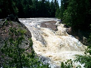
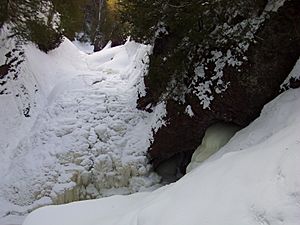
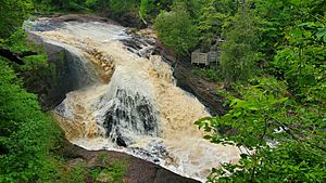
The part of the Black River that is a Wild and Scenic River is famous for its many waterfalls. The river drops more than 200 feet (61 m) as it flows from near Copper Peak down to Lake Superior. You can find five main waterfalls within about two miles (3.2 km) of its mouth.
Some of these waterfalls are easy to reach from the County Road 513 (also known as Black River Road). This road was named a National Forest Scenic Byway in 1992. Other waterfalls might need a bit more of a hike to see. Trails with unique stairways and viewing platforms make it easier to visit Gorge Falls and Potawatomi Falls. These trails are even called National Recreation Trails!
Smaller Falls: Narrows, Chippewa, and Algonquin
As the Black River gets closer to Lake Superior, you'll find three smaller waterfalls first: Narrows Falls, Chippewa Falls, and Algonquin Falls. Narrows and Algonquin Falls are more like fast-moving rapids or cascades. Chippewa Falls drops almost 10 feet (3.0 m) over rocks and fallen trees. These spots are a bit harder to get to, so fewer people visit them.
Big Drops: Great Conglomerate and Potawatomi Falls
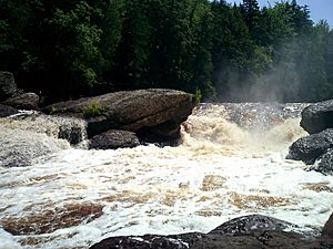
Great Conglomerate Falls is one of the first big waterfalls you'll see as you head north along the river. Here, the river plunges 30 feet (9.1 m) around a huge conglomerate rock, big boulders, and tree trunks into a deep gorge. Potawatomi Falls is also impressive, dropping nearly 40 feet (12 m) in two parts. It also flows around a large conglomerate rock, similar to Great Conglomerate Falls.
Powerful Falls: Gorge and Sandstone Falls
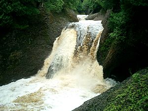
At Gorge Falls, the Black River squeezes into a narrow space, only about seven feet (2.1 m) wide. Then it drops 20 feet (6.1 m) into a steep gorge, creating lots of foam as the water crashes against the rocks. Sandstone Falls drops a total of 25 feet (7.6 m) in two sections. It's named for the sandstone rocks in the riverbed that the water has cut channels through over time.
Beautiful Rainbow Falls
Rainbow Falls is the last waterfall on the Black River before it reaches Lake Superior, less than one mile (1.6 km) away. It's also the tallest, with water falling 45 feet (14 m) into a rocky gorge. This waterfall creates a lot of mist. On sunny days, this mist often forms a constant rainbow, which is how it got its name! Getting to Rainbow Falls can be a bit of a workout, as there are about 200 steps built into the side of the hill.
River Branches and Features
The Black River has many smaller streams and features that join it along its path. Here are some of them, starting from the mouth of the river:
- Rainbow Falls
- Sagaigan Creek (on the left side)
- Sagaigan Lake
- Sandstone Falls
- Gorge Falls
- Potawatomi Falls
- Great Conglomerate Falls
- Sand Island Creek (on the left side)
- Algonquin Falls
- Kirby Creek (on the left side)
- Chippewa Falls
- Reed Creek (on the right side)
- Narrows Creek (on the left side)
- Montowibo Creek (on the left side)
- Sapsucker Creek (on the left side)
- Sixmile Creek (on the right side)
- Powder Mill Creek (on the right side)
- Sellwood Creek (on the left side)
- Kallander Creek (on the right side)
- Abitosse Creek (on the left side)
- Jackson Creek (on the left side)
- Planter Creek (on the right side)
- Berranger Creek (on the left side)
- Connor Creek (on the left side)
- Bowden Creek (on the left side)
- Finnegan Creek (on the left side)
- Alward Creek (on the left side)
- McVichie Creek (on the right side)
- Gabbro Falls
- Neepikon Falls
- Little Black River (on the left side)
- Sunday Lake
- Wakefield
- Ramsay
- Sunset Creek (on the left side)
- Granite Falls
- Hosking Creek (on the left side)
- Devils Creek (on the left side)
- Palms Creek (on the right side)
- McDonald Creek (on the left side)
- McDonald Lake
- Bice Creek (on the left side)
- Mosinee Creek (on the left side)
- McDonald Lake
- Wester Creek (on the right side)
- Underwood Creek (on the left side)
- Black River Lake
 | Janet Taylor Pickett |
 | Synthia Saint James |
 | Howardena Pindell |
 | Faith Ringgold |


