Black Run (Spruce Run tributary) facts for kids
Quick facts for kids Black Run |
|
|---|---|

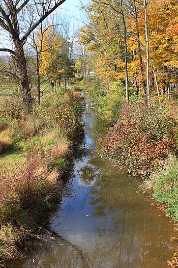
Black Run in its lower reaches
|
|
| Other name(s) | Blacks Run |
| Physical characteristics | |
| Main source | Buffalo Mountain in West Buffalo Township, Union County, Pennsylvania between 1,520 and 1,540 feet (460 and 470 m) |
| River mouth | Spruce Run in Buffalo Township, Union County, Pennsylvania 502 ft (153 m) 40°59′09″N 76°59′03″W / 40.9858°N 76.9842°W |
| Length | 4.7 mi (7.6 km) |
| Basin features | |
| Progression | Spruce Run → Buffalo Creek → West Branch Susquehanna River → Susquehanna River → Chesapeake Bay |
| Basin size | 4.72 sq mi (12.2 km2) |
| Tributaries |
|
Black Run, sometimes called Black's Run, is a small stream in Union County, Pennsylvania. It's like a smaller river that flows into a bigger one called Spruce Run. Black Run is about 4.7 miles (7.6 km) long. It travels through two areas: West Buffalo Township and Buffalo Township.
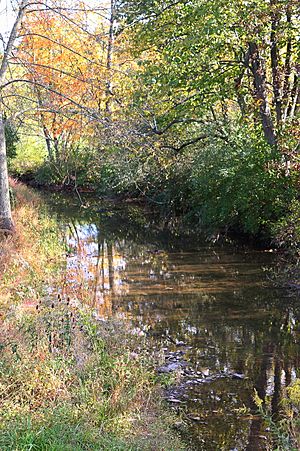
The land area that drains water into Black Run is about 4.72 square miles (12.2 km2). This stream has two smaller streams that flow into it, but they don't have names. Black Run is considered a healthy stream, meaning it's not listed as polluted. Most of the land around it is covered in forests, but some parts are used for farming. You can also find a few bridges built over the stream.
Where Does Black Run Flow?
Black Run starts high up on Buffalo Mountain in West Buffalo Township. From there, it flows southeast for a short distance, reaching the bottom of the mountain and entering a valley.
Then, it turns east and flows for a few miles. During this part of its journey, it enters Buffalo Township. Here, two smaller streams, which don't have names, join Black Run from its left side. Eventually, the stream turns south-southeast and flows for more than a mile. Finally, it meets and joins Spruce Run. Black Run flows into Spruce Run about 0.80 miles (1.29 km) before Spruce Run itself ends.
Understanding the Land Around Black Run
The area of land that collects and drains water into Black Run is called its watershed. This watershed covers about 4.72 square miles (12.2 km2). The end of Black Run is located in a map area called Lewisburg. However, its beginning is in a different map area called Williamsport SE. The stream also flows through the Mifflinburg map area.
Most of the land in the Black Run watershed is covered by forests, about 71 percent. Another 22 percent of the land is used for farming. A small part, about 3 percent, is covered by hard surfaces like roads or buildings.
The Black Run watershed makes up about 3 percent of the larger Buffalo Creek watershed.
A Look at Black Run's History
Black Run was officially added to the Geographic Names Information System on August 2, 1979. It's also known by its other name, Black's Run.
Records show that a piece of land near Black Run was surveyed, or measured, by a person named James Wilson in 1771. A few years later, in 1774, William Black settled along the stream. Later, in 1793, a wagonmaker and farmer named Phillip Stahl moved from Bucks County and settled near the mouth of the stream, close to a place called Mazeppa.
Over the years, several bridges have been built over Black Run.
- In 1936, a steel bridge (called T-389) was built about 0.8 miles (1.3 km) north of Mazeppa. It was repaired in 2003 and is 46.9 feet (14.3 m) long.
- In 1948, a concrete bridge (carrying State Route 1002) was built over the stream in Mazeppa. This bridge is 39.0 feet (11.9 m) long.
 | Delilah Pierce |
 | Gordon Parks |
 | Augusta Savage |
 | Charles Ethan Porter |


