Blackthorn Peak facts for kids
Quick facts for kids Blackthorn Peak |
|
|---|---|
| Black Thorn | |

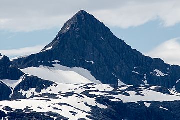
Blackthorn Peak, northeast aspect
|
|
| Highest point | |
| Elevation | 4,117 ft (1,255 m) |
| Prominence | 1,900 ft (580 m) |
| Isolation | 2.5 mi (4.0 km) |
| Parent peak | Mount Aleutka (5200 ft) |
| Geography | |
| Location | Glacier Bay National Park Hoonah-Angoon Alaska, United States |
| Parent range | Fairweather Range Saint Elias Mountains |
| Topo map | USGS Mount Fairweather C-2 |
| Climbing | |
| First ascent | 1898 by gold prospectors |
Blackthorn Peak, also known as Black Thorn, is a mountain in southeast Alaska. It stands 4,117 feet (1,255 meters) tall. You can find it at the top of Geikie Inlet in Glacier Bay National Park and Preserve. This peak is part of the Fairweather Range within the larger Saint Elias Mountains.
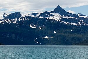
Blackthorn Peak is located just east of the Geikie Glacier. It's about 80 miles (129 km) west-northwest of Juneau. Even though it's not the tallest mountain, it rises sharply from the water in just over two miles. This means it looks very impressive!
The mountain got its name in 1896 from Harry Fielding Reid. He was an American scientist who studied glaciology, which is the study of glaciers. If the weather is good, you might see Blackthorn Peak from Glacier Bay, a popular spot for cruise ships. The best time to see or climb the peak is usually from May to June.
Weather Around Blackthorn Peak
Blackthorn Peak is in a subpolar oceanic climate zone. This means it has long, cold, and snowy winters. Summers are cool.
How Weather Systems Affect the Peak
Weather systems from the Gulf of Alaska hit the Saint Elias Mountains. This forces the air upwards, a process called orographic lift. This causes a lot of rain and snow to fall on the mountain.
Temperatures and Water Flow
Temperatures can drop very low, sometimes below −20 °C. With the wind, it can feel even colder, below −30 °C. All the rain and melted snow from the mountain flows into the Glacier Bay Basin.
 | Janet Taylor Pickett |
 | Synthia Saint James |
 | Howardena Pindell |
 | Faith Ringgold |


