Blenheim, Queensland facts for kids
Quick facts for kids BlenheimQueensland |
|||||||||||||||
|---|---|---|---|---|---|---|---|---|---|---|---|---|---|---|---|

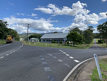
View across Blenheim with the public hall in the foreground, 2024
|
|||||||||||||||
| Population | 264 (2021 census) | ||||||||||||||
| • Density | 7.354/km2 (19.05/sq mi) | ||||||||||||||
| Postcode(s) | 4341 | ||||||||||||||
| Area | 35.9 km2 (13.9 sq mi) | ||||||||||||||
| Time zone | AEST (UTC+10:00) | ||||||||||||||
| Location | |||||||||||||||
| LGA(s) | Lockyer Valley Region | ||||||||||||||
| State electorate(s) | Lockyer | ||||||||||||||
| Federal Division(s) | Wright | ||||||||||||||
|
|||||||||||||||
Blenheim is a small rural area, also called a locality, in the Lockyer Valley Region of Queensland, Australia. It's a quiet place where people live and work.
In the 2021 census, Blenheim had a population of 264 people.
Contents
Blenheim's Past: A Look at History
How Blenheim Got Its Name
The area was first known as Sandy Creek. Later, it was renamed Blenheim. This name came from Blenheim Park in Oxfordshire, England. That park was named after the famous Battle of Blenheim.
Early Schools and Churches
Blenheim State School first opened its doors on 7 April 1879. It started with 73 students.
In 1895, a German Baptist church was built in Blenheim. Over time, fewer people attended. The church eventually closed and was moved to Laidley.
Another church, Blenheim Lutheran Church, opened on Sunday, 31 March 1912. In 1938, it was also moved to Laidley. It became a church hall for the Laidley Lutheran Church.
Blenheim Public Hall
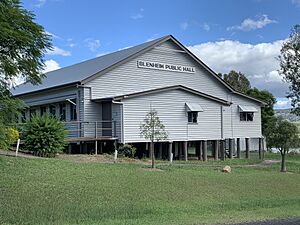
The Blenheim Public Hall was officially opened in August 1948. Ted Maher, a local politician, opened it. The hall celebrated its 70th anniversary in August 2018. A special mural made for the hall's opening is still on display there.
Who Lives in Blenheim: Population Details
The number of people living in Blenheim changes over time.
- In the 2021 census, Blenheim had a population of 264 people.
Important Places: Heritage Listings
A heritage listing means a place is important to history and should be protected.
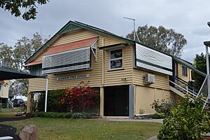
- Blenheim State School, located at 81 Blenheim Road, is a heritage-listed site. This means it's recognized for its historical value.
Learning in Blenheim: Education
Blenheim State School is a government primary school. It teaches students from Prep to Year 6. You can find it at 81 Blenheim Road. In 2018, the school had 81 students. It had 5 teachers and 5 other staff members.
There are no high schools directly in Blenheim. Students go to nearby towns for secondary education. The closest government high schools are:
 | Ernest Everett Just |
 | Mary Jackson |
 | Emmett Chappelle |
 | Marie Maynard Daly |


