
Ropeley, Queensland facts for kids
Quick facts for kids RopeleyQueensland |
|||||||||||||||
|---|---|---|---|---|---|---|---|---|---|---|---|---|---|---|---|

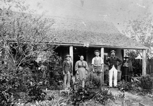
Ropeley Immanuel Lutheran Church, 2006
|
|||||||||||||||

Ropeley
Location in Queensland
|
|||||||||||||||
| Population | 206 (2021 census) | ||||||||||||||
| • Density | 7.57/km2 (19.6/sq mi) | ||||||||||||||
| Postcode(s) | 4343 | ||||||||||||||
| Area | 27.2 km2 (10.5 sq mi) | ||||||||||||||
| Time zone | AEST (UTC+10:00) | ||||||||||||||
| Location | |||||||||||||||
| LGA(s) | Lockyer Valley Region | ||||||||||||||
| State electorate(s) | Lockyer | ||||||||||||||
| Federal Division(s) | Wright | ||||||||||||||
|
|||||||||||||||
Ropeley is a small, quiet place in the countryside of Queensland, Australia. It's part of the Lockyer Valley Region. In 2021, about 206 people lived there.
Contents
Exploring Ropeley's Location
Ropeley is a rural area. A part of it, called Ropeley East, is located in the eastern section of the area.
A Look Back at Ropeley's History
Ropeley has a rich history, especially with its schools and churches.
Early Schools in Ropeley
The first school in the area was called Deep Gully Provisional School. It opened in 1890. Just two years later, in 1892, its name changed to Ropeley Provisional School. On September 2, 1901, it became Ropeley State School. This school celebrated its 100th birthday in 1990!
Another school, Ropeley East State School, opened on May 4, 1915. However, it closed its doors in 1955.
Churches and Community
The Lutheran community in Ropeley started in 1886. The Ropeley Immanuel Lutheran Church was officially opened on Sunday, February 4, 1923. It was a huge event, with about 1,200 people attending! This new church brought together two separate Lutheran groups in the area.
Another important church, the Ropeley Apostolic Church, opened on Sunday, June 21, 1914. Reverend Heinrich Frederick Nieumeyer led the opening ceremony. The church building was 30 feet long and 21 feet wide. It also had a small room called a vestry and a porch with a bell. The land for the church was kindly given by August Schneider. Mr. L. Roberts built the church for £140, and volunteers helped move materials. The altar inside was made from cedar wood by Mr. Laffey.
Who Lives in Ropeley?
The number of people living in Ropeley changes over time.
- In 2011, there were 232 people.
- By 2016, the population was 194 people.
- In 2021, the population grew slightly to 206 people.
Learning in Ropeley

Ropeley State School is a government primary school for students from Prep to Year 6. It's located at 4 Hoger Road. In 2013, the school had 11 students and two teachers. By 2015, only one child was enrolled. In 2018, there were 5 students and 2 teachers. As of 2023, the school is officially open, but it's not currently operating because there are no students enrolled.
There isn't a high school in Ropeley. The closest government high school is Lockyer District State High School in Gatton.
Places to Visit in Ropeley

Ropeley has a few important community places.
Churches
- Ropeley Immanuel Lutheran Church is at 400 Ropeley Rockside Road. They hold church services every Sunday.
- Ropely Apostolic Church is at 86 Steinmullers Road.
Cemeteries
Ropeley also has two cemeteries:
- Ropeley Immanuel Lutheran cemetery is next to the Immanuel Lutheran Church.
- Ropeley Scandinavian Lutheran cemetery is connected to a former Scandinavian Lutheran community.
