Blue Hill, Nebraska facts for kids
Quick facts for kids
Blue Hill, Nebraska
|
|
|---|---|

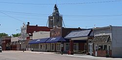
Downtown Blue Hill: north side of West Gage Street, May 2010
|
|

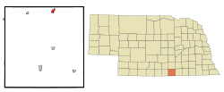
Location of Blue Hill, Nebraska
|
|
| Country | United States |
| State | Nebraska |
| County | Webster |
| Area | |
| • Total | 0.73 sq mi (1.90 km2) |
| • Land | 0.73 sq mi (1.90 km2) |
| • Water | 0.00 sq mi (0.00 km2) |
| Elevation | 1,972 ft (601 m) |
| Population
(2020)
|
|
| • Total | 805 |
| • Density | 1,098.23/sq mi (423.83/km2) |
| Time zone | UTC-6 (Central (CST)) |
| • Summer (DST) | UTC-5 (CDT) |
| ZIP code |
68930
|
| Area code(s) | 402 |
| FIPS code | 31-05560 |
| GNIS feature ID | 2394202 |
| Website | http://bluehillne.com/ |
Blue Hill is a small town in Webster County, Nebraska, United States. In 2010, about 936 people lived there. The current mayor of Blue Hill is Kirsten Schofield.
Contents
History of Blue Hill
Blue Hill was first called Belmont. It was planned in 1878 when the Burlington and Missouri River Railroad built a railway line to that spot. The name was changed to Blue Hill because there was already another town named Belmont in Nebraska. The name "Blue Hill" comes from the nearby Blue River.
The Blue Hill Country Club was built in the late 1950s or early 1960s. It was built by Axel E. Ohlin and his son Dale R. Ohlin, who were from nearby Hastings, Nebraska.
Geography of Blue Hill
Blue Hill covers about 0.73 square miles (1.90 square kilometers) of land. There is no water area within the city limits. Blue Hill is located about 22.5 miles north of the border between Nebraska and Kansas. It is also about 150 miles west of the Missouri River.
Climate in Blue Hill
Blue Hill has a climate with warm summers and cold winters. Here is a table showing the average weather conditions:
| Climate data for Blue Hill, Nebraska (coordinates:40°18′21″N 98°30′17″W / 40.3058°N 98.5047°W, 1991-2020) | |||||||||||||
|---|---|---|---|---|---|---|---|---|---|---|---|---|---|
| Month | Jan | Feb | Mar | Apr | May | Jun | Jul | Aug | Sep | Oct | Nov | Dec | Year |
| Average precipitation inches (mm) | 0.65 (17) |
0.80 (20) |
1.47 (37) |
2.60 (66) |
4.57 (116) |
3.61 (92) |
3.92 (100) |
3.48 (88) |
2.32 (59) |
2.05 (52) |
1.26 (32) |
0.85 (22) |
27.58 (701) |
| Average snowfall inches (cm) | 5.7 (14) |
7.8 (20) |
3.2 (8.1) |
1.4 (3.6) |
0.0 (0.0) |
0.0 (0.0) |
0.0 (0.0) |
0.0 (0.0) |
0.0 (0.0) |
1.2 (3.0) |
1.6 (4.1) |
4.4 (11) |
25.3 (63.8) |
| Average precipitation days (≥ 0.01 in) | 3.4 | 3.7 | 5.2 | 7.1 | 9.2 | 7.9 | 6.7 | 6.4 | 4.9 | 4.9 | 3.7 | 3.3 | 66.4 |
| Average snowy days (≥ 0.01 in) | 2.7 | 2.9 | 1.4 | 0.8 | 0 | 0 | 0 | 0 | 0 | 0.3 | 1.3 | 2.3 | 11.7 |
| Source: NOAA | |||||||||||||
Population of Blue Hill
The population of Blue Hill has changed over the years. Here is a look at how many people have lived there since 1880:
| Historical population | |||
|---|---|---|---|
| Census | Pop. | %± | |
| 1880 | 138 | — | |
| 1890 | 796 | 476.8% | |
| 1900 | 823 | 3.4% | |
| 1910 | 761 | −7.5% | |
| 1920 | 726 | −4.6% | |
| 1930 | 669 | −7.9% | |
| 1940 | 565 | −15.5% | |
| 1950 | 574 | 1.6% | |
| 1960 | 723 | 26.0% | |
| 1970 | 784 | 8.4% | |
| 1980 | 883 | 12.6% | |
| 1990 | 810 | −8.3% | |
| 2000 | 867 | 7.0% | |
| 2010 | 936 | 8.0% | |
| 2020 | 805 | −14.0% | |
| U.S. Decennial Census | |||
2010 Census Information
In 2010, the census showed that 936 people lived in Blue Hill. There were 363 households, which are groups of people living together. Out of these, 228 were families. The city had about 1282 people per square mile.
Most of the people in Blue Hill were White (97.4%). A small number were African American, Native American, Asian, or Pacific Islander. About 1.8% of the population was Hispanic or Latino.
About 32.8% of households had children under 18 living with them. More than half (52.1%) were married couples. About 34.4% of all households had only one person living there. Also, 22% of households had someone aged 65 or older living alone. The average household had 2.37 people, and the average family had 3.04 people.
The average age of people in Blue Hill was 44.1 years. About 25.4% of residents were under 18 years old. About 22% were 65 years or older. The population was 45.2% male and 54.8% female.
See also
 In Spanish: Blue Hill (Nebraska) para niños
 | Bayard Rustin |
 | Jeannette Carter |
 | Jeremiah A. Brown |

