
Webster County, Nebraska facts for kids
Quick facts for kids
Webster County
|
|
|---|---|

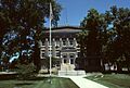
Webster County Courthouse in Red Cloud
|
|

Location within the U.S. state of Nebraska
|
|
 Nebraska's location within the U.S. |
|
| Country | |
| State | |
| Founded | 1871 |
| Named for | Daniel Webster |
| Seat | Red Cloud |
| Largest city | Red Cloud |
| Area | |
| • Total | 575 sq mi (1,490 km2) |
| • Land | 575 sq mi (1,490 km2) |
| • Water | 0.1 sq mi (0.3 km2) 0.02%% |
| Population | |
| • Estimate
(2021)
|
3,411 |
| • Density | 6.1/sq mi (2.4/km2) |
| Time zone | UTC−6 (Central) |
| • Summer (DST) | UTC−5 (CDT) |
| Congressional district | 3rd |
Webster County is a county located in the state of Nebraska in the United States. In 2020, about 3,411 people lived there. The main town and county seat (where the county government is) is Red Cloud.
Webster County was created in 1871. It was named after a famous American leader, Daniel Webster.
If you look at Nebraska license plates, cars from Webster County have the number 45. This is because in 1922, when the license plate system started, Webster County had the 45th largest number of registered vehicles.
Contents
Exploring Webster County's Geography
Webster County is located in the southern part of Nebraska. Its southern border touches the northern border of Kansas. The land in Webster County has gentle, rolling hills that slope towards the east. The flatter areas are used for farming. Farmers often use a special watering system called center pivot irrigation to grow their crops.
The Republican River flows through the lower part of the county, moving eastward. The county covers an area of about 575 square miles. Almost all of this area is land, with only a tiny bit (0.1 square miles) being water.
Main Roads in Webster County
 U.S. Highway 136
 U.S. Highway 281
 Nebraska Highway 4
 Nebraska Highway 78
Neighboring Counties
Webster County shares its borders with several other counties:
- Adams County - to the north
- Clay County - to the northeast
- Nuckolls County - to the east
- Jewell County, Kansas - to the southeast (in Kansas)
- Smith County, Kansas - to the southwest (in Kansas)
- Franklin County - to the west
- Kearney County - to the northwest
Nature Areas to Visit
- Indian Creek State Wildlife Management Area
- Liberty Cove Recreation Area
People of Webster County: Demographics
| Historical population | |||
|---|---|---|---|
| Census | Pop. | %± | |
| 1870 | 16 | — | |
| 1880 | 7,104 | 44,300.0% | |
| 1890 | 11,210 | 57.8% | |
| 1900 | 11,619 | 3.6% | |
| 1910 | 12,008 | 3.3% | |
| 1920 | 10,922 | −9.0% | |
| 1930 | 10,210 | −6.5% | |
| 1940 | 8,701 | −14.8% | |
| 1950 | 7,395 | −15.0% | |
| 1960 | 6,224 | −15.8% | |
| 1970 | 5,396 | −13.3% | |
| 1980 | 4,858 | −10.0% | |
| 1990 | 4,279 | −11.9% | |
| 2000 | 4,061 | −5.1% | |
| 2010 | 3,812 | −6.1% | |
| 2020 | 3,395 | −10.9% | |
| 2021 (est.) | 3,411 | −10.5% | |
| US Decennial Census 1790-1960 1900-1990 1990-2000 2010-2013 |
|||
In 2000, there were 4,061 people living in Webster County. These people lived in 1,708 households, and 1,118 of these were families. The county had about 7 people per square mile.
Most of the people (98.10%) identified as White. Smaller groups included Black or African American (0.15%), Native American (0.27%), Asian (0.47%), and Pacific Islander (0.07%). Some people (0.71%) were from two or more races. About 0.54% of the population identified as Hispanic or Latino.
Many people in Webster County have German (50.7%), English (9.7%), American (8.3%), or Irish (7.6%) backgrounds.
About 26.80% of households had children under 18 living with them. Many households (57.70%) were married couples. About 32.60% of all households were individuals living alone. Of those living alone, 17.90% were 65 years old or older.
The average age of people in the county was 44 years old. For every 100 females, there were about 92.70 males.
The average income for a household in the county was $30,026 per year. For families, the average income was $36,513. About 11.20% of the population lived below the poverty line. This included 13.50% of those under 18 and 10.50% of those 65 or older.
Towns and Villages in Webster County
Cities
Villages
Other Places
- Inavale (This is a "census-designated place," which means it's a community that the government counts separately for population data, but it's not officially a city or village.)
Small Communities (Unincorporated)
Images for kids
-
Webster County Courthouse in Red Cloud
See also
 In Spanish: Condado de Webster (Nebraska) para niños
