
Adams County, Nebraska facts for kids
Quick facts for kids
Adams County
|
|
|---|---|
_from_S.JPG)
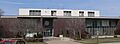
Adams County Courthouse in Hastings
|
|

Location within the U.S. state of Nebraska
|
|
 Nebraska's location within the U.S. |
|
| Country | |
| State | |
| Founded | 1867 (authorized) 1871 (organized) |
| Named for | John Adams |
| Seat | Hastings |
| Largest city | Hastings |
| Area | |
| • Total | 564 sq mi (1,460 km2) |
| • Land | 563 sq mi (1,460 km2) |
| • Water | 1.0 sq mi (3 km2) 0.2%% |
| Population | |
| • Estimate
(2021)
|
31,027 |
| • Density | 56/sq mi (22/km2) |
| Time zone | UTC−6 (Central) |
| • Summer (DST) | UTC−5 (CDT) |
| Congressional district | 3rd |
Adams County is a county in the state of Nebraska. It's located in the central part of the state. As of 2020, about 31,205 people live there. The main city and county seat is Hastings.
The county was officially created in 1867 and fully set up in 1871. It was named after John Adams, who was the second President of the United States. Adams County is part of the larger area around Hastings.
If you see a Nebraska license plate with the number 14, it means the car is from Adams County. This system started in 1922. Adams County had the 14th highest number of registered vehicles back then.
Contents
Geography
Adams County covers about 564 square miles. Most of this area is land. Only a small part, about 1 square mile, is water.
Main Roads
Many important roads run through Adams County. These roads help people travel and transport goods.
 U.S. Highway 6
 U.S. Highway 34
 U.S. Highway 281
 Nebraska Highway 74
Train Travel
You can also travel by train in Adams County. The California Zephyr train, run by Amtrak, stops at the Hastings station.
Neighboring Counties
Adams County shares its borders with several other counties.
- Hamilton County – to the northeast
- Clay County – to the east
- Webster County – to the south
- Kearney County – to the west
- Buffalo County – to the northwest
- Hall County – to the north
People of Adams County
| Historical population | |||
|---|---|---|---|
| Census | Pop. | %± | |
| 1870 | 19 | — | |
| 1880 | 10,235 | 53,768.4% | |
| 1890 | 24,303 | 137.4% | |
| 1900 | 18,840 | −22.5% | |
| 1910 | 20,900 | 10.9% | |
| 1920 | 22,621 | 8.2% | |
| 1930 | 26,275 | 16.2% | |
| 1940 | 24,576 | −6.5% | |
| 1950 | 28,855 | 17.4% | |
| 1960 | 28,944 | 0.3% | |
| 1970 | 30,553 | 5.6% | |
| 1980 | 30,656 | 0.3% | |
| 1990 | 29,625 | −3.4% | |
| 2000 | 31,151 | 5.2% | |
| 2010 | 31,364 | 0.7% | |
| 2020 | 31,205 | −0.5% | |
| 2021 (est.) | 31,027 | −1.1% | |
| US Decennial Census 1790-1960 1900-1990 1990-2000 2010-2021 |
|||
In 2000, there were about 31,151 people living in Adams County. The population density was about 55 people per square mile. Most people in the county are White. There are also people of Black, Native American, Asian, and other backgrounds. Some residents are of Hispanic or Latino heritage.
Many households in Adams County have children under 18. About half of the households are married couples living together. The average age of people in the county was 36 years old in 2000.
Communities
Adams County has one main city and several smaller towns and areas.
City
- Hastings (This is the county seat, meaning it's where the county government is located.)
Villages
These are smaller towns in Adams County.
Unincorporated Communities
These are places where people live, but they are not officially organized as a city or village.
Townships
Townships are smaller divisions of the county, often used for local government or land organization.
- Ayr
- Blaine
- Cottonwood
- Denver
- Hanover
- Highland
- Juniata
- Kenesaw
- Little Blue
- Logan
- Roseland
- Silver Lake
- Verona
- Wanda
- West Blue
- Zero
Images for kids
-
Adams County Courthouse in Hastings
See also
 In Spanish: Condado de Adams (Nebraska) para niños
