Blythe Intake facts for kids
Quick facts for kids Blythe Intake |
|
|---|---|

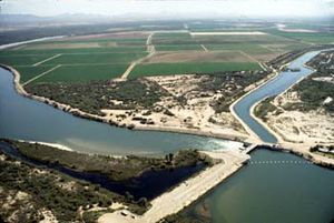
Palo Verde Dam site of the Blythe Intake
|
|
| Location | Palo Verde Dam |
| Built | 1887 |
| Designated | March 1, 1982 |
| Reference no. | 948 |
| Lua error in Module:Location_map at line 420: attempt to index field 'wikibase' (a nil value). | |

The Blythe Intake is a really important historical spot in California. It's where the very first irrigation canal was built to bring water to the Palo Verde Valley way back in 1877. This canal helped turn dry land into farms! You can find it north of Blythe, California, in Riverside County, California. Because it was so important, the Blythe Intake became a California Historic Landmark (No. 948) on March 1, 1982. Today, the original site is part of the Palo Verde Dam.
Contents
How the Palo Verde Valley Got Water
The Big Idea for a New Valley
In the 1870s, a smart engineer named William Calloway saw something special. He explored an area across the Colorado River from Ehrenberg, Arizona. Calloway realized this dry land had huge potential if it could get water. He started making plans and claiming land for development.
Thomas Blythe Steps In
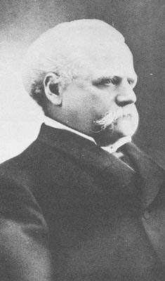
Calloway got a wealthy man named Thomas Henry Blythe interested in his big idea. Blythe, who was born Thomas Williams in Mold, Wales, wanted to help create a new "empire" next to the Colorado River. On July 17, 1877, Blythe officially claimed the rights to use water from the Colorado River. This was for what would become the "Blythe Intake."
Building the Water System
Blythe hired George Irish to help Calloway build the irrigation system. Sadly, Calloway passed away in 1880. C.C. Miller, the father of Frank Augustus Miller, took over his work. Thomas Blythe himself passed away in 1883, but his vision for the valley lived on.
Exploring the Palo Verde Valley
Where is the Palo Verde Valley?
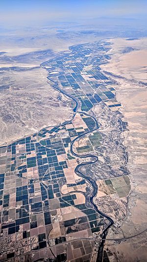
The Palo Verde Valley is a unique place located in the Lower Colorado River Valley. It sits right on the eastern border of Southern California with Arizona. This valley is part of the Colorado Desert, which is a section of the larger Sonoran Desert.
What Makes the Valley Special?
Most of the Palo Verde Valley is in Riverside County. A smaller part of it stretches into Imperial County. To the east, across the Colorado River, is La Paz County in Arizona. The valley is surrounded by interesting mountains. The Big Maria Mountains are to the north, and the Colorado River forms its eastern and southern edges. Other nearby mountains include the McCoy Mountains to the west and the Chocolate Mountains to the south.
A Special Historical Marker
Remembering the Blythe Intake
You can find a special marker for this California Historical Landmark on U.S. Route 95. It's at milepost 10.5, on the right side if you're driving north. This marker tells the story of the Blythe Intake.
What the Marker Says
The sign at the site reads:
- NO. 948 SITE OF - On July 17, 1877, Thomas Blythe, a San Francisco financier, filed the first legal claim for Colorado River water rights. Oliver Callaway planned a diversion dam and canal which opened in 1877 to irrigate the Palo Verde Valley. This made possible the settlement and development of the valley.
See also
 | Sharif Bey |
 | Hale Woodruff |
 | Richmond Barthé |
 | Purvis Young |


