Imperial County, California facts for kids
Quick facts for kids
Imperial County, California
|
|||
|---|---|---|---|
| County of Imperial | |||
|
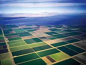
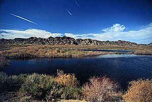
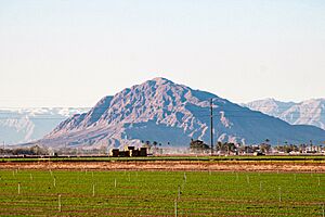
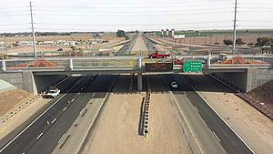
Images, from top down, left to right: The fields of Imperial Valley, Salton Sea, Imperial County Courthouse
|
|||
|
|||
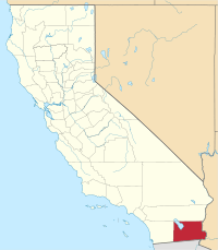
Location in the state of California
|
|||
| Country | United States | ||
| State | California
|
||
| Region | Imperial Valley | ||
| Incorporated | August 7, 1907 | ||
| Named for | Imperial Valley, which was named after the Imperial Land Company | ||
| County seat | El Centro | ||
| Largest community | El Centro (population) Salton City (area) |
||
| Government | |||
| • Type | Council–CEO | ||
| • Body | Board of Supervisors | ||
| Area | |||
| • Total | 4,482 sq mi (11,610 km2) | ||
| • Land | 4,177 sq mi (10,820 km2) | ||
| • Water | 305 sq mi (790 km2) | ||
| Highest elevation | 4,551 ft (1,387 m) | ||
| Lowest elevation | -232 ft (−70.7 m) | ||
| Population | |||
| • Total | 179,702 | ||
| • Density | 43/sq mi (17/km2) | ||
| GDP | |||
| • Total | $11.064 billion (2022) | ||
| Time zone | UTC−8 (Pacific Time Zone) | ||
| • Summer (DST) | UTC−7 (Pacific Daylight Time) | ||
| Area codes | 442/760 | ||
| FIPS code | 06-025 | ||
| GNIS feature ID | 277277 | ||
| Congressional district | 25th | ||
Imperial County (Spanish: Condado de Imperial) is a county in the southeastern part of California. It's located right on the border with Mexico. As of 2020, about 179,702 people live here. This makes it the least populated county in Southern California.
The main city and county seat is El Centro. Imperial County is the newest county in California. It was created in 1907 from the eastern half of San Diego County.
Imperial County is in the Imperial Valley, a desert region. It borders San Diego County to the west and Riverside County to the north. To the east is Arizona, and to the south is the Mexican state of Baja California.
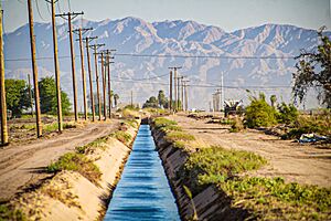
Even though it's a desert with hot temperatures and little rain (about 3 inches (76 mm) per year), farming is a huge part of its economy. This is possible because of irrigation from the Colorado River. Water comes through the All-American Canal.
Mexican culture has a strong influence here. About 80% of the people in Imperial County are of Hispanic background, mostly Mexican. Other groups include non-Hispanic white, African American, Native American, and Asian people.
Contents
History of Imperial County

Early Peoples and Explorers
Long ago, the Quechan people lived along the Colorado River. The Kamia-Kumeyaay lived to their west, and the Cahuilla lived to the north.
In 1540, Spanish explorer Melchor Díaz was one of the first Europeans to visit the Imperial Valley area. Another explorer, Juan Bautista de Anza, explored the area in 1776. The local tribes sometimes fought each other. For example, the Quechan and Kumeyaay teamed up against the Maricopa and Cahuilla. These conflicts made it hard for the Spanish to travel through the area.
After the Mexican–American War in 1848, the northern part of the valley became part of the U.S. The southern part stayed with Mexico.
The Yuma War
In 1850, a conflict called the Yuma War began. This happened after a group called the Glanton Gang caused trouble with the Quechan people. The Quechan and their allies fought against the U.S. Army. In 1851, the Quechan surrounded Fort Yuma, forcing the American soldiers to leave. The Americans returned in 1852 and eventually defeated the Quechan.
Forming the County
Small communities started to appear in the early 1800s. But most permanent settlements came after 1900.
In 1905, heavy rains caused the Colorado River to flood. The water filled canals built for farming in the Imperial Valley. Since parts of the valley are below sea level, the water didn't drain away. Instead, it formed what we now call the Salton Sea.
Imperial County was officially created in 1907. It was named after the Imperial Valley. The valley itself was named after the Imperial Land Company. This company wanted to develop farms in the southern part of the Colorado Desert. They also owned land in Mexico.
By 1910, the company had helped set up many farms on both sides of the border. The Mexican Revolution (a big conflict in Mexico) then made things difficult. Over time, many people from Mexico chose to stay and build new lives in the valley.
During the Great Depression and the Dust Bowl in the 1930s, many people looking for work moved to Imperial County. The All American Canal, which brings water from the Colorado River, was finished between 1948 and 1951. By 1950, the county's population had grown a lot.
Places to Visit
Fort Yuma
Fort Yuma is located by the Colorado River in Winterhaven, California. It was built in 1848 after the Mexican-American War. Its purpose was to protect the new town of Yuma, Arizona and control the local Yuma Indians.
Blue Angels Air Shows
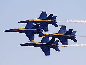
NAF El Centro is where the U.S. Navy Flight Demonstration Squadron, The Blue Angels practice in the winter. They often start their air show season here in March. It's a great place to see amazing aerial stunts!
Imperial Valley Expo & Fairgrounds
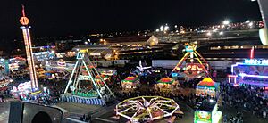
The city of Imperial hosts the California Mid-Winter Fair and Fiesta. This county fair takes place in late February or early March. You can also find the Imperial Valley Speedway here, a 3⁄8 mile (600 m) race track.
Algodones Sand Dunes
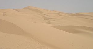
The Algodones Dunes are the largest sand dunes in California. They stretch for over 40 miles (64 km) and are about 5 miles (8 km) wide. This area is popular for ATV and off-roading fun. You might also recognize them from movies like Return of the Jedi!
Colorado River
The Colorado River flows for about 1,450 miles (2,330 km) through the southwestern United States and Mexico. It starts in the Rocky Mountains. People love to visit the river for water sports like fishing, boating, water skiing, and jet skiing.
Salvation Mountain
Salvation Mountain is a unique, colorful mountain near Calipatria, California. It's made from adobe, straw, and lots of paint. A man named Leonard Knight built it to share the message that "God Loves Everyone."
Anza-Borrego Desert State Park
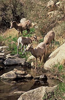
Anza-Borrego Desert State Park is California's largest state park, partly located in Imperial County. It has 500 miles (800 km) of dirt roads and many hiking trails. The park is named after explorer Juan Bautista de Anza and the Spanish word for bighorn sheep, borrego.
In springtime, especially after rain, the desert comes alive with blooming wildflowers and cacti. You might see animals like bobcats, coyotes, golden eagles, mule deer, and roadrunners. Many different reptiles also live here, such as chuckwallas, desert tortoises, and kingsnakes.
Fossil Canyon and Painted Gorge
Near Ocotillo, California, you can explore Fossil Canyon. It's a great spot to look for fossils. You won't find dinosaurs here, but you might find ancient oysters, seashells, and coral. These are from a time long ago when the area was covered by an ocean.
The Painted Gorge is on the eastern side of the Coyote Mountains. Its rocks have amazing shapes and colors like dark red, purple, and brown. These colors change as the sun shines on them.
Imperial National Wildlife Refuge
The Imperial National Wildlife Refuge protects wildlife along 30 miles (50 km) of the lower Colorado River. It's a green oasis in the desert, providing a home for migratory birds and desert animals.
Sonny Bono Salton Sea National Wildlife Refuge
The Sonny Bono Salton Sea National Wildlife Refuge is at the southern end of the Salton Sea. It's unique because it's 227 feet (69 m) below sea level! This refuge is important for birds traveling along the Pacific Flyway. It gets very hot here, with temperatures often over 100 °F (38 °C) from May to October.
Museum of History in Granite
In the town of Felicity, you can visit the Museum of History in Granite. It features huge granite monuments, each 100 feet (30 m) long. These monuments tell stories like the History of Humanity and the History of the United States of America.
Geography of Imperial County
Imperial County covers about 4,482 square miles (11,610 km2). Most of this is land, but 305 square miles (790 km2) (6.8%) is water. A large part of Imperial County is actually below sea level. It's roughly twice the size of the state of Delaware!
The county is bordered by Riverside County to the north and Yuma County, Arizona to the east. To the south is Mexico, and to the west is San Diego County. The Colorado River forms the eastern border.
Two very interesting natural features are found here:
- The Salton Sea, which is 235 feet (72 m) below sea level.
- The Algodones Dunes, one of the biggest sand dune areas in America.
Imperial County is part of the Colorado Desert, which is an extension of the larger Sonoran Desert. The Chocolate Mountains are located east of the Salton Sea. They stretch for about 60 miles (97 km).
The ground here is very active due to tectonic plates moving. This means the area can have earthquakes. The land is also stretching, causing it to sink over time. There are also some interesting hot springs and volcanic areas. The most recent volcanic eruption was about 1,800 years ago.
Protected Natural Areas
- Cibola National Wildlife Refuge (part)
- Imperial National Wildlife Refuge (part)
- Sonny Bono Salton Sea National Wildlife Refuge
People of Imperial County
As of the 2020 census, the population of Imperial County was 179,702. In 2010, about 80.4% of the people identified as Hispanic or Latino. The rest of the population included White, African American, Native American, and Asian people.
Economy of Imperial County
Farming is the biggest industry in Imperial County. It makes up almost half of all jobs. Even though it's a desert, a huge system of canals brings water from the Colorado River through the All-American Canal. This allows farmers to grow crops all year round.
The Imperial Irrigation District manages this water system. It includes over 1,400 miles (2,300 km) of canals and 1,100 miles (1,800 km) of pipelines. Because of this water, Imperial Valley is a major source of winter fruits, vegetables, cotton, and grain for the U.S. and other countries. Alfalfa is another important crop. Imperial County grows almost two-thirds of all vegetables eaten by Americans in the winter!
El Centro is the main business hub. Many jobs there are in services and retail.
Imperial County is also becoming a popular place for filming movies. Its desert scenery, especially the sand dunes, looks like other parts of the world. Movies like Return of the Jedi, Stargate, and Jarhead have been filmed here.
Green Energy in Imperial County
Imperial Valley is a growing center for renewable energy projects, especially solar and geothermal power. California wants to use more clean energy, and this valley has lots of sunshine and open desert land.
Many projects are being built on land managed by the U.S. government. For example, Stirling Energy is building one of the world's largest solar thermal plants here. It will cover 10 square miles (26 km2) and power up to 600,000 homes. CalEnergy also runs a geothermal plant that can power 300,000 homes.
Getting Around Imperial County
Main Roads
 Interstate 8
 State Route 7
 State Route 78
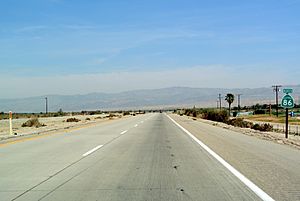
 State Route 86
 State Route 98
 State Route 111
 State Route 115
 State Route 186
Imperial County is connected by several major highways. Interstate 8 goes east and west, connecting to Arizona and San Diego. Other state routes connect to places like the Coachella Valley and Los Angeles metropolitan area.
Public Transport
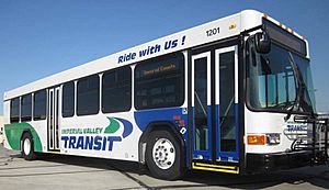
You can travel around Imperial County using Greyhound Lines and Imperial Valley Transit buses. There are also buses that connect Imperial County to Yuma, Arizona. Amtrak trains pass through the county, but they don't stop here. The closest train stop is in Yuma.
Airports
Imperial County has several airports:
- Imperial County Airport: The main airport, mostly for small planes. It has some commercial flights.
- Holtville Airport: For general aviation, near Holtville.
- Brawley Municipal Airport: For general aviation, in Brawley.
- Calexico Airport: For general aviation, in Calexico.
- Cliff Hatfield Memorial Airport: For general aviation, in Calipatria.
- Salton Sea Airport: For general aviation, in Salton City.
- Douthitt Strip Airport: A private airport in El Centro.
- Naval Air Facility El Centro: A U.S. Navy airfield in El Centro.
Communities in Imperial County
Cities
- Brawley
- Calexico
- Calipatria
- El Centro (county seat)
- Holtville
- Imperial
- Westmorland
Census-Designated Places (CDPs)
These are areas that are like towns but are not officially incorporated as cities.
Other Communities
- Alamorio
- Andrade
- Bard
- Bonds Corner
- Boulder Park
- Coyote Wells
- Dixieland
- Felicity
- Glamis
- Kane Spring
- Meloland
- Mount Signal
- Obregon
- Picacho
- Plaster City
- Rockwood
- Slab City
Indian Reservations
- Fort Yuma Indian Reservation (partially in Yuma County, Arizona)
- Torres-Martinez Indian Reservation (partially in Riverside County)
Education in Imperial County
Imperial County has several school districts:
Unified School Districts
These districts include both elementary and high schools.
- Calexico Unified School District
- Calipatria Unified School District
- Coachella Valley Unified School District
- Holtville Unified School District
- Imperial Unified School District
- San Pasqual Valley Unified School District
High School Districts
These districts focus on high schools.
- Brawley Union High School District
- Central Union High School District
Elementary School Districts
These districts focus on elementary schools.
- Brawley Elementary School District
- El Centro Elementary School District
- Heber Elementary School District
- Magnolia Union Elementary School District
- McCabe Union Elementary School District
- Meadows Union Elementary School District
- Mulberry Elementary School District
- Seeley Union Elementary School District
- Westmorland Union Elementary School District
See also
 In Spanish: Condado de Imperial para niños
 | Shirley Ann Jackson |
 | Garett Morgan |
 | J. Ernest Wilkins Jr. |
 | Elijah McCoy |


