
Seeley, California facts for kids
Quick facts for kids
Seeley
|
|
|---|---|

Seeley's welcome sign
|
|

Location in Imperial County and the state of California
|
|

Seeley, California
Location in the United States
|
|
| Country | United States |
| State | California |
| County | Imperial |
| Area | |
| • Total | 1.242 sq mi (3.218 km2) |
| • Land | 1.219 sq mi (3.157 km2) |
| • Water | 0.023 sq mi (0.061 km2) 1.9% |
| Elevation | -36 ft (-11 m) |
| Population
(2020)
|
|
| • Total | 1,729 |
| • Density | 1,353.3/sq mi (507.5/km2) |
| Time zone | UTC-8 (Pacific (PST)) |
| • Summer (DST) | UTC-7 (PDT) |
| ZIP code |
92273
|
| Area codes | 442/760 |
| FIPS code | 06-70798 |
| GNIS feature IDs | 1661418, 2409303 |
Seeley is a small community in Imperial County, California. It's called a "census-designated place" (CDP), which means it's a special area defined by the U.S. Census Bureau for collecting population data. Seeley is located about 7.5 miles (12 km) west of El Centro. In 2020, about 1,729 people lived there.
Contents
A Look at Seeley's History

Seeley is one of the oldest towns in Imperial County. It started in the early 1900s. The first post office opened in 1909. The town was named after Henry Seeley, who helped develop the area.
Seeley began as a stop for stagecoaches. These were like old-time buses pulled by horses. It was built near a lake called Blue Lake, which has since dried up.
In 1946, the NAF El Centro was built next to Seeley. This is where the famous Blue Angels flight team practices in the winter. In 1964, Interstate 8, a major highway, was built just south of Seeley. A part of this highway near Seeley is the lowest point on the entire Interstate Highway System, at 52 feet (16 meters) below sea level!
Understanding Seeley's Geography
Seeley is located in a unique spot. The New River runs along its western side. The town also sits on top of the Imperial Fault, which is a crack in the Earth's crust. This means the area can experience earthquakes.
Like much of the Imperial Valley, Seeley is entirely below sea level. This means it's lower than the ocean! The area used to be a basin for the "Blue Lake."
The total area of Seeley is about 1.2 square miles (3.2 square kilometers). Most of this is land, with a small amount of water.
Seeley's Climate
Seeley has a desert climate. This means it gets a lot of sunshine all year round. It's often very hot and dry. On climate maps, this type of weather is called "Bwh."
Who Lives in Seeley?
The U.S. Census Bureau collects information about people living in places like Seeley. This helps us understand the community.
Seeley's Population in 2010
In 2010, Seeley had 1,823 people. The population density was about 1,399.9 people per square mile (540.5 people per square kilometer).
Here's a look at the different groups of people living in Seeley in 2010:
- About 42.9% were White.
- About 1.1% were African American.
- About 0.4% were Native American.
- About 1.2% were Asian.
- About 0.1% were Pacific Islander.
- About 45.6% were from other races.
- About 8.7% were from two or more races.
- A large number, about 85.6%, were Hispanic or Latino.
All 1,823 people lived in homes. There were 493 households. A household is a group of people living together in one home.
- About 56% of households had children under 18.
- About 54.4% were married couples.
- The average household had about 3.53 people.
The population was spread out by age:
- About 33.2% were under 18 years old.
- About 11.2% were 18 to 24 years old.
- About 24.2% were 25 to 44 years old.
- About 21.4% were 45 to 64 years old.
- About 9.9% were 65 years or older.
The average age in Seeley was 28.5 years.
There were 556 housing units. About half of these homes were owned by the people living in them, and the other half were rented.
Seeley's Population in 2000
In 2000, Seeley had 1,624 people. The population density was about 1,346.3 people per square mile (520 people per square kilometer).
The racial makeup in 2000 was:
- About 54.7% White.
- About 0.7% Black or African American.
- About 1.0% Native American.
- About 2.3% Asian.
- About 0.1% Pacific Islander.
- About 35.9% from other races.
- About 5.2% from two or more races.
- About 81.5% of the population was Hispanic or Latino.
There were 438 households. About 54.8% of these had children under 18. The average household size was 3.7 people. The average family size was 4.0 people.
The population was also spread out by age in 2000:
- About 38.2% were under 18.
- About 8.7% were 18 to 24.
- About 28.8% were 25 to 44.
- About 17.1% were 45 to 64.
- About 7.1% were 65 or older.
The average age was 27 years.
In 2000, the average income for a household in Seeley was $31,058. About 26.3% of the population lived below the poverty line. This included 36% of those under 18.
Community Services and Infrastructure
The Seeley County Water District is a special group that provides water and sewer services to the community.
Historical Landmark Nearby
Near Seeley, you can find California Historical Landmark number 1008, called Yuha Well. This well was an important stop for early explorers.
The marker at the site tells us:
NO. 1008 YUHA WELL - Known as Santa Rosa de Las Lajas (Flat Rocks), this site was used on March 8, 1774 by the Anza Exploring Expedition, opening the land route from Sonora, Mexico, to Alta California. On December 11 to 15, 1775, the three divisions of Anza's colonizing expedition used this first good watering spot beyond the Colorado River on the way from Sonora to San Francisco.
This means that in 1774, an explorer named Juan Bautista de Anza used this well. He was opening a new land route from Mexico to California. Later, in 1775, his larger group of settlers also used this well as their first good water stop after crossing the Colorado River.
Images for kids
-
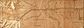
Seely on a map from 1920
See also
 In Spanish: Seeley (California) para niños
