Boggeragh Mountains facts for kids
Quick facts for kids Boggeragh Mountains |
|
|---|---|
| Irish: An Bhograch | |
| Highest point | |
| Peak | Musheramore |
| Elevation | 644 m (2,113 ft) |
| Geography | |
| Country | Republic of Ireland |
| Provinces of Ireland | Munster |

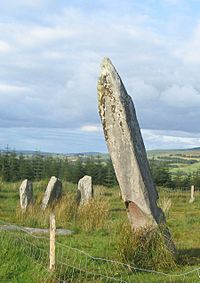
The Boggeragh Mountains (Irish: An Bhograch) are a range of hills located in County Cork, Ireland. They sit between two important rivers: the Munster Blackwater to the north and the River Lee to the south. The highest point in these mountains is Musheramore (Irish: Muisire Mór), which reaches 644 metres (2,113 feet) above sea level.
Contents
Exploring the Boggeragh Mountains in Ireland
The Boggeragh Mountains are a natural wonder in County Cork. They offer beautiful views and a unique environment. This area is a great place to learn about geology and renewable energy.
What Makes the Boggeragh Mountains Special?
The landscape of the Boggeragh Mountains is very interesting. You will find large areas of blanket bog, which is a type of peatland. There are also green grasslands, clear streams, and parts covered by forestry. This mix of habitats makes the mountains home to various plants and animals.
How Were the Boggeragh Mountains Formed?
These mountains were created over millions of years. They are made from a type of rock called Old Red Sandstone. This sandstone was laid down during the Devonian Period, a very long time ago. Later, during the last glacial period, huge sheets of ice moved across the land. These glaciers carved and shaped the mountains into the form we see today.
Wind Power in the Mountains
In September 2009, work began on a wind farm in the Boggeragh Mountains. By February 2010, 19 large Vestas V90-3MW wind turbines were built and working. These turbines use the wind to create clean electricity. This helps to power homes and businesses in Ireland using renewable energy.
 | Bessie Coleman |
 | Spann Watson |
 | Jill E. Brown |
 | Sherman W. White |


