Bouaké facts for kids
Quick facts for kids
Bouaké
Bwake
|
|
|---|---|
|
City, sub-prefecture, and commune
|
|

Bouaké
|
|
| Country | |
| District | Vallée du Bandama |
| Region | Gbêkê |
| Department | Bouaké |
| Founded | 1899 |
| Area | |
| • Total | 1,770 km2 (680 sq mi) |
| • City | 71.788 km2 (27.718 sq mi) |
| Elevation | 312 m (1,024 ft) |
| Population
(2021 census)
|
|
| • Total | 832,371 |
| • Density | 470.3/km2 (1,218/sq mi) |
| • City | 740,000 |
| • City density | 10,310/km2 (26,700/sq mi) |
| Time zone | UTC+0 (GMT) |
Bouaké (or Bwake) is the second-largest city in Ivory Coast, a country in West Africa. About 740,000 people lived here in 2021. It is an important center for three levels of government: the Vallée du Bandama District, the Gbêkê Region, and the Bouaké Department.
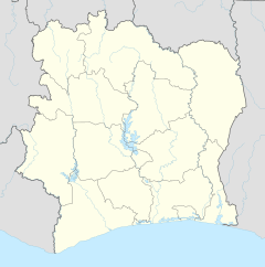
The city is located in the middle of Ivory Coast. It's about 50 kilometers (31 miles) northeast of Lake Kossou, which is the country's biggest lake. Bouaké is also about 350 kilometers (217 miles) north of Abidjan, a major coastal city. It's also around 100 kilometers (62 miles) northeast of Yamoussoukro, the capital city of Ivory Coast.
Contents
What Does the Name Bouaké Mean?
The name Bouaké might have two different origins:
- It could come from the name of a chief called Kwa Gbéké. He helped start the first settlement that grew into the city of Bouaké.
- Another idea is that the name comes from two words in the Baoulé language: "Boua" meaning sheep and "Ké" meaning dry. This suggests it was a place where people, perhaps the Jula, dried sheep skins.
How Many People Live in Bouaké?
The number of people living in Bouaké has grown a lot over the years. Here's how the population has changed:
| Year | Population |
| 1921 | 3,600 |
| 1945 | 22,000 |
| 1960 | 60,000 |
| 1970 | 120,000 |
| 1975 | 175,000 |
| 1988 | 329,850 |
| 1998 | 461,618 |
| 2014 | 542,000 |
A Look at Bouaké's Past
In the 1800s, groups of people related to the Akan, like the Assabou and Baoulé, settled near where Bouaké is today. The first village was called Gbèkèkro, named after the Baoulé leader, Gossan Kwa Gbeke. "Kro" means town or settlement.
Bouaké officially started as a French military base in 1899. It became an important administrative center in 1914.
Later, in 2002, the city faced some challenges. The Bouaké University, which opened in 1996, had to close for a few years. With help from Unesco, the university was able to reopen in April 2005.
Bouaké's Weather
Bouaké has a tropical wet and dry climate. This means it has a long wet season and a shorter dry season. The wet season lasts from March to October. The dry season, influenced by the harmattan wind, covers the other four months.
Even though it has a long wet season, Bouaké doesn't get as much rain as coastal cities like Abidjan. On average, Bouaké receives about 1,100 millimeters (43 inches) of rain each year.
| Climate data for Bouaké | |||||||||||||
|---|---|---|---|---|---|---|---|---|---|---|---|---|---|
| Month | Jan | Feb | Mar | Apr | May | Jun | Jul | Aug | Sep | Oct | Nov | Dec | Year |
| Mean daily maximum °C (°F) | 33.0 (91.4) |
33.5 (92.3) |
33.8 (92.8) |
32.7 (90.9) |
31.0 (87.8) |
29.9 (85.8) |
27.8 (82.0) |
27.7 (81.9) |
28.5 (83.3) |
30.1 (86.2) |
31.3 (88.3) |
31.7 (89.1) |
30.9 (87.6) |
| Daily mean °C (°F) | 26.6 (79.9) |
27.8 (82.0) |
27.8 (82.0) |
27.0 (80.6) |
26.1 (79.0) |
25.0 (77.0) |
24.1 (75.4) |
23.8 (74.8) |
24.3 (75.7) |
25.0 (77.0) |
25.7 (78.3) |
25.7 (78.3) |
25.7 (78.3) |
| Mean daily minimum °C (°F) | 20.6 (69.1) |
21.8 (71.2) |
22.3 (72.1) |
22.0 (71.6) |
21.7 (71.1) |
21.2 (70.2) |
20.8 (69.4) |
20.9 (69.6) |
21.1 (70.0) |
21.3 (70.3) |
21.3 (70.3) |
20.3 (68.5) |
21.3 (70.3) |
| Average precipitation mm (inches) | 12.5 (0.49) |
40.0 (1.57) |
83.8 (3.30) |
126.4 (4.98) |
123.7 (4.87) |
147.2 (5.80) |
117.5 (4.63) |
128.0 (5.04) |
168.1 (6.62) |
107.9 (4.25) |
30.2 (1.19) |
14.6 (0.57) |
1,099.9 (43.30) |
| Mean monthly sunshine hours | 226.5 | 206.6 | 201.4 | 194.2 | 202.3 | 129.7 | 97.7 | 90.6 | 122.8 | 174.0 | 184.7 | 188.0 | 2,018.5 |
| Source 1: NOAA | |||||||||||||
| Source 2: Climate Charts (latitude: 07°44'N; longitude: 005°04'W; elevation: 376m) | |||||||||||||
Bouaké's Economy
Bouaké produces things like tobacco products, building materials, and textiles. It also processes crops such as cotton, sisal, and rice. Gold, mercury, and manganese can be found in the areas nearby.
The city's economy faced difficulties for almost ten years starting in 2002. Many businesses either closed or moved to Abidjan, which is Ivory Coast's main economic city on the coast. This caused a big drop in jobs. For example, the city's largest textile factory, Gonfreville Establishment, lost 80% of its workers.
However, the economy slowly started to get better in the early 2010s. After the government regained control of Bouaké, the city began to rebuild. Roads were repaired, making it easier to transport goods. Cash crops like cotton and cashews were transported in larger amounts to be processed in Bouaké.
In 2012, a company from Singapore called Olam opened a cashew processing factory in Bouaké, creating nearly 2,400 jobs. The farming business is now returning to how it was before the conflict. Banks have opened new branches, and supermarkets are back to normal. The government is helping this growth with new rules and projects, like building a highway to connect Bouaké to the capital, Yamoussoukro.
Getting Around Bouaké
Airports and Railways
Bouaké has its own airport, called Bouaké Airport, located northwest of the city. It has a long runway, about 3,300 meters (10,827 feet) long.
The city is also on a railway line that connects Abidjan to Ouagadougou in Burkina Faso. The Sitarail company operates the Railway Station Bouaké.
Roads
Several main roads connect Bouaké to other cities. The A3 and A8 roads are important routes.
- The A3 goes north to Katiola and Korhogo. It also connects to destinations in Burkina Faso and Mali.
- The A10 starts in Bouaké and goes east towards Ghana, connecting to Bondoukou and Abengourou.
- The A8 connects to Abengourou to the north and Abidjan to the south.
- The A3 southbound leads to the political capital Yamoussoukro and the economic capital Abidjan.
- The A8 westbound goes to Beoumi and Lake Kossou, continuing to Man and Danané, with further connections to Liberia and Guinea.
Learning in Bouaké
Bouaké is home to the Université Alassane Ouattara, which was founded in 1992. The city also has many schools for younger students.
|
Primary Schools
Secondary Schools
Semi-Public
Private
Public Colleges
Private Colleges
|
Places to Worship
In Bouaké, you can find many different places of worship. The most common are Muslim mosques. There are also Christian churches and temples, including:
- Roman Catholic Archdiocese of Bouaké (Catholic Church)
- United Methodist Church Ivory Coast (World Methodist Council)
- Union of Missionary Baptist Churches in Ivory Coast (Baptist World Alliance)
- Assemblies of God
City Leaders
Bouaké is managed by a mayor. Here is a list of some of the mayors who have led the city since 1960:
| Date elected | Name | Party |
|---|---|---|
| 1960 | Djibo Sounkalo | PDCI-RDA |
| 1980 | Konan Blédou | PDCI-RDA |
| 1985 | Konan Blédou | PDCI-RDA |
| 1990 | Konan Antoine | PDCI-RDA |
| 1995 | Konan Konan Denis | PDCI-RDA |
| 2000 | Fanny Ibrahima | RDR |
City Zones
The city of Bouaké is divided into different areas, called sub-prefectures. The main city area is one sub-prefecture. The areas just outside the city are part of another sub-prefecture called "Bouaké-SP". Bouaké is also known as a commune.
The city itself is divided into several zones:
- North East: Dougouba, Liberté, Kodiakoffikro, Attienkro, Dar-es-salam 2 and 3, Camp Militaire, Belleville 1 and 2, Sokoura, IDESSA, Kanakro
- North West: Koko, Lycée Municipal, Zone industrielle, Tièrèkro, Gonfreville, Niankoukro, Aéroport, Konankankro, Allokokro, Mamianou, Kamounoukro, Dar-es-salam 1, Tolla Kouadiokro, Beaufort
- South East: Nimbo, Air France 1 2 and 3, N'Gouatanoukro, Kennedy
- South West: N'Gattakro, Ahougnanssou, Broukro 1 and 2, Houphouët-ville, N'Dakro
- Center: Commerce
Sports in Bouaké
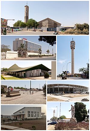
Bouaké has a large stadium called Stade Bouaké, also known as the Stadium of Peace. It was built in 1984 for the 1984 Africa Cup of Nations. The stadium is being renovated to host games for the 2023 Africa Cup of Nations. Its capacity will increase from 35,000 to 40,000 people.
The local football team is called Bouaké FC. They play their games at the Stade Bouaké.
Some famous football players from Bouaké have played for the Ivorian national football team. These include the brothers Kolo Touré and Yaya Toure, as well as Abdul Razak (footballer) and Lassina Diabaté.
Sister Cities
Bouaké has special connections with other cities around the world. These are called "twin towns" or "sister cities." They often share cultural or economic ties.
 Mopti, Mali
 Brescia, Italy
 Beersheba, Israel
 Villeneuve-sur-Lot, France
 Reutlingen, Germany
 Zimnicea, Romania
See also
 In Spanish: Bouaké para niños
 | Bessie Coleman |
 | Spann Watson |
 | Jill E. Brown |
 | Sherman W. White |


