
Boundary Cone facts for kids
Quick facts for kids Boundary Cone |
|
|---|---|

View of Boundary Cone from Mohave Valley, on the Colorado River
|
|
| Highest point | |
| Elevation | 3,432 ft (1,046 m) NAVD 88 |
| Prominence | 750 ft (229 m) |
| Geography | |

Boundary Cone
Location in Arizona
|
|
| Location | Mohave County, Arizona, U.S |
| Parent range | Black Mountains |
| Topo map | USGS Boundary Cone |
| Geology | |
| Mountain type | volcanic neck |
| Climbing | |
| Easiest route | from Oatman, Arizona |
Boundary Cone is a cool natural landmark in Mohave County, Arizona. It's a tall, cone-shaped hill that stands out in the landscape. You can find it in the western part of the Black Mountains.
This peak is located east of the Mohave Valley. It's northeast of Needles, California and southeast of Bullhead City. Boundary Cone is about 4 miles (6.4 km) southwest of the small town of Oatman. It's also about 12 miles (19 km) east of the Colorado River.
Contents
What is Boundary Cone?
Boundary Cone is a special type of landform called a volcanic neck. Imagine a volcano that was active a very, very long time ago. When it erupted, lava flowed out. But sometimes, lava also hardened inside the volcano's vent, which is like its chimney.
Over millions of years, the softer rock around this hardened lava wore away due to wind and water. What was left standing was the super hard core of the volcano's vent. That's what a volcanic neck is! It's like the skeleton of an ancient volcano.
A Special Place for Native Americans
For many Native American tribes, Boundary Cone is more than just a hill. It's a very important place with deep religious and cultural meaning. They have stories and traditions connected to this peak and the land around it.
Because of its importance, the Bureau of Land Management (which manages public lands) and the Arizona State Historic Preservation Office (which protects historic places) agreed in 2006 that Boundary Cone should be recognized. They said it's special enough to be on the National Register of Historic Places. This list includes places that are important to the history and culture of the United States.
An Important Landmark
Boundary Cone has always been easy to spot. This made it a very helpful landmark for people traveling through this area a long time ago. Before maps and GPS, travelers would use natural features like Boundary Cone to know where they were going. It helped them find their way across the vast landscape.
Images for kids
-
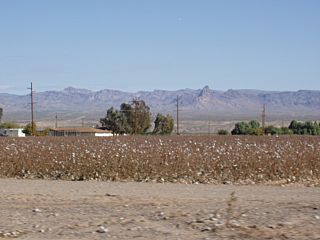
Fort Mojave Indian Reservation, with Boundary Cone in the distance
-
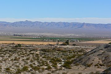
Mohave Valley, with Boundary Cone on the right


