Boykin, Georgia facts for kids
Quick facts for kids
Boykin, Georgia
|
|
|---|---|

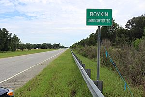
Boykin limit on US27 / GA1
|
|
| Country | |
| State | |
| County | Miller |
| Area | |
| • Total | 2.425 sq mi (6.28 km2) |
| • Land | 2.421 sq mi (6.27 km2) |
| • Water | 0.004 sq mi (0.01 km2) |
| Elevation | 131 ft (40 m) |
| Population
(2020)
|
|
| • Total | 151 |
| • Density | 62.37/sq mi (24.08/km2) |
| Time zone | UTC-5 (Eastern (EST)) |
| • Summer (DST) | UTC-4 (EDT) |
| ZIP code |
39837 (Colquitt)
|
| Area code(s) | 229 |
| FIPS code | 13-09852 |
| GNIS feature ID | 2587025 |
Boykin is a small place in Miller County, Georgia, in the United States. It is known as an unincorporated community, which means it doesn't have its own local government like a city or town. It is also a census-designated place (CDP), which is an area the government defines for counting people. In 2020, about 151 people lived in Boykin.
History of Boykin
This community was probably named after Guilford A. Boyken, Sr., who was an early settler in the area. A post office was opened in Boykin in 1897. It helped people send and receive mail until it closed in 1932.
The Georgia General Assembly, which is like Georgia's state parliament, officially made Boykin a "Town of Boykin" in 1903. This gave it a town charter, allowing it to have its own local government. However, the town's charter was ended in 1995. This means Boykin no longer has its own town government and is now an unincorporated community.
Where is Boykin?
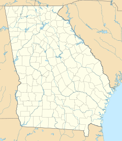
Boykin is located in the southern part of Miller County, Georgia. It is right along U.S. Route 27, a major road.
- It is about 5 miles (8 km) southeast of Colquitt, which is the main town and county seat of Miller County.
- It is also about 16 miles (26 km) northwest of Bainbridge.
The area of Boykin includes a small amount of water. To the south, there is a stream called Big Drain. This stream flows west into Spring Creek, which then goes south to Lake Seminole. Lake Seminole is where the Flint River and Chattahoochee River meet to form the Apalachicola River.
According to the U.S. Census Bureau, the Boykin CDP covers a total area of about 2.4 square miles (6.2 square kilometers). Only a very small part of this area, about 0.004 square miles (0.010 square kilometers), is water.
People in Boykin
| Historical population | |||
|---|---|---|---|
| Census | Pop. | %± | |
| 2010 | 143 | — | |
| 2020 | 151 | 5.6% | |
| U.S. Decennial Census 1850-1870 1870-1880 1890-1910 1920-1930 1940 1950 1960 1970 1980 1990 2000 2010 2020 |
|||
Boykin was first counted as a census designated place in the 2010 U.S. Census. A census is a count of all the people living in a certain area.
Here's a look at the different groups of people living in Boykin, based on the U.S. Census:
| Race / Ethnicity (NH = Non-Hispanic) | Pop 2010 | Pop 2020 | % 2010 | % 2020 |
|---|---|---|---|---|
| White alone (NH) | 107 | 93 | 74.83% | 61.59% |
| Black or African American alone (NH) | 30 | 31 | 20.98% | 20.53% |
| Native American or Alaska Native alone (NH) | 0 | 2 | 0.00% | 1.32% |
| Asian alone (NH) | 0 | 0 | 0.00% | 0.00% |
| Pacific Islander alone (NH) | 0 | 0 | 0.00% | 0.00% |
| Some Other Race alone (NH) | 0 | 1 | 0.00% | 0.66% |
| Mixed Race or Multi-Racial (NH) | 3 | 4 | 2.10% | 2.65% |
| Hispanic or Latino (any race) | 3 | 20 | 2.10% | 13.25% |
| Total | 143 | 151 | 100.00% | 100.00% |
See also
 In Spanish: Boykin (Georgia) para niños


