
Boyne Island, Queensland facts for kids
Quick facts for kids Boyne IslandQueensland |
|||||||||||||||
|---|---|---|---|---|---|---|---|---|---|---|---|---|---|---|---|

Boyne Island from the air - May 2023
|
|||||||||||||||

Boyne Island
Location in Queensland
|
|||||||||||||||
| Population | 4,835 (2021 census) | ||||||||||||||
| • Density | 97.87/km2 (253.5/sq mi) | ||||||||||||||
| Postcode(s) | 4680 | ||||||||||||||
| Area | 49.4 km2 (19.1 sq mi) | ||||||||||||||
| Time zone | AEST (UTC+10:00) | ||||||||||||||
| Location |
|
||||||||||||||
| LGA(s) | Gladstone Region | ||||||||||||||
| State electorate(s) | Gladstone | ||||||||||||||
| Federal Division(s) | Flynn | ||||||||||||||
|
|||||||||||||||
Boyne Island is a lovely coastal town in Queensland, Australia. It's part of the Gladstone Region. In 2021, about 4,835 people lived here. Boyne Island is located about 25 kilometers (15 miles) south of the city of Gladstone.
Contents
Exploring Boyne Island's Geography
Boyne Island sits on the west side of the Boyne River. It's a special kind of island called a "holm," which means it's an island found in a river or an estuary (where a river meets the sea).

The Boyne River forms the eastern edge of the island for about 4 kilometers. To the south and west, the South Trees Inlet borders the island for about 9 kilometers and 8 kilometers respectively.
Just across the Boyne River to the east is Tannum Sands. These two towns are often called "twin towns" because they are so close.
A Look Back at Boyne Island's History
The town of Boyne Island gets its name from the Boyne River. John Oxley, an explorer, named the river in 1823.
In the past, Boyne Island was used for different things. First, people raised sheep here. Later, they grew small crops and plants, fished, and harvested timber.
Churches and Schools in Boyne Island
_and_St_Luke%27s_Anglican_Church_(right),_Boyne_Island,_1992.jpg)
St Luke's Anglican Church was built in 1924 on Sayre Crescent. It was made of timber. Even though the old church building is still there, a new brick church called St Mark's was built next to it in 1995.
Boyne Island State School opened its doors to students on January 27, 1953.
What is Boyne Island Like Today?
Boyne Island is mostly a place where people live. Many residents work at the nearby Boyne Island aluminium smelter or in other industries in Gladstone.
Boyne Island's Economy
Australia's largest aluminium smelter, Boyne Smelters Ltd., is located north of the town. It's a very important part of the local economy.
Education for Kids in Boyne Island

Boyne Island State School is a government primary school for students from Prep to Year 6. It's located at 151 Malpas Street. In 2018, the school had 384 students. It also has a special education program.
The Boyne Island Environmental Education Centre is a great place for learning outdoors. It's at 61 Malpas Street. Students can enjoy hands-on activities here. They learn about the local coast, marine life, and coral reefs. They also learn how people use these natural areas.
There isn't a high school in Boyne Island. Most older students go to Tannum Sands State High School, which is in the nearby town of Tannum Sands.
Local Facilities and Parks
The Gladstone Regional Council runs a public library on Boyne Island. You can find it at the corner of Wyndham & Hayes Avenue.
St Mark's Anglican Church is located on the corner of Malpas Street and Sayre Crescent.
Boyne Island has many parks where you can play and relax. Some of these include:
- Bauhinia Street Park
- Boyne Island Conservation Park
- Bray Park
- Colyer Park
- Dennis Park Sports Complex
- Hayes Park
- Jacaranda Drive Park
- Kirrang Park
- Lions Park
- Malpas Park
- Wyndham Park Heritage Site
Sports and Activities in Boyne Island
Boyne Island is a great place for sports! Three different types of football are played here.
- The Boyne Tannum Football Club, also known as the Sharks, plays in the local soccer competition.
- The Boyne Island-Tannum Sands AFC, called the BITS Saints, is a very successful Australian Rules Football club. They play at Boyne Island Oval.
- The Tannum Sands Seagulls play in the local Rugby League competition at Dennis Park.

If you like golf, there's a 13-hole Boyne Island Tannum Sands Golf Course right next to the Boyne River.
Exciting Events in Boyne Island
Boyne Island is famous for the Boyne Tannum HookUp. This is a huge fishing event that happens every year in May, during the Labour Day long weekend. It takes place at Bray Park, near the skate park. More than 3,000 people take part in this popular event!
Famous People from Boyne Island
- Natalya Diehm is a talented Freestyle BMX competitor who comes from Boyne Island.
Images for kids
-
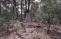
William Wyndham's gravesite, 2004
.jpg)
