Brandreth facts for kids
Quick facts for kids Brandreth |
|
|---|---|

Brandreth Summit
|
|
| Highest point | |
| Elevation | 715 m (2,346 ft) |
| Prominence | c. 60 m |
| Parent peak | Great Gable |
| Listing | Hewitt, Nuttall, Wainwright |
| Geography | |
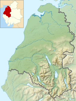
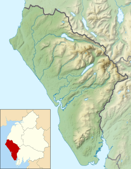
| Location | Cumbria, England |
| Parent range | Lake District, Western Fells |
| OS grid | NY215119 |
| Topo map | OS Landranger 89, 90, Explorer OL4 |
Brandreth is a mountain, also called a fell, in the beautiful Lake District in England. It stands between two other famous fells, Great Gable and Haystacks. You can find Brandreth in the part of the Lake District known as the Western Fells.
Contents
Exploring Brandreth's Shape and Location
The Western Fells are a group of mountains in the Lake District. They form a big horseshoe shape around a long valley called Ennerdale. Brandreth is close to Great Gable, which is like the main mountain in this area.
Brandreth has a unique triangular shape. It connects to other fells through three different ridges, which are like high pathways between mountains.
- One ridge goes north to Green Gable.
- Another ridge goes north-west towards Haystacks.
- A third ridge goes north-east to Grey Knotts.
Brandreth is special because water from its slopes flows into three different lakes: Ennerdale Water, Derwentwater, and Buttermere. This shows how important its location is for the water system of the Lake District!
Valleys Around Brandreth
On its south-west side, Brandreth drops steeply into the Ennerdale valley. To the east, you'll find a valley called Gillercomb. This valley is a "hanging valley," which means it's a valley that sits high up on the side of a mountain, often formed by glaciers. Gillercomb empties into the wider valley of Borrowdale. The northern slopes of Brandreth gently go down towards a valley called Warnscale.
What Brandreth is Made Of: Geology
Brandreth's summit (the very top) is mostly made of old lava from volcanoes! These rocks are called Birker Fell Formation. There are also layers of sandstone and other volcanic rocks.
At the bottom of the northern slope, there used to be a large slate quarry called Dubs Quarry. A quarry is a place where rocks are dug out of the ground. This quarry is now closed.
Reaching the Top: The Summit
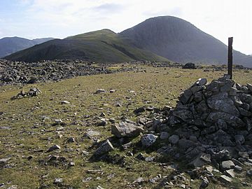
The very top of Brandreth is a bit rocky and open. You'll find a cairn there, which is a pile of stones that marks the highest point. This cairn is built around an old boundary post where fences from the three ridges meet.
From the summit, you can see amazing views of many other high fells in the Lake District. You can get especially good views of Pillar and the North Western Fells.
How to Climb Brandreth
There are several ways to climb Brandreth, depending on where you start:
- From Honister Pass: This is a popular starting point because it's already quite high up. There's a clear path that goes directly to the summit, passing over Grey Knotts.
- From Buttermere: You can start from Gatesgarth, which is at the end of Buttermere lake. From there, a path goes up the Warnscale Beck valley.
- From Borrowdale: If you're coming from Borrowdale, you can follow a path up Sour Milk Gill into Gillercomb, then climb up to Gillercomb Head.
- From Ennerdale: You can also take a longer walk up the Ennerdale valley before starting your climb up Brandreth.
Many hikers don't just climb Brandreth by itself. They often include it as part of a longer walk, perhaps visiting its neighbours like Great Gable as well.
 | Frances Mary Albrier |
 | Whitney Young |
 | Muhammad Ali |


