Grey Knotts facts for kids
Quick facts for kids Grey Knotts |
|
|---|---|

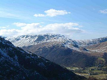
Grey Knotts seen from above the Stonethwaite valley
|
|
| Highest point | |
| Elevation | 697 m (2,287 ft) |
| Prominence | c. 15 m |
| Parent peak | Brandreth |
| Listing | Wainwright, Nuttall |
| Geography | |
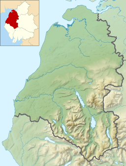
| Location | Cumbria, England |
| Parent range | Lake District, Western Fells |
| OS grid | NY217125 |
| Topo map | OS Landranger 89, 90 OS Explore Outdoor Leisure 4 |
Grey Knotts is a mountain, or "fell," located in the beautiful Lake District in England. It stands about one kilometer south of the B5289 road, which crosses the Honister Pass. You can see Grey Knotts clearly from the middle of Borrowdale valley, where it rises above the village of Seatoller.
This fell reaches a height of 697 meters (about 2,287 feet). It is part of a longer ridge that starts from the woodlands near Seatoller. This ridge stretches for four kilometers to the southwest and then south, eventually leading to Great Gable, another famous mountain. The name "Grey Knotts" originally referred only to the rocky top of the mountain. However, it is now used for the entire fell. On maps, this area is sometimes called Seatoller Fell.
Contents
What is Grey Knotts Like?
Grey Knotts is known as a "Wainwright" fell. This means it was described in a famous series of guidebooks by Alfred Wainwright. It also qualifies as a "Nuttall" mountain. A Nuttall is a mountain in England or Wales that is at least 2,000 feet high and rises at least 15 meters above the land connecting it to a higher peak. Grey Knotts just barely meets this height requirement compared to the nearby mountain, Brandreth.
Cool Features on Grey Knotts
Most of the interesting features of Grey Knotts are on its eastern side, which faces the Borrowdale valley. One notable spot is Raven Crag, which rock climbers call Gillercombe Buttress. This area is popular for bouldering. Bouldering is a type of rock climbing done on large rocks or "boulders" that have broken off the main cliff. There are also several regular climbing routes up the main crag itself.
Gillercombe is a great example of a "hanging valley." This is a valley that is higher than the main valley it joins, often with a waterfall where the two meet. From Gillercombe, a stream called Sour Milk Gill flows down into Borrowdale. It creates many beautiful waterfalls as it descends.
What Rocks Make Up Grey Knotts?
The main types of rocks found on Grey Knotts are called andesite lavas. These rocks are part of something called the Birker Fell Formation. They were formed from ancient volcanic eruptions.
The Old Graphite Mine
On the Borrowdale side of Grey Knotts, near the top of Newhouse Gill, you can find the site of the old Borrowdale graphite mines. Graphite was once called Plumbago. These mines started in the 16th century, likely by German workers.
At first, the very pure graphite found here was only used for marking sheep. But later, people discovered that graphite was perfect for lining the molds used to make cannonballs and musket balls. This made its value skyrocket in the 17th century, as countries like England, France, and the Dutch Republic were building up their armies.
Graphite was also used to make pencils. This led to the start of the Cumberland pencil industry in Keswick in 1790. The mine eventually closed in 1891. By then, new methods meant that graphite didn't need to be quite so pure, making the Borrowdale mine too expensive to run.
How to Climb Grey Knotts
You can climb Grey Knotts from a few different starting points:
- From Seathwaite or Seatoller in Borrowdale.
- From the top of the Honister Pass.
If you start from Seathwaite, your path will go up Newhouse Gill. This allows you to see the old graphite mines along the way. The path from Seatoller requires you to walk about one kilometer along the B5289 road before you get onto the fell. From there, you follow a wall and then climb the northern part of Raven Crag to reach the top.
Many walkers choose to start their climb from the top of the Honister Pass. This is a good option because you begin at a higher elevation, around 356 meters (about 1,167 feet). Grey Knotts is often a first stop for people who are heading to climb Great Gable from Honister Pass. They usually cross over the nearby fells of Brandreth and Green Gable on their journey.
The Top of Grey Knotts
The very top of Grey Knotts is covered with grey, rocky outcrops called "tors." Two of these tors are about the same height, giving the fell twin summits. The eastern top has an Ordnance Survey trig point, which is a marker used for surveying.
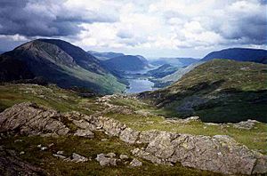
You'll also find several small tarns (small mountain lakes) on the summit. There are also some fence posts that can help you find your way, especially in cloudy weather. The view from the top is fantastic! You can see the beautiful Buttermere valley to the northwest and the impressive Scafell mountain range to the south.
 | Shirley Ann Jackson |
 | Garett Morgan |
 | J. Ernest Wilkins Jr. |
 | Elijah McCoy |


