Brattahlíð facts for kids
| Lua error in Module:Wikidata at line 70: attempt to index field 'wikibase' (a nil value).
Modern reconstruction of Thjodhild's church, with Tunulliarfik Fjord in the background (then called Eriksfjord)
|
|
| Alternative name | Brattahlid |
|---|---|
| Location | 5 km Southwest from Narsarsuaq, Greenland |
| Region | Greenland |
| Coordinates | 61°09′08″N 45°30′54″W / 61.15222°N 45.51500°W |
| History | |
| Associated with | Norsemen |
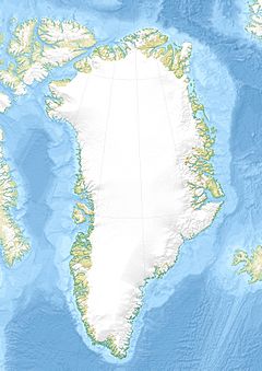
Brattahlíð (also known as Brattahlid) was the home of Erik the Red. He was a famous Viking who started a settlement in southwestern Greenland around the late 900s. Today, the village of Qassiarsuk is located in the same spot, about 5 km (3 mi) southwest of Narsarsuaq.
The site is about 96 km (60 mi) from the ocean. It sits at the end of the Tunulliarfik Fjord, which means it's safe from big ocean storms. Erik and his family lived here for about 500 years, until the mid-1400s. The name Brattahlíð means "the steep slope." In 2017, this important site, along with other old places in Greenland, became a UNESCO World Heritage List site. It is part of " Kujataa Greenland: Norse and Inuit Farming at the Edge of the Ice Cap."
Contents
Exploring Brattahlíð's Churches
At Brattahlíð, people believe the very first European church in the Americas was built. It was called Þjóðhildarkirkja (Thjodhild's church), which was actually a small chapel. Today, you can see a new version of this chapel built nearby, along with a copy of a Norse longhouse (a long, narrow house).
The Main Church Building
Later, after the Norse people became Christians, a larger main church was built. Archaeologists have found pieces of melted bell metal there. The old foundation stones of this church and other buildings could still be seen in the 1900s. They also found signs of a possible forge, a place where metal was heated and shaped.
This main church was about 12.5 meters (41 ft) long and 4.5 meters (15 ft) wide. It had two entrances and a fireplace in the middle. It seems a fire destroyed it. This church, built around the 1300s, might have been built on top of an even older church.
The Churchyard and Graves
The churchyard (graveyard) has tombstones. One stone has a cross carved into it. Another stone has runes (old Viking letters) that say "Ingibjørg's Grave." Today, stones clearly show where the church used to be. Visitors can also see the surrounding graveyard.
Life on the Farm
Near the church, there was a large farm building. It was about 53 meters (174 ft) long and 14 meters (46 ft) wide. Its stone walls were about 1.5 meters (5 ft) thick. An outer bank made of sod (turf) helped keep the building warm. Inside, the floor was made of flat stones. Stalls for animals were made from flat stones or, in one case, a whale's shoulder-blade.
Some of these farm buildings were still standing in 1953. Today, they mostly look like dips in the ground.
Brattahlíð's Farmland Today
Brattahlíð still has some of the best farmland in Greenland. This is because it's located at the inner end of Eriksfjord. This spot protects it from the cold, foggy weather and icy waters of the outer coast. Today, Brattahlíð has a youth hostel and a small store. You can find more services across the fjord in Narsarsuaq.
The Viking Assembly (Þing)
Brattahlíð was also the place where the first Greenlandic Þing (parliament) was held. This was similar to the Althing in Iceland. We don't know the exact spot where it took place.
Why the Norse Settlements Disappeared
It's not fully clear why the Norse settlements disappeared around the late 1400s. Many things likely played a part:
- The Little Ice Age brought colder temperatures.
- The soil became less fertile due to erosion.
- Norway stopped supporting the settlements after the Black Plague and political problems.
- Europeans found easier ways to get furs.
- The Hanseatic League became more powerful in trade.
- The Inuit people moved southward, leading to competition.
See also
 In Spanish: Brattahlíð para niños
 | Mary Eliza Mahoney |
 | Susie King Taylor |
 | Ida Gray |
 | Eliza Ann Grier |


