Buckland, Tasmania facts for kids
Quick facts for kids BucklandTasmania |
|||||||||||||||
|---|---|---|---|---|---|---|---|---|---|---|---|---|---|---|---|

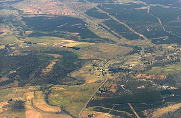
Aerial view of Buckland from the west
|
|||||||||||||||
| Population | 179 (2016 census) | ||||||||||||||
| Postcode(s) | 7190 | ||||||||||||||
| Location | 25 km (16 mi) SW of Triabunna | ||||||||||||||
| LGA(s) | Glamorgan–Spring Bay | ||||||||||||||
| Region | South-east | ||||||||||||||
| State electorate(s) | Lyons | ||||||||||||||
| Federal Division(s) | Lyons | ||||||||||||||
|
|||||||||||||||
Buckland is a small rural town in Tasmania, Australia. It is part of the Glamorgan–Spring Bay area. Buckland is located about 25 kilometres (16 miles) south-west of the town of Triabunna. In 2016, about 179 people lived in Buckland.
Buckland is a village found along the Tasman Highway. It is known for its old church, called St John the Baptist Church.
Contents
History of Buckland
The area where Buckland is located was first settled around 1820. It was originally known as Prosser Plains. This name came from the nearby Prosser River. The oldest house still standing in Buckland was built in 1826 and is called Woodsden.
How Buckland Got Its Name
The village was renamed Buckland in 1846 by Governor John Franklin. It was named after William Buckland, who was a famous geologist and a church leader. The Buckland Inn, a local hotel, was built in 1841 and started serving guests in 1845.
Post Office and Church
The Prosser's Plains Post Office opened on October 19, 1838. It was later renamed "Buckland" around 1884. The post office closed in 1981.
The foundation stone for the St John the Baptist Church was placed on August 22, 1846. This was done by Fitzherbert Adams Marriott, a church official from Hobart. The church is a historic landmark in the town.
Timber Mill Operations
A timber mill operated in Buckland for many years. It started in 1948 and closed down in 1981. This mill was an important part of the local economy.
Official Locality Status
Buckland was officially recognized as a locality in 1960. This means it was given its official boundaries and name on maps.
Geography of Buckland
The Prosser River is an important natural feature of Buckland. It flows through the area from west to east. The river also forms a small part of Buckland's western border.
Roads in Buckland
Buckland has several important roads that connect it to other places.
Major Highways
The Tasman Highway (also known as Route A3) passes through Buckland. It runs from the south-west to the east of the town. This highway is a main route for travel in Tasmania.
Local Roads
- Buckland Road (Route C318) starts at the Tasman Highway. It goes north-west from there until it leaves the area.
- Nugent Road (Route C335) also starts at the Tasman Highway. It runs south from the highway until it exits Buckland.
See also
 In Spanish: Buckland (Tasmania) para niños
 | James Van Der Zee |
 | Alma Thomas |
 | Ellis Wilson |
 | Margaret Taylor-Burroughs |


