Orford, Tasmania facts for kids
Quick facts for kids OrfordTasmania |
|
|---|---|

Township of Orford
|
|
| Population | 553 (2006 census) |
| Postcode(s) | 7190 |
| Location | |
| LGA(s) | Glamorgan Spring Bay Council |
| State electorate(s) | Lyons |
| Federal Division(s) | Lyons |
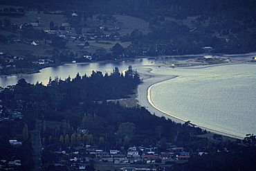
Orford is a small town on the east coast of Tasmania, Australia. It is about 73 kilometres north-east of Hobart, the capital city. Orford is known for its beautiful coastal views and is a popular spot for holidays. The town is located where the Prosser River meets Prosser Bay, which then opens into the Mercury Passage. In 2006, about 553 people lived in Orford.
Contents
History of Orford
Orford was named by Edward Walpole in 1831. He owned a large piece of land there and called it "Strawberry Hill." This name came from a famous house in London owned by his relative, Horace Walpole, who was the Third Earl of Orford.
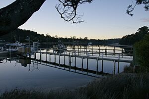
The town first started as a port for a convict settlement on Maria Island. Convicts were people sent from Britain as punishment. However, the port at Orford was never very big. It only had a few small jetties (docks) in the shallow river. The river mouth has a sandbar, which means large ships cannot easily enter.
The bigger town of Triabunna, about 6 kilometres north, became the main port for the area. It is where fishing boats and timber ships operate. Triabunna is also where you can catch a ferry to Maria Island.
The first Post Office in Orford opened on September 1, 1870.
A quarry (a place where stone is dug out) near Orford used to provide sandstone. This stone was used to build important buildings in cities like Hobart and Melbourne. There is still a quarry operating in the nearby town of Buckland.
Orford's Environment
Orford has warm and sunny weather in summer, which is why many people visit for holidays. Winters are cooler but usually mild. It doesn't rain a lot, but showers can happen at any time of the year.
The land around Orford is mostly hilly. Much of it is covered in dry eucalyptus forests. In areas with better soil, the land has been cleared. These fields are used to raise sheep and sometimes to grow crops like wheat or oats. Growing grain has become less common over the last 50 years.
Important Bird Area
A special place in Orford is the sandspit at Raspins Beach. This small area is part of the Raspins Beach Conservation Area. It is known as an Important Bird Area (IBA) because many special birds live and breed there.
- Fairy Terns: About 15 to 25 pairs of vulnerable fairy terns regularly breed here. "Vulnerable" means they are at risk of becoming endangered.
- Plovers and Oystercatchers: You can also find breeding pairs of red-capped and hooded plovers, as well as pied oystercatchers.
- Red-necked Stints: In summer, large groups of up to 50 red-necked stints visit the area.
The sandspit changes shape with the tides and river flow. It is mostly bare sand, but some patches of grass grow there. During winter storms, it can be covered by seawater.
People and their dogs often use the nearby sandy beaches for fun. This can disturb the nesting birds, even though the Tasmanian Parks and Wildlife Service tries to keep people away from the bird nesting sites during summer.
Population and Services
Orford has a small number of people who live there all the time. In 2001, there were about 485 residents, and this grew to 518 in 2011. The average age of people living in Orford is 57 years old.
However, many people own "shacks" (a local word for holiday homes) in Orford. These owners come to visit on weekends and during school holidays. This means the population can grow to over 3,000 people in the summer months (December to February).
Even though it's a small town, Orford has many useful services:
- A supermarket
- Three cafes and eateries
- A hotel and other places to stay
- Police and fire brigade
- A primary school
- A library
Fun Things to Do in Orford
Orford is a great place for visitors, with many clean and pretty beaches. Some popular ones include Raspins, Millingons, Spring, and Rheban. There's also a campsite at Raspins Beach.
If you like golf, there's a good 9-hole Orford Golf Course. You can also visit the Darlington Vineyard nearby.
There are several walking trails to explore:
- The Convict Trail along the Prosser River.
- A coastal walk along the cliffs between East Shelly Beach and Spring Beach.
- The scenic Thumbs lookout in the nearby Wielangta Forest, which offers amazing views of the area.
For fishing fans, Prosser Bay and the Mercury Passage are excellent spots. You can catch fish like flathead, trevally, trumpeter, abalone (a type of shellfish), and southern rock lobster (also called crayfish).
You can also enjoy views of Maria Island from parts of Orford and Spring Beach.
Sanda House, the oldest house in Orford, now operates as a bed and breakfast. There are many other accommodation options available too.
In February 2007, an artificial reef and dive site was created. A ship called the Troy D was sunk in the Mercury Passage, about 1 kilometre off Maria Island. This was done to make the area even better for scuba diving. The water is very clean, and there is lots of sea life to see.
Orford's Climate
Orford has an oceanic climate, which means its temperatures and rainfall are similar to Hobart. Like most of Tasmania's east coast, Orford can have very hot days in summer, sometimes reaching as high as 38 °C. Snow is very rare, but you might see frost several times each winter when it's not cloudy or drizzling.
| Climate data for Orford (1951-2014) | |||||||||||||
|---|---|---|---|---|---|---|---|---|---|---|---|---|---|
| Month | Jan | Feb | Mar | Apr | May | Jun | Jul | Aug | Sep | Oct | Nov | Dec | Year |
| Record high °C (°F) | 38.8 (101.8) |
38.8 (101.8) |
36.2 (97.2) |
30.0 (86.0) |
25.7 (78.3) |
20.5 (68.9) |
19.5 (67.1) |
22.6 (72.7) |
28.4 (83.1) |
32.4 (90.3) |
35.6 (96.1) |
37.2 (99.0) |
38.8 (101.8) |
| Mean daily maximum °C (°F) | 22.0 (71.6) |
21.9 (71.4) |
20.6 (69.1) |
18.4 (65.1) |
15.7 (60.3) |
13.3 (55.9) |
13.0 (55.4) |
14.0 (57.2) |
15.7 (60.3) |
17.3 (63.1) |
18.7 (65.7) |
20.4 (68.7) |
17.6 (63.7) |
| Mean daily minimum °C (°F) | 11.8 (53.2) |
12.1 (53.8) |
10.7 (51.3) |
8.4 (47.1) |
6.2 (43.2) |
4.1 (39.4) |
3.5 (38.3) |
4.2 (39.6) |
5.6 (42.1) |
7.2 (45.0) |
9.1 (48.4) |
10.5 (50.9) |
7.8 (46.0) |
| Record low °C (°F) | 3.2 (37.8) |
3.3 (37.9) |
1.1 (34.0) |
0.0 (32.0) |
−2.1 (28.2) |
−5.3 (22.5) |
−3.3 (26.1) |
−2.9 (26.8) |
−2.6 (27.3) |
0.0 (32.0) |
0.4 (32.7) |
3.2 (37.8) |
−5.3 (22.5) |
| Average precipitation mm (inches) | 47.9 (1.89) |
45.1 (1.78) |
45.9 (1.81) |
57.0 (2.24) |
57.6 (2.27) |
53.0 (2.09) |
58.6 (2.31) |
61.8 (2.43) |
51.8 (2.04) |
59.4 (2.34) |
66.9 (2.63) |
62.8 (2.47) |
655.4 (25.80) |
| Average rainy days | 9.8 | 8.8 | 10.2 | 11.5 | 12.7 | 12.5 | 13.8 | 13.8 | 13.2 | 13.8 | 13.9 | 12.1 | 146.1 |
| Source: Bureau of Meteorology | |||||||||||||
Louisville Point Development
A large new housing and tourism project called Solis was approved in May 2004. This big development, costing about A$150 million, is happening at Louisville Point, just north of Orford.
The plan includes:
- 550 new homes
- 60 special "eco-tourism" cabins (designed to be friendly to the environment)
- A central area with shops, a day spa, restaurants, and bars
- An 18-hole golf course designed by famous golfer Greg Norman
Construction started in 2007 and is expected to take about 10 years to finish.
 | Georgia Louise Harris Brown |
 | Julian Abele |
 | Norma Merrick Sklarek |
 | William Sidney Pittman |


