
Maria Island facts for kids
|
[name]:
wukaluwikiwayna
|
|
|---|---|

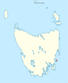
Location of Maria Island (shaded red) in Tasmania
|
|
| Etymology | In honour of Maria van Diemen (née van Aelst), wife of Anthony van Diemen; named in 1642 by Abel Tasman |
| Geography | |
| Location | East coast of Tasmania |
| Coordinates | 42°38′S 148°05′E / 42.633°S 148.083°E |
| Archipelago | Maria Island Group |
| Adjacent bodies of water | Tasman Sea |
| Total islands | Two |
| Major islands | Maria Island; Ile du Nord |
| Area | 115.5 km2 (44.6 sq mi) |
| Length | 20 km (12 mi) |
| Width | 13 km (8.1 mi) |
| Highest elevation | 711 m (2,333 ft) |
| Highest point | Mount Maria |
| Administration | |
|
Australia
|
|
| State | Tasmania |
| Local government area | Glamorgan Spring Bay Council |
| Largest settlement | Darlington |
| Demographics | |
| Population | Rangers are the only residents |
| Additional information | |
| Time zone | |
| • Summer (DST) | |
| Maria Island National Park | |

Maria Island (also called wukaluwikiwayna in the palawa kani language) is a beautiful, mountainous island. It is located in the Tasman Sea, off the east coast of Tasmania, Australia. The island covers about 115.5 square kilometers (44.6 square miles). It is part of the Maria Island National Park, which also includes a special marine area.
The island is about 20 kilometers (12 miles) long from north to south. At its widest, it is about 13 kilometers (8 miles) from west to east. The closest point to mainland Tasmania is about 4 kilometers (2.5 miles) away.
The island was named in 1642 by a Dutch explorer named Abel Tasman. He named it after Maria van Diemen, who was the wife of Anthony van Diemen. Anthony van Diemen was a very important leader in the Dutch East Indies.
Contents
Geography and Landscape
Maria Island has a unique shape, like a figure-eight. The northern part of the island is much larger than the southern part. These two parts are connected by a narrow strip of land about 3 kilometers (1.9 miles) long. This strip is called McRaes Isthmus.
The island has rugged mountains. The highest point is Mount Maria, which is 711 meters (2,333 feet) above sea level. It is located in the northern part of the island. Maria Island has been separated from mainland Tasmania for about 3,000 to 4,000 years.
Island Life and Economy
The narrow waterway between Maria Island and mainland Tasmania is called Mercury Passage. It was named after a ship called HMS Mercury.
The only settlement on the island is Darlington. It is near the northern tip of the island. Darlington has many old buildings. Today, only a few park rangers live there permanently. During summer holidays, many tourists visit the island. Tourism is very important for the local economy.
In nearby towns like Triabunna, other main jobs include fishing, forestry, and agriculture. People catch rock lobster, scalefish, scallops, and abalone near the island. Mussels are also farmed in Mercury Passage.
History of Maria Island
Maria Island has a rich history, from ancient Aboriginal times to its use as a national park today.
Aboriginal People
Long before Europeans arrived, Aboriginal people from the Tyreddeme group often visited Maria Island. They were part of the Oyster Bay tribe. You can still find many signs of their presence, especially around the bays on the island's narrow middle section.
In 1802, a French expedition led by Nicolas Baudin met the Aboriginal people on Maria Island. Whalers also met them in the early 1800s.
Convict Settlements

Maria Island was home to convict settlements twice in the 1800s. The first time was from 1825 to 1832. The second time was from 1842 to 1851.
One famous person held here was William Smith O'Brien. He was an Irish nationalist leader. He was sent to Maria Island because of his part in a rebellion in 1848.
Three buildings from the first convict era are still in Darlington:
- The Commissariat Store: Built in 1825, it is now the park's reception and visitor center.
- The Convict Penitentiary: Finished in 1828, it now offers accommodation for visitors.
- The Convict-built Dam: On Bernacchis Creek, it still provides water for Darlington.
Early Industries and Farming
Seal hunting happened on the island from at least 1805. From the 1830s to 1840s, people also hunted whales from the shore at four spots on the island.
In the 1880s, an Italian businessman named Diego Bernacchi started businesses on the island. These included making silk and wine. He also built a cement factory. This factory used limestone from the Fossil Cliffs.
A large cement factory was built in Darlington in the early 1920s. It had a small railway to carry materials from the quarries to the factory. At its busiest, Darlington had hundreds of residents and several hotels. However, by 1930, all these businesses failed. This was due to problems like the Great Depression, poor quality limestone, and high transport costs.
For about 40 years, until the late 1960s, farming was the main activity on the island.
Maria Island National Park
The Tasmanian Government bought all the private land on the island. They created the national park in 1972. It was made bigger in 1991 to include part of the sea around the island.

Island Environment
Maria Island is home to many different plants and animals.
Plant Life
The island has fourteen different types of plant communities. Most of the island is covered in various kinds of eucalypt forests. There are also natural and old clearings that provide food for many animals.
Animal Life


Many animals live on Maria Island. Most of them are native to Tasmania. Some animals, like eastern grey kangaroos, red-necked wallabies, and Cape Barren geese, were brought to the island in the late 1960s and early 1970s.
You can often see bare-nosed wombats (Vombatus ursinus) on the island. There are also Tasmanian pademelons. Other animals include common brushtail and ringtail possums. You might also spot short-beaked echidnas and three types of snake.
Birds
Maria Island is a very important place for birds. BirdLife International has named it an Important Bird Area (IBA). This is because it is home to many endangered swift parrots and forty-spotted pardalotes. More than 1% of the world's Pacific gulls live here. The island also has most of Tasmania's unique bird species.
Tasmanian Devils
In November 2012, Tasmanian devils were brought to the island. These devils are part of a special "insurance population." This means they are safe from the devil facial tumour disease. This disease is affecting many devils on mainland Tasmania. Park staff on the island care for these devils. Visitors sometimes get to see them.
It seems that the devils are affecting the bird life on the island. For example, a group of Little penguins that used to have 3,000 breeding pairs has since disappeared from the island.
Marine Life and Habitats
The marine part of the national park protects the ocean around Maria Island. This area has more and larger marine animals than the surrounding waters. It is one of the most studied marine protected areas in Australia. It is also a popular spot for divers. The marine park area is usually within 1 kilometer (0.6 miles) of the island's low water mark.
Climate
Maria Island has a mild climate. Here is some weather information from 2016:
| Climate data for Maria Island (Point Lesueur; 28 m AMSL) | |||||||||||||
|---|---|---|---|---|---|---|---|---|---|---|---|---|---|
| Month | Jan | Feb | Mar | Apr | May | Jun | Jul | Aug | Sep | Oct | Nov | Dec | Year |
| Record high °C (°F) | 35.2 (95.4) |
32.6 (90.7) |
29.6 (85.3) |
27.5 (81.5) |
21.0 (69.8) |
18.5 (65.3) |
18.0 (64.4) |
19.4 (66.9) |
23.5 (74.3) |
29.0 (84.2) |
30.8 (87.4) |
35.5 (95.9) |
35.5 (95.9) |
| Mean daily maximum °C (°F) | 21.4 (70.5) |
21.0 (69.8) |
20.2 (68.4) |
17.6 (63.7) |
15.3 (59.5) |
13.1 (55.6) |
12.7 (54.9) |
13.5 (56.3) |
15.3 (59.5) |
16.8 (62.2) |
18.1 (64.6) |
19.9 (67.8) |
17.1 (62.8) |
| Mean daily minimum °C (°F) | 13.6 (56.5) |
13.8 (56.8) |
13.0 (55.4) |
11.2 (52.2) |
9.5 (49.1) |
8.0 (46.4) |
7.4 (45.3) |
7.5 (45.5) |
8.5 (47.3) |
9.4 (48.9) |
10.9 (51.6) |
12.2 (54.0) |
10.4 (50.7) |
| Record low °C (°F) | 8.1 (46.6) |
7.7 (45.9) |
6.3 (43.3) |
5.2 (41.4) |
4.0 (39.2) |
3.5 (38.3) |
2.5 (36.5) |
1.8 (35.2) |
2.8 (37.0) |
2.5 (36.5) |
4.5 (40.1) |
6.2 (43.2) |
1.8 (35.2) |
| Average rainfall mm (inches) | 45.3 (1.78) |
34.2 (1.35) |
41.3 (1.63) |
34.2 (1.35) |
38.5 (1.52) |
50.5 (1.99) |
29.8 (1.17) |
44.1 (1.74) |
44.8 (1.76) |
35.1 (1.38) |
54.9 (2.16) |
49.6 (1.95) |
518.1 (20.40) |
| Average rainy days (≥ 1 mm) | 5.1 | 6.0 | 7.1 | 5.5 | 5.9 | 6.6 | 6.9 | 6.9 | 6.4 | 7.1 | 7.6 | 6.8 | 77.9 |
| Source: Bureau of Meteorology | |||||||||||||
Visiting Maria Island
Maria Island is a great place to visit for a day trip or a longer stay.
How to Get There
A ferry travels from the town of Triabunna to Darlington Bay on Maria Island several times a day. The trip by sea is about 16 kilometers (10 miles). You might see Common dolphins, Australian fur seals, and seabirds like Australasian gannets and shy albatrosses during the ferry ride. You can also take tourist flights to the island from Cambridge Airport.
Places to Stay
You can stay in very basic accommodation at "the Penitentiary" in Darlington. This building was once a convict prison. You need to book with the Parks and Wildlife Service. The rooms have bunk beds, a table, chairs, and a wood heater. You must bring all your own cooking gear, lights, bedding, and food. There is no electricity or running water in the rooms. However, toilets, hot showers, and barbecues are nearby. Many visitors also like to camp in the camping area in Darlington.
Things to Do and See

Visitors to Maria Island enjoy walking, bicycling, swimming, snorkeling, diving, and watching wildlife. Many people also enjoy learning about the island's history. Most of the island's walking trails include historical sites.
Two popular places to visit are the Painted Cliffs and the Fossil Cliffs. Both are on the island's coastline.
- The Painted Cliffs are made of sandstone. They have beautiful patterns from natural iron stains.
- The Fossil Cliffs are tall limestone cliffs. They contain many ancient fossils.
For longer walks, you can hike up Bishop and Clerk (620 meters / 2,034 feet) or Mount Maria (711 meters / 2,333 feet). The walk to Mount Maria takes about six to seven hours round trip from Darlington. Bishop and Clerk takes about four hours round trip.
Most roads and tracks on the island are good for bicycling. You can rent bicycles and helmets in Triabunna and bring them on the ferry. A bike is very helpful if you want to see a lot of the island in one day. Remember, you cannot ride bikes on beaches or on the two mountain tracks.
A track goes 20 kilometers (12 miles) south from Darlington to Haunted Bay. This track has many interesting spots along the way. Haunted Bay is named for the sounds of many fairy penguins that live there. The track south is popular for bike rides or multi-day walks.
Major campsites outside Darlington include Frenchs Farm (11 kilometers / 6.8 miles from Darlington) and Encampment Cove (another 2 kilometers / 1.2 miles away). These spots have rainwater tanks.
From Encampment Cove, it's a short walk (just over 1 kilometer / 0.6 miles) to the ruins of Maria Island's second convict station. This station was at Point Lesueur on the island's west coast. Other great places to visit are Soldiers Beach and Bloodstone Beach on the western side of the island. Shoal Bay and Riedle Bay, which are beaches on either side of McRaes Isthmus, are also worth seeing.
In 2007, an old ship called the Troy D was sunk near the island. It was placed there to create a dive wreck for people to explore underwater.
Images for kids
-
Location of Maria Island (shaded red) in Tasmania
See also
 In Spanish: Isla Maria (Tasmania) para niños
