
Triabunna facts for kids
Quick facts for kids TriabunnaTasmania |
|||||||||||||||
|---|---|---|---|---|---|---|---|---|---|---|---|---|---|---|---|

Triabunna with The Three Thumbs in the background
|
|||||||||||||||

Triabunna
Location in Tasmania
|
|||||||||||||||
| Population | 905 (2021 census) | ||||||||||||||
| Established | 1830 | ||||||||||||||
| Postcode(s) | 7190 | ||||||||||||||
| Location | |||||||||||||||
| LGA(s) | Glamorgan Spring Bay Council | ||||||||||||||
| Region | South-east | ||||||||||||||
| State electorate(s) | Lyons | ||||||||||||||
| Federal Division(s) | Lyons | ||||||||||||||
|
|||||||||||||||
|
|||||||||||||||
Triabunna is a small town in Tasmania, Australia. It's located in the Glamorgan–Spring Bay Council area. This town is about 86 kilometers (53 miles) north-east of Hobart, the capital city of Tasmania. In 2021, about 905 people lived in Triabunna.
Triabunna is the second largest town on Tasmania's east coast. It's an important center for the Glamorgan Spring Bay Council. The town is right on the coast, nestled in Spring Bay. It's where MacCleans Creek and Vickerys Rivulet meet the sea. The closest town is Orford, which is 6 kilometers (4 miles) south.
The area around Triabunna is very pretty. You'll find beaches, hills, and beautiful eucalyptus forests. Many old buildings from Tasmania's early days are still here. Triabunna also has amazing views of Maria Island. You can take a short ferry ride from town to visit the island.
On the Triabunna foreshore, there's a special place called the Tasmanian Seafarers Memorial. This memorial remembers all Tasmanian sailors who have died at sea. It also honors anyone who died in Tasmanian waters, no matter their job or where they were from. Every October, a service is held to add new names to the memorial.
The weather on Tasmania's east coast is usually mild. Triabunna enjoys warm, sunny summers. This makes it a great spot for holidays or for people to retire. The nice beaches and easy access make it popular for water sports. People enjoy fishing, sailing, surfing, and diving here. Triabunna also has great places for tennis, cricket, golf, and Australian rules football. Many people also love Bushwalking in the nearby forests.
Contents
History of Triabunna
The area where Triabunna is now was once called Tenby. This name appeared on a map in 1837. The name "Triabunna" started being used by 1866. The town was officially named a locality in 1960.
The name "Triabunna" comes from an Aboriginal Tasmanian word. It means the Tasmanian native hen, a bird found only in Tasmania. The town began in 1830. It was first a military base for the 63rd regiment. Later, the 51st regiment also stayed in Triabunna.
By 1831, there was a whaling station in Spring Bay. Whaling stations were places where whales were processed after being caught. By 1837, there were at least nine such stations in the Spring Bay area.
The first post office in Spring Bay opened on February 28, 1832. It closed later that year but reopened in 1836. In 1881, it was renamed the Triabunna Post Office.
Geography and Climate
The Tasman Sea is to the east of Triabunna.
Weather in Triabunna
Triabunna has an oceanic climate. This means it has mild summers and cool winters. Sometimes, strong winds called foehn winds blow from the Central Highlands. These winds can make the temperature much hotter, especially in summer.
- In January, the average high temperature is about 22.1°C (71.8°F).
- In July, the average high is about 13.1°C (55.6°F).
- The average low temperature in January and February is around 12.0°C (53.6°F).
- In July, the average low is about 3.6°C (38.5°F).
Triabunna gets a moderate amount of rain each year, about 668.6 mm (26.3 inches). It rains on about 144 days a year, mostly in winter. The town doesn't get a lot of sunshine. It has about 150 cloudy days and only 51 clear days each year. The hottest temperature ever recorded was 39.7°C (103.5°F) on December 30, 2019. The coldest was -5.3°C (22.5°F) on June 24, 1972. This weather information comes from Orford, which is close to Triabunna.
| Climate data for Triabunna (42º33'00"S, 147º52'48"E, 14 m AMSL) (1951-2024 normals and extremes) | |||||||||||||
|---|---|---|---|---|---|---|---|---|---|---|---|---|---|
| Month | Jan | Feb | Mar | Apr | May | Jun | Jul | Aug | Sep | Oct | Nov | Dec | Year |
| Record high °C (°F) | 38.8 (101.8) |
38.8 (101.8) |
36.2 (97.2) |
31.4 (88.5) |
25.7 (78.3) |
20.5 (68.9) |
19.5 (67.1) |
22.6 (72.7) |
28.4 (83.1) |
32.4 (90.3) |
36.8 (98.2) |
39.7 (103.5) |
39.7 (103.5) |
| Mean daily maximum °C (°F) | 22.1 (71.8) |
21.8 (71.2) |
20.6 (69.1) |
18.4 (65.1) |
15.7 (60.3) |
13.3 (55.9) |
13.1 (55.6) |
14.0 (57.2) |
15.8 (60.4) |
17.4 (63.3) |
18.8 (65.8) |
20.4 (68.7) |
17.6 (63.7) |
| Mean daily minimum °C (°F) | 12.0 (53.6) |
12.0 (53.6) |
10.7 (51.3) |
8.4 (47.1) |
6.3 (43.3) |
4.2 (39.6) |
3.6 (38.5) |
4.2 (39.6) |
5.6 (42.1) |
7.3 (45.1) |
9.2 (48.6) |
10.6 (51.1) |
7.8 (46.1) |
| Record low °C (°F) | 3.2 (37.8) |
3.3 (37.9) |
1.1 (34.0) |
0.0 (32.0) |
−2.1 (28.2) |
−5.3 (22.5) |
−3.3 (26.1) |
−2.9 (26.8) |
−2.6 (27.3) |
0.0 (32.0) |
0.4 (32.7) |
3.2 (37.8) |
−5.3 (22.5) |
| Average precipitation mm (inches) | 52.2 (2.06) |
43.7 (1.72) |
46.8 (1.84) |
55.9 (2.20) |
57.4 (2.26) |
54.4 (2.14) |
53.6 (2.11) |
61.9 (2.44) |
52.5 (2.07) |
61.7 (2.43) |
66.8 (2.63) |
62.1 (2.44) |
668.6 (26.32) |
| Average precipitation days (≥ 0.2 mm) | 9.6 | 8.8 | 10.1 | 11.2 | 12.6 | 12.4 | 13.7 | 13.7 | 13.0 | 13.6 | 13.6 | 11.8 | 144.1 |
| Average afternoon relative humidity (%) | 64 | 64 | 64 | 66 | 69 | 73 | 71 | 65 | 64 | 62 | 65 | 62 | 66 |
| Average dew point °C (°F) | 12.3 (54.1) |
12.4 (54.3) |
11.3 (52.3) |
9.7 (49.5) |
8.2 (46.8) |
6.7 (44.1) |
6.1 (43.0) |
5.8 (42.4) |
7.0 (44.6) |
7.7 (45.9) |
9.7 (49.5) |
10.7 (51.3) |
9.0 (48.2) |
| Source: Bureau of Meteorology (1951-2024 normals and extremes) | |||||||||||||
Getting Around Triabunna
The main road that goes through Triabunna is the Tasman Highway (Route A3). It runs from the south to the north of the town. Another road, Route C319 (Freestone Point Road), starts from the Tasman Highway. It goes south to Freestone Point and then ends there.
Images for kids
-
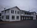
The historic Spring Bay Hotel
-

A view of Charles Street in Triabunna


