Buffalo Peak facts for kids
Quick facts for kids Buffalo Peak |
|
|---|---|

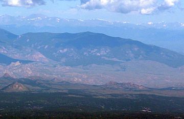
Buffalo Peak viewed from Pikes Peak
|
|
| Highest point | |
| Elevation | 11,594 ft (3,534 m) |
| Prominence | 929 ft (283 m) |
| Isolation | 4.28 mi (6.89 km) |
| Listing | Colorado county high points 38th |
| Geography | |
| Location | High point of Jefferson County, Colorado, United States |
| Parent range | Front Range, Kenosha Mountains |
| Topo map | USGS 7.5' topographic map Green Mountain, Colorado |
Buffalo Peak is a tall mountain in Colorado, United States. It's part of the Kenosha Mountains range, which is a section of the huge Rocky Mountains in North America. This amazing peak stands 11,594 feet (about 3,534 meters) high!
Buffalo Peak is located in the Lost Creek Wilderness area, which is part of the Pike National Forest. It's about 12.4 kilometers (or 7.7 miles) west of the community of Deckers, Colorado. What makes Buffalo Peak extra special is that it's the highest point in all of Jefferson County, Colorado.
Exploring Buffalo Peak
Buffalo Peak is a significant mountain for a few reasons. Its height, 11,594 feet, makes it one of the higher peaks in its area. A mountain's summit is its very top, the highest point.
Where is Buffalo Peak?
This mountain is found within the Lost Creek Wilderness. A wilderness area is a protected natural space where human activity is limited. This helps keep the environment wild and natural. The Lost Creek Wilderness is part of the larger Pike National Forest. National Forests are managed by the government to protect natural resources and provide places for people to enjoy nature.
Being the highest point in Jefferson County means that Buffalo Peak is a special landmark. People who enjoy hiking and exploring often try to visit the highest points in different counties or states.
Mountain Names Through Time
Mountains often have different names over history. Buffalo Peak has had a couple of names.
- Buffalo Peak - This name became official in 1906.
- Freemans Peak - This was an earlier name for the mountain.
 | James B. Knighten |
 | Azellia White |
 | Willa Brown |


